August 15, 2007
Tropics Are Heating up...
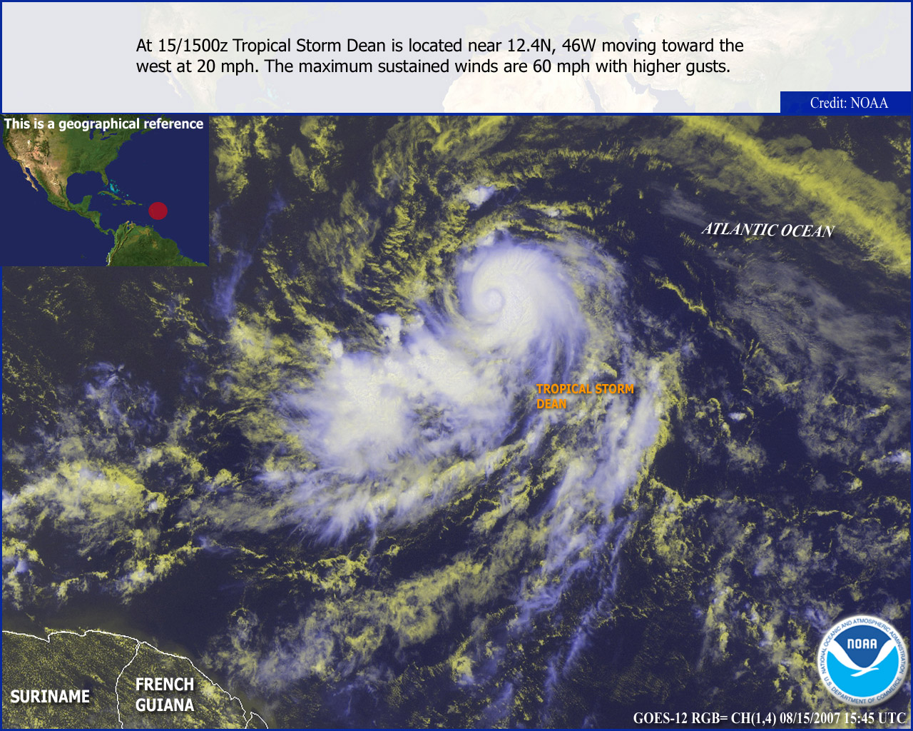
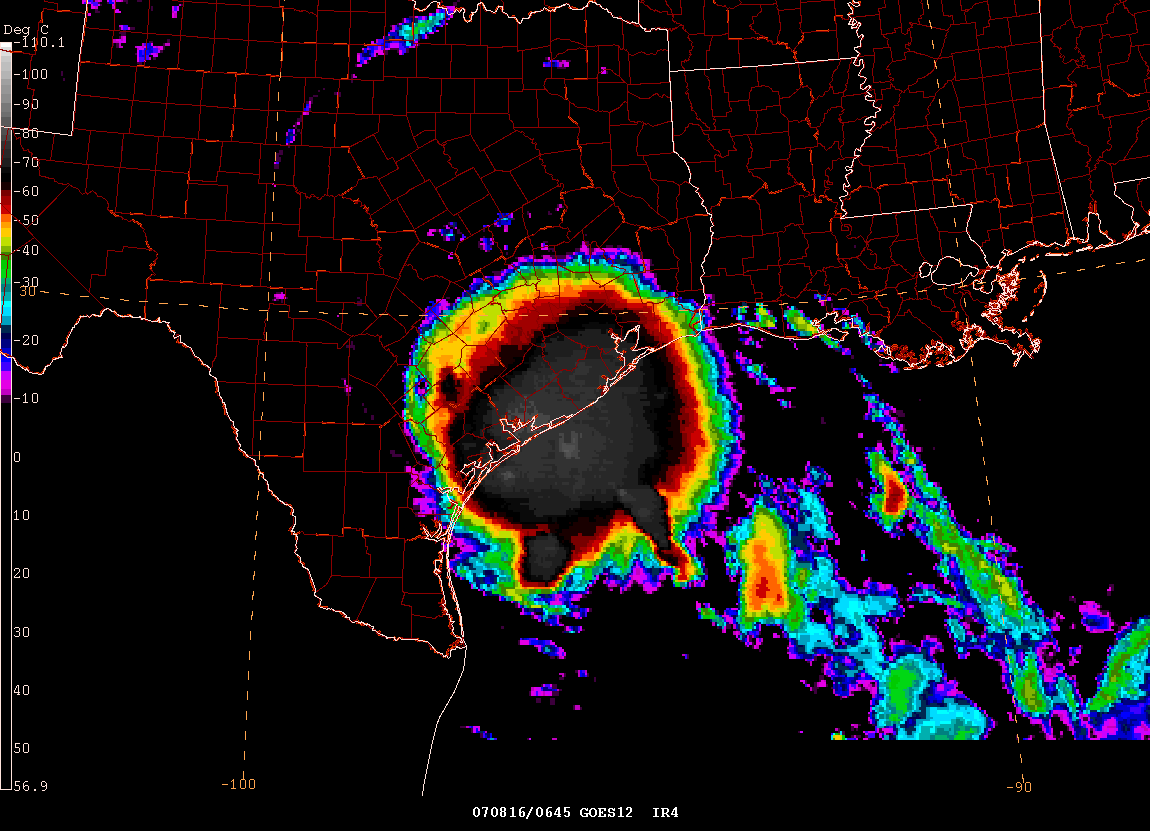
Early morning satellite images show that Tropical Storm Dean has not strengthened overnight. This could be because of some dry air and unfavorable shear conditions. This is expected to improve over the next 24 hours and Dean will likely strengthen into a hurricane before reaching the Caribbean Islands. Long range models now take the storm south of Cuba on day five and six. There is a possibility that Dean could impact the United States sometime next week. Meanwhile, the newly formed tropical depression in the Gulf of Mexico continues to move northwestward. There has been little change in intensity overnight. The system is expected to strengthen to a tropical storm before making landfall in Texas over the next few days. Again, the main threat will be moderate to heavy rainfall and isolated tornadoes.
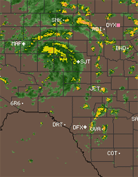
As of 11 a.m. tropical storm warnings have
been issued for portions of Texas. As of 11 a.m. tropical depression
number 5 has been upgraded to
Tropical Storm Erin.
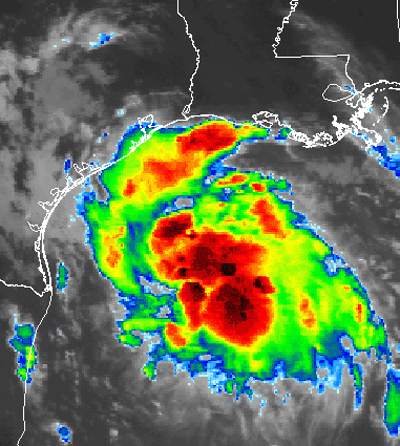
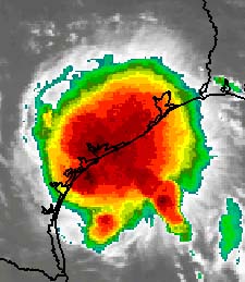
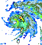
Tropical Storm Erin
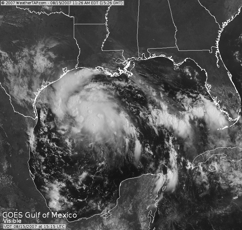
Visible Image of Erin - via
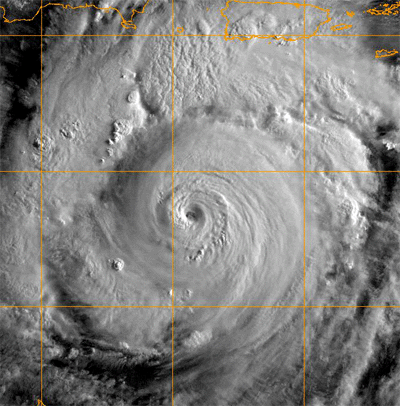
weathertap.com Beautiful image of Dean
Terrible, relentless, unforgiving, and wicked
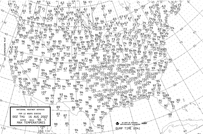
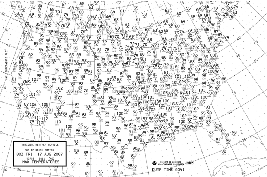
heat continues across much of the Central and Southern United States.
At 2 p.m. this afternoon temperatures have climbed to between 100 and
105 (without the heat index) across Western Kentucky. My reporting
station, here in Lone Oak, is showing 101. The
Benton, Kentucky
station is showing 105. Incredible heat. A heat advisory
is in effect through 9 p.m. tonight.
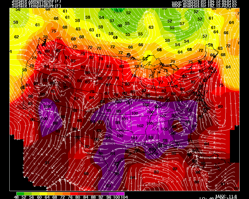
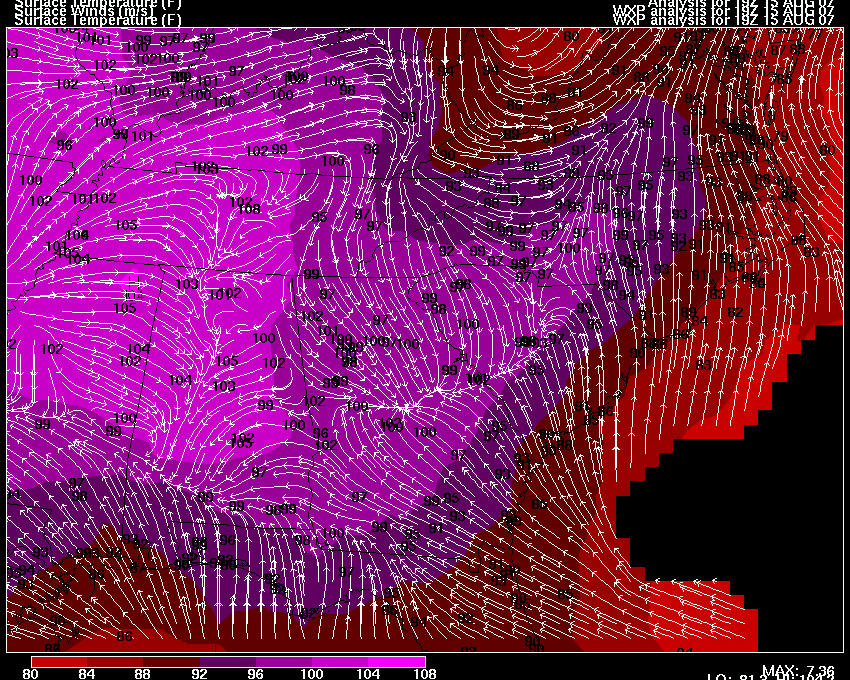
Temperatures at 19z
Southeast U.S. Temperatures
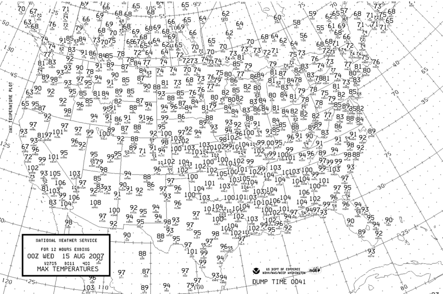
High Temps Yesterday
August 16, 2007
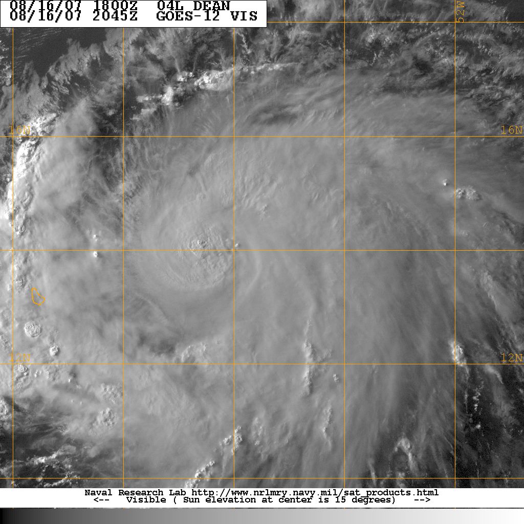
Erin Moves Ashore...Dean Strengthens.
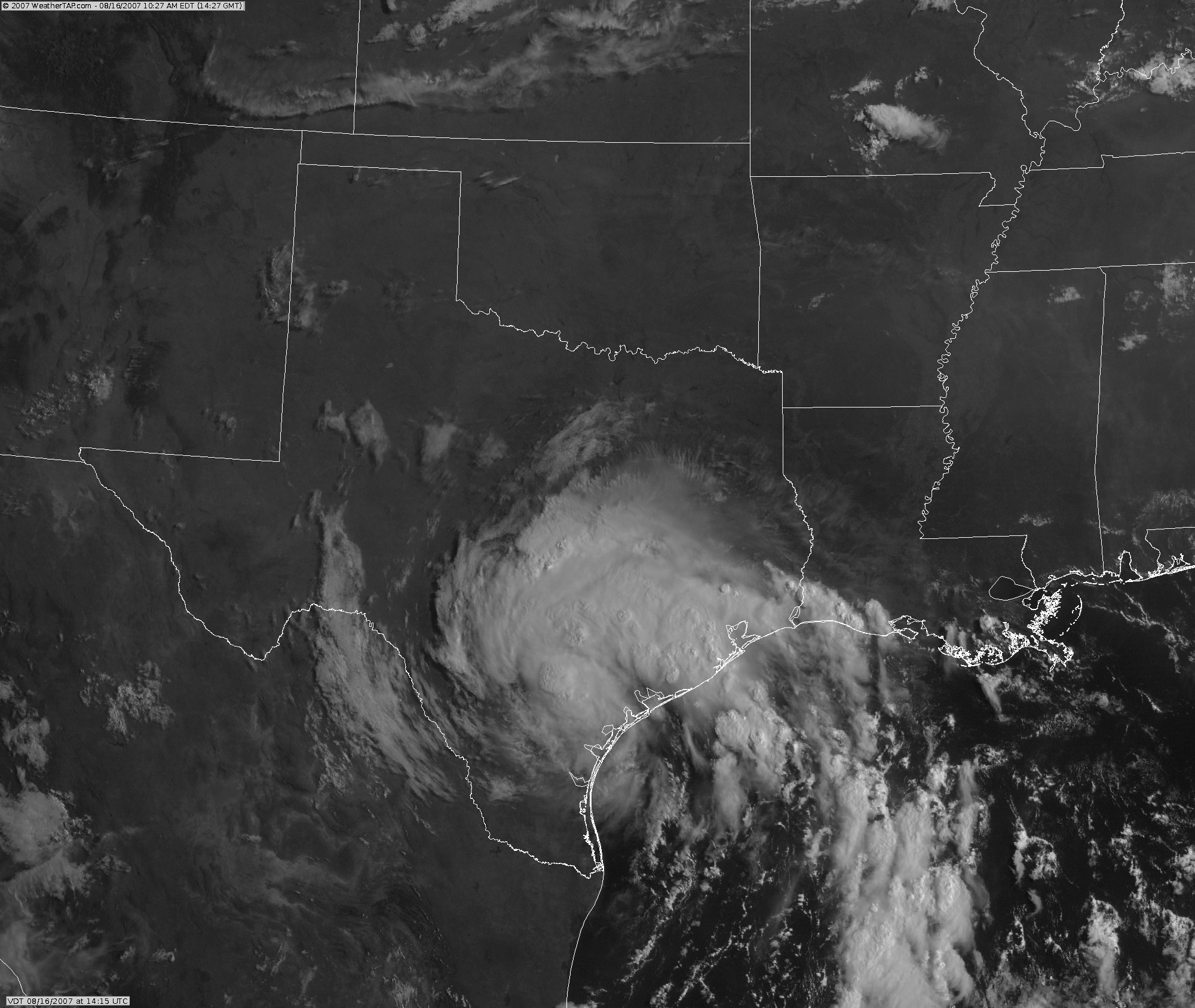
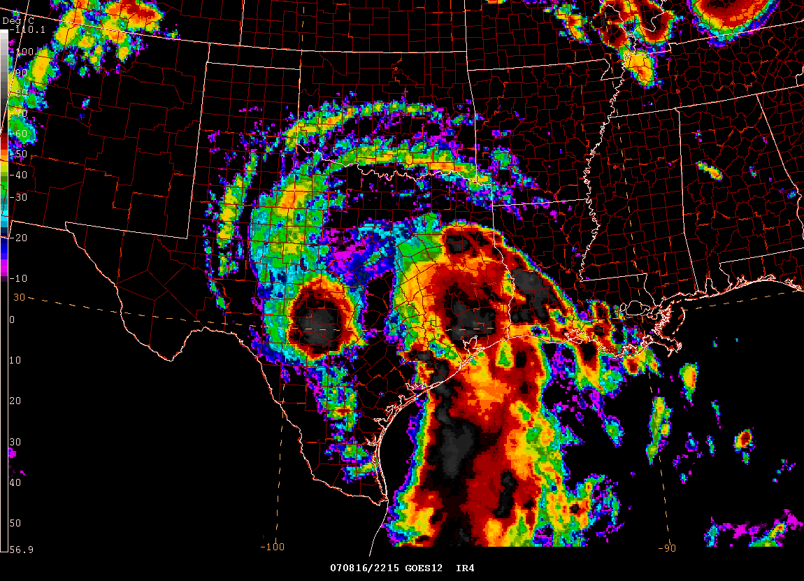
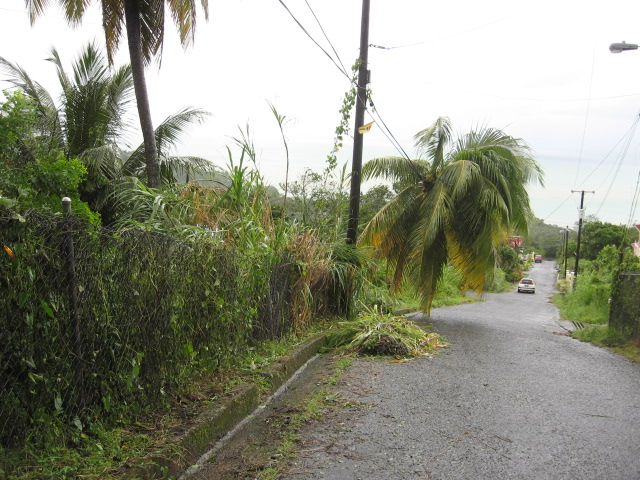
Tropical storm Erin moved ashore this morning. Radar loop. The storm made landfall near Lamar, Texas with winds of 35-40 mph. The National Hurricane Center has downgraded Erin to a tropical depression. The main threat from this system will be heavy rainfall and isolated tornadoes. There have been several tornado warnings this morning. Meanwhile, Tropical Storm Dean has intensified to a hurricane with winds of 80 mph. Dean continues to move west/northwest and if this course continues he will start to impact the islands over the next 24-48 hours. Hurricane warnings may be necessary for portions of the Caribbean Islands over the next 12-24 hours. Dean is expected to continue to strengthen and will likely be a category two or three hurricane within the next 24-36 hours. It is still too early to determine whether or not Dean will impact the United States.
Satellite Loop of Erin
Satellite Loop of Dean and Erin
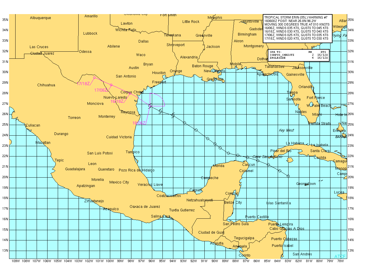
Erin - Hitting Texas
Tropical Storm Erin Track
Tropical Storm Erin Visible Image
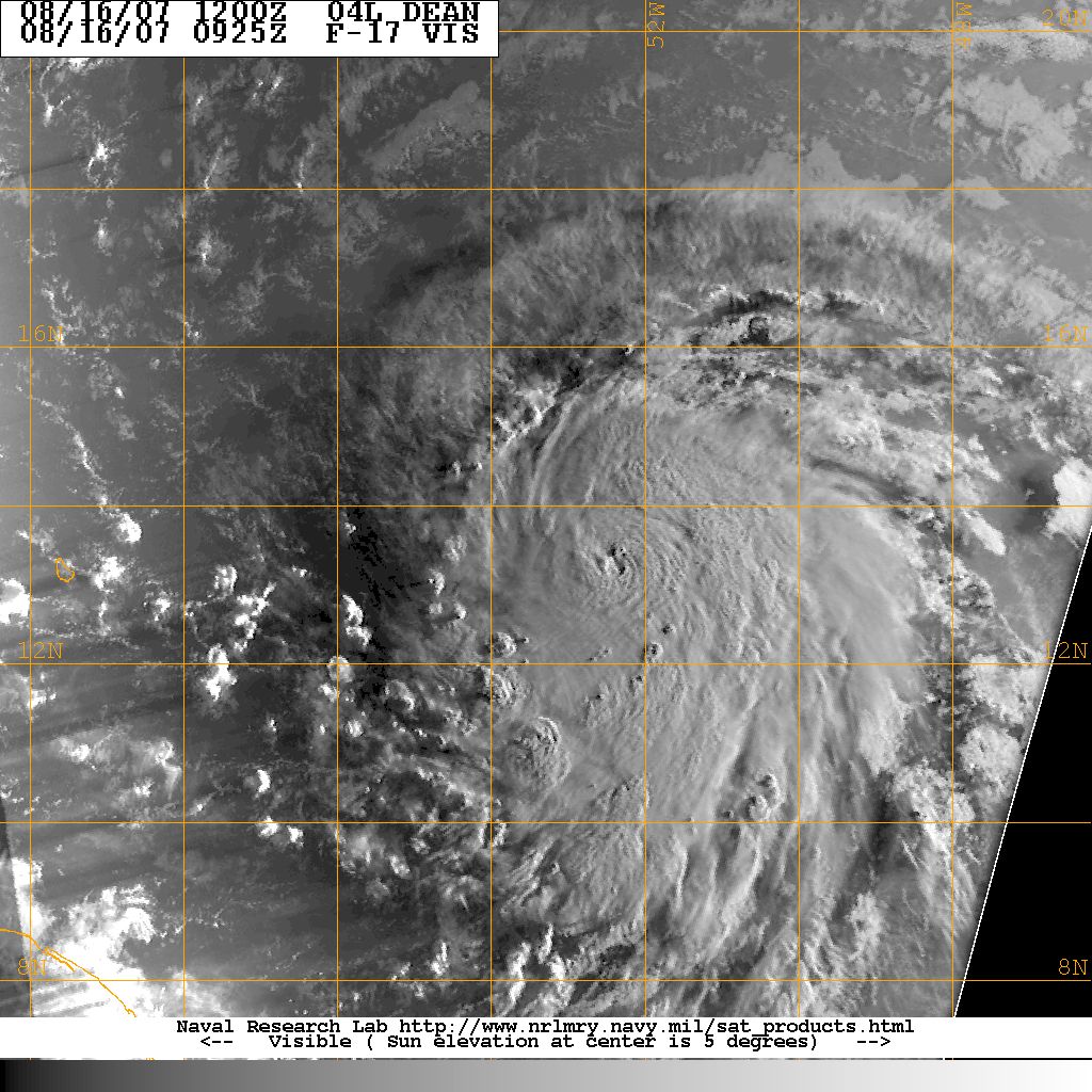
Hurricane Dean - Visible Image
Meanwhile, extremely hot conditions continue
to prevail across the Central and Southern United States. A
frontal system will bring some hope to the Ohio Valley with possible
showers and thunderstorms scattered along it. Severe thunderstorms
are likely this morning across portions of Illinois and later in the day
further east. Temperatures will once again approach 100 degrees
across many locations of the Southern United States. Temperatures of
100-107 were reported yesterday across portions of the Ohio and
Tennessee Valleys. Incredible heat. Temperatures last night
at 10 p.m. were 90 degrees and above at Nashville - TN, St Louis- MO,
and Memphis - TN.
August 15th High Temps
At 2 p.m. temperatures were ranging from 100 to 106 degrees across Southern Illinois, Southern Indiana, Kentucky, and southward. The temperature here in Lone Oak has reached 101 degrees so far today. Temperatures in Benton, Kentucky have reached 105 and Barkley Regional Airport reported 104 earlier this afternoon. Record heat.
Dean Upgraded to Category 2 Hurricane...
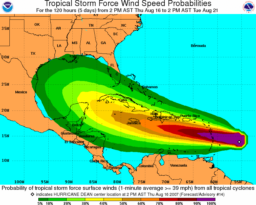
Hurricane Dean continues to gain strength this evening. Winds are now up to 100 miles per hour near the center. Current forecasts take this system into the Caribbean over the next few days. Hurricane warnings have now been issued for portions of the Eastern Caribbean. There are concerns that Dean could move into the Gulf of Mexico by early next week. Additional strengthening is expected and Dean could become a category three or four as it moves through the Caribbean. Unfortunately, it now appears that Hurricane Dean could impact the United States. Stay tuned.
Evening Satellite Image
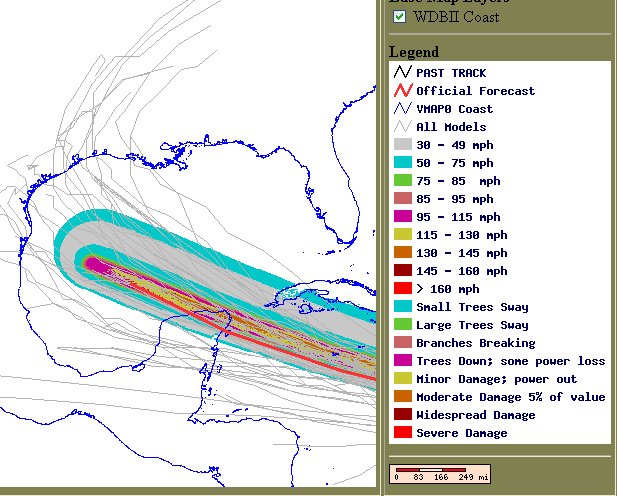
Evening Track Forecast from the NHC
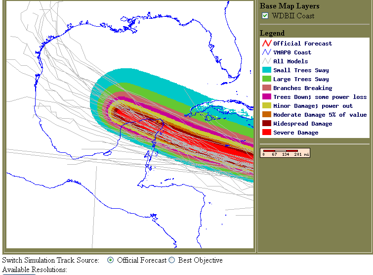
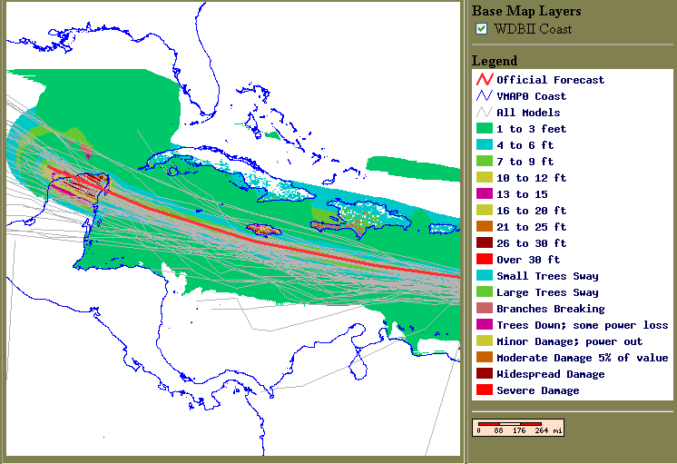
Damage Potential Map - Forecast
Possible Storm Surge - Forecast
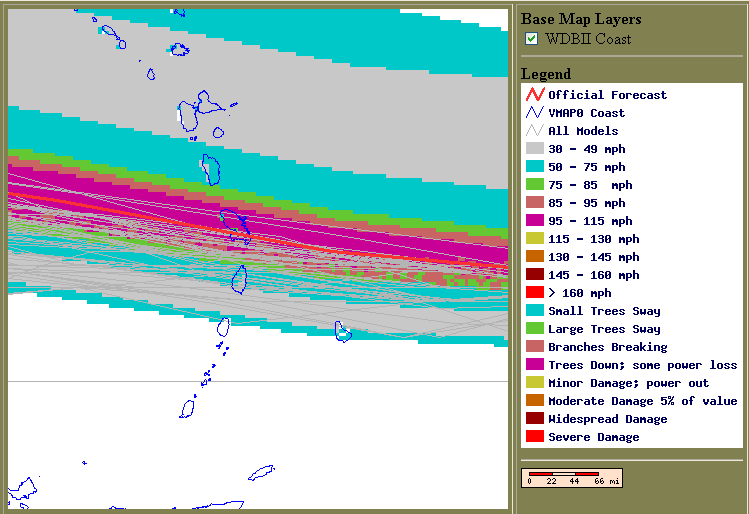
Wind Potential Caribbean Islands
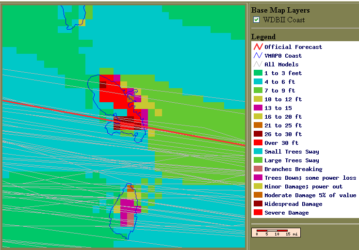
Storm Surge Forecast
Tropical Depression Erin continues to spin
itself out across Southern Texas. Flash flooding has been the main
problem today. There were reports, from the National Weather
Service, of water rescues in San Antonia. Rainfall amounts
of between 1"-7" have been received across the path of the system.
Heavy rainfall will continue through tonight.

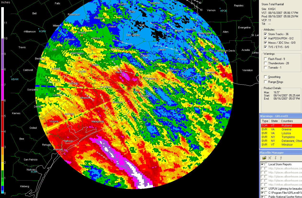
Radar Animation
via
weathertap San
Antonio Rainfall Totals
Houston Rainfall Totals
Scattered severe thunderstorms are moving across this region as of early this evening. A number of large hail and damaging wind reports have been received by the National Weather Service. A severe thunderstorm watch covers portions of Missouri, Illinois, Indiana, Kentucky, Ohio, and eastward.
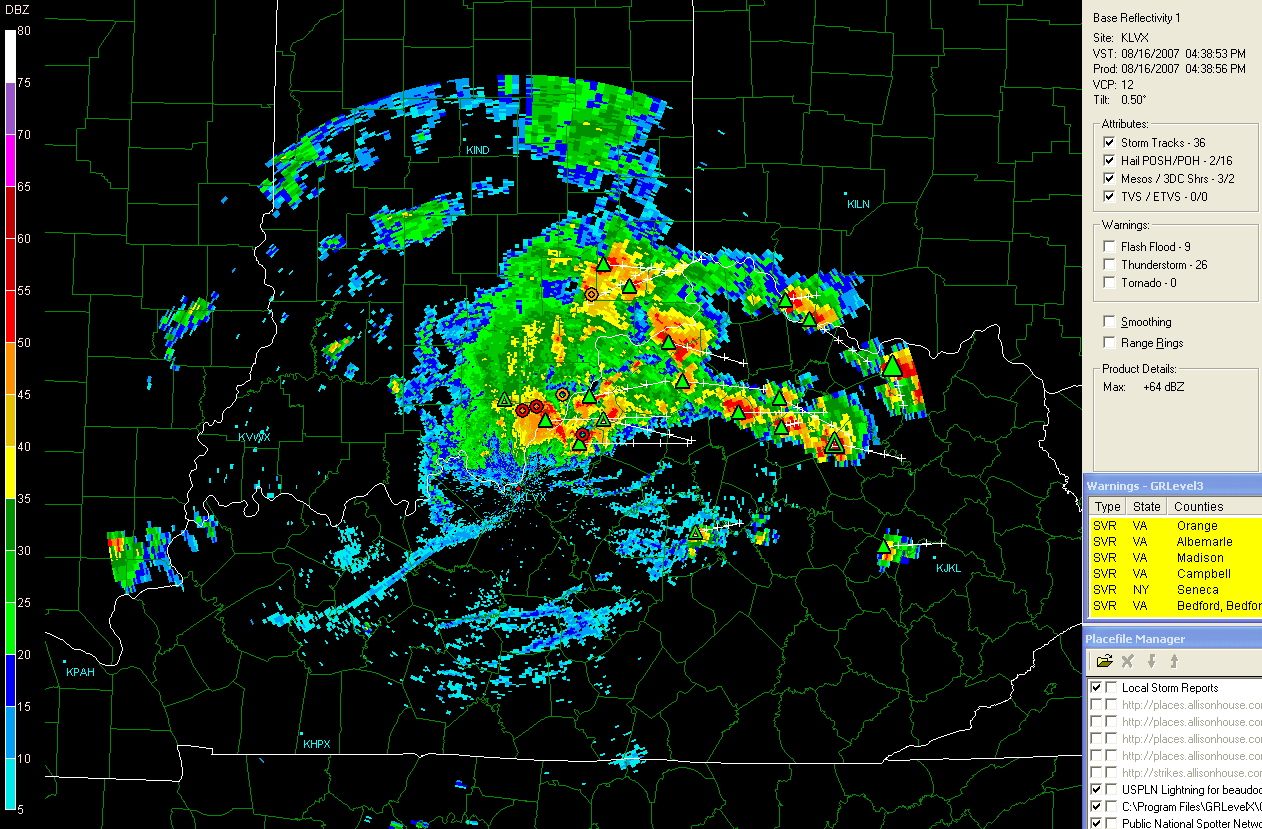
4:30 p.m.
Paducah, KY - Radar
4:30 p.m. Louisville, KY Radar
107 Degrees in Paducah, Kentucky This Afternoon...
Amazing heat across Western Kentucky this afternoon. The National Weather Service recorded a temperature of 105 degrees. This is the highest temperate since the 1960s at Barkley Regional Airport. The 107 degree reading at WPSD-TV 6 was the highest reading that Meteorologist Cal Sisto has witnessed in his 25 years of living here. Amazing temperatures for this region.
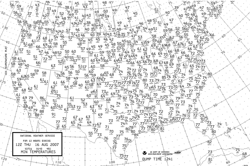
August 16th High Temps
Thursday Low Temps
Evening view of Erin
August 17, 2007
If you are looking for historic weather books - I have a few for sale at this web-site. You can also view more of my weather photography at this site.
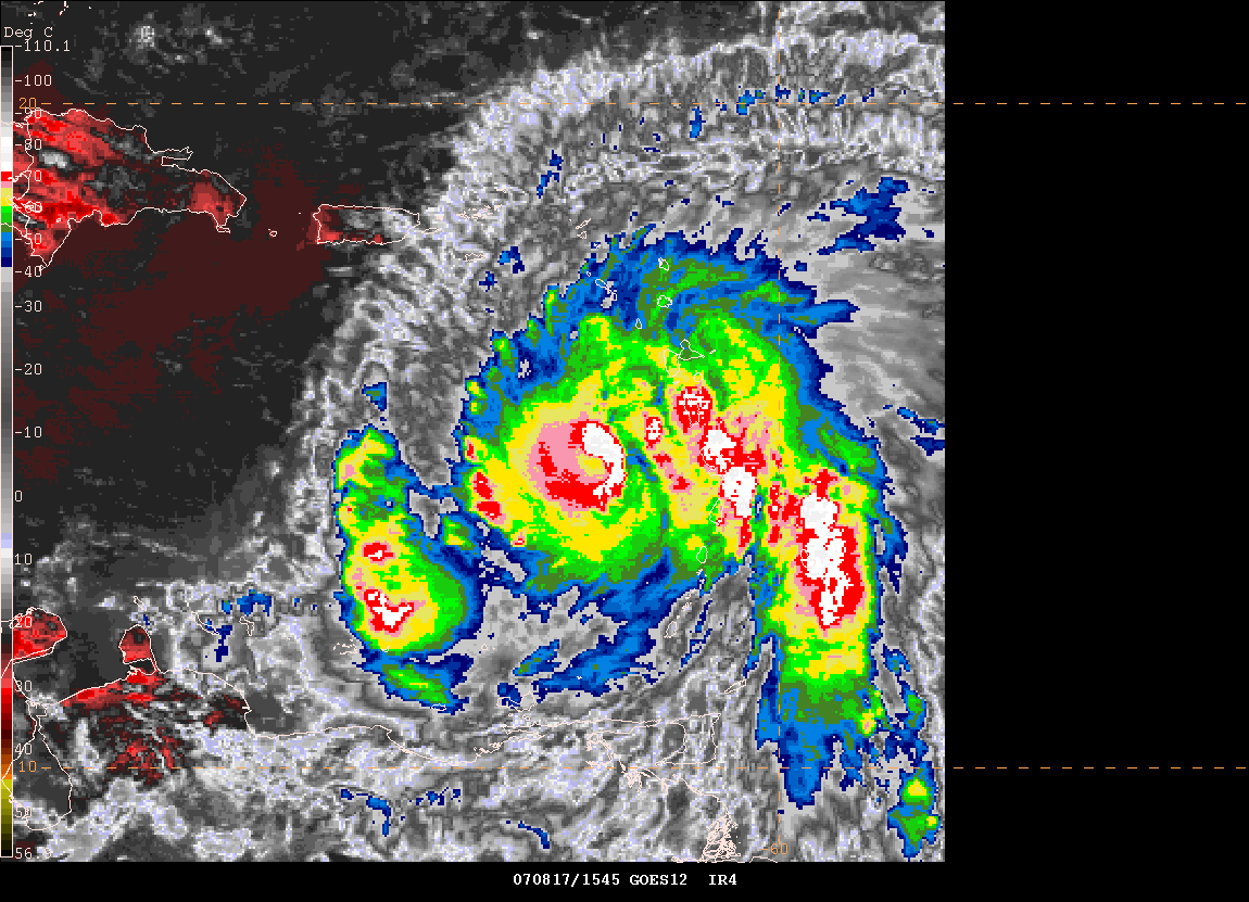
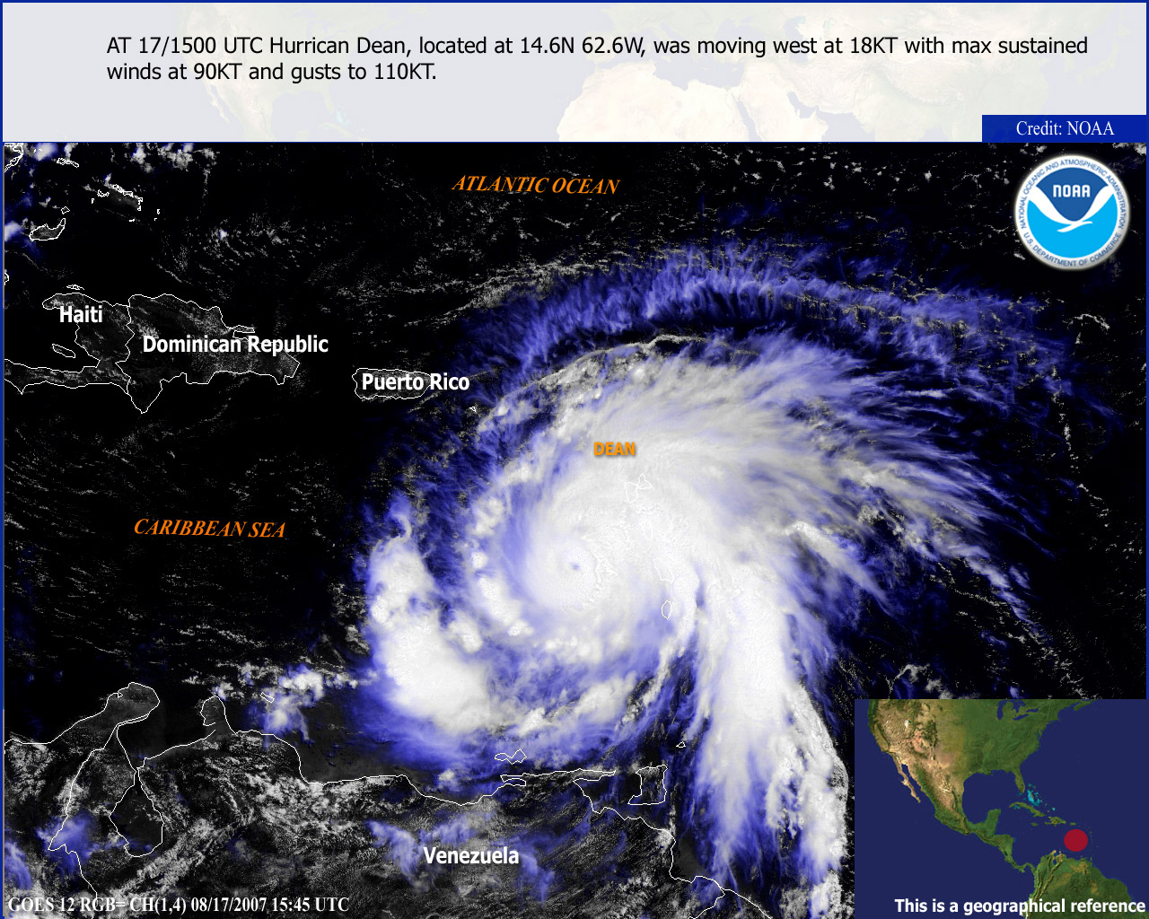
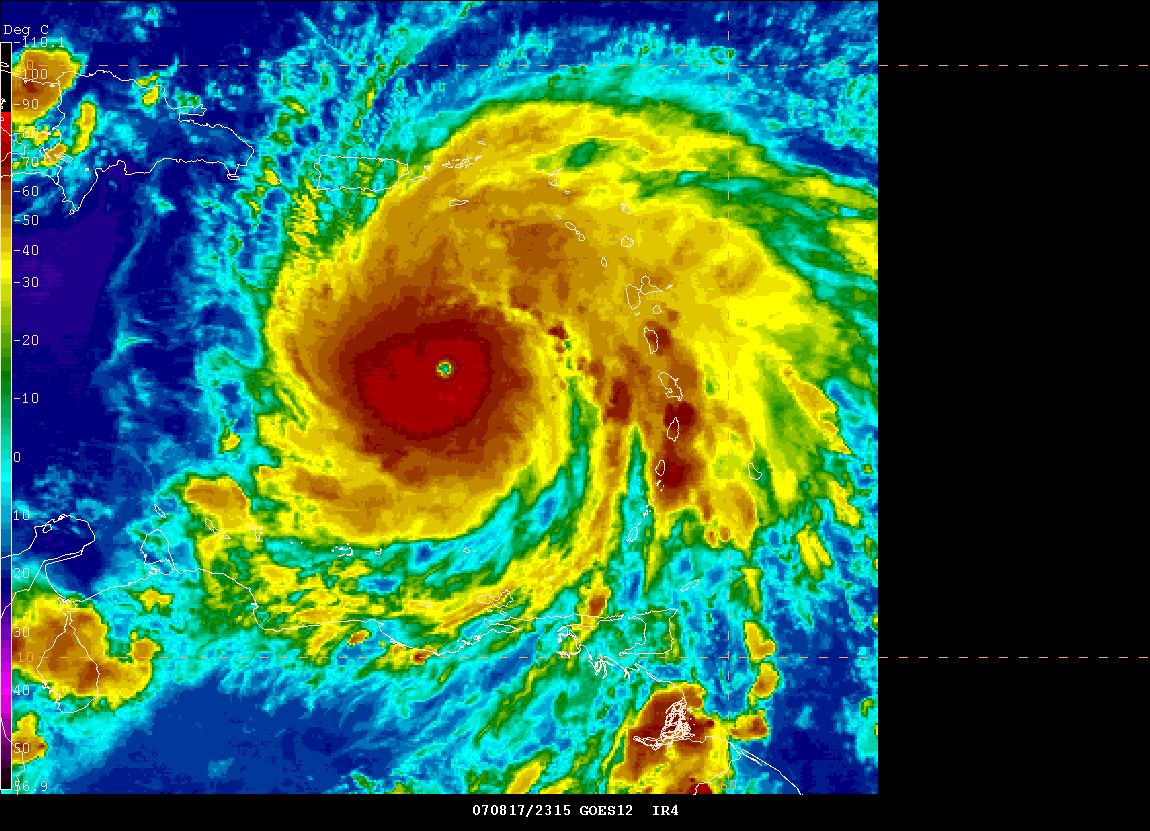
Hurricane Dean continues to move into and through the Caribbean this morning. He has been bringing severe squalls to the islands of Martinique and Dominica. So far most of the damage reports have mainly been to trees and some roof damage. There have been reports from St.Lucia of major flooding, roofs of our structures, and significant tree damage. Dean had weakened slightly overnight and satellite presentations, earlier this morning, were not as impressive as they were yesterday. However, Dean has already started to regain strength as of 9 a.m. Dean could become a category three or four hurricane within the next 24-48 hours. Exact track path is still uncertain. At this time it appears the greatest threat will be to the northern portions of the Yucatan Peninsula. After that areas from Texas to Mexico should be alert as Dean moves in their direction. Hurricane audio feeds can be here at this site.
Radar
Animation
Long Radar
Loop
The WaveWAtch Model is showing an interesting path...with the eye north of the Yucatan.
Wave Model showing the eventual track of Dean. One of many
solutions.
Track possibilities for Dean
Dean has strengthened this morning - winds at 11 a.m. are now estimated to be 105 miles per hour. A well respected forecaster, Don Sutherland, is calling for Dean to hit the Yucatan Peninsula and continue westward striking Mexico a second time south of Texas. You can read his forecast here.
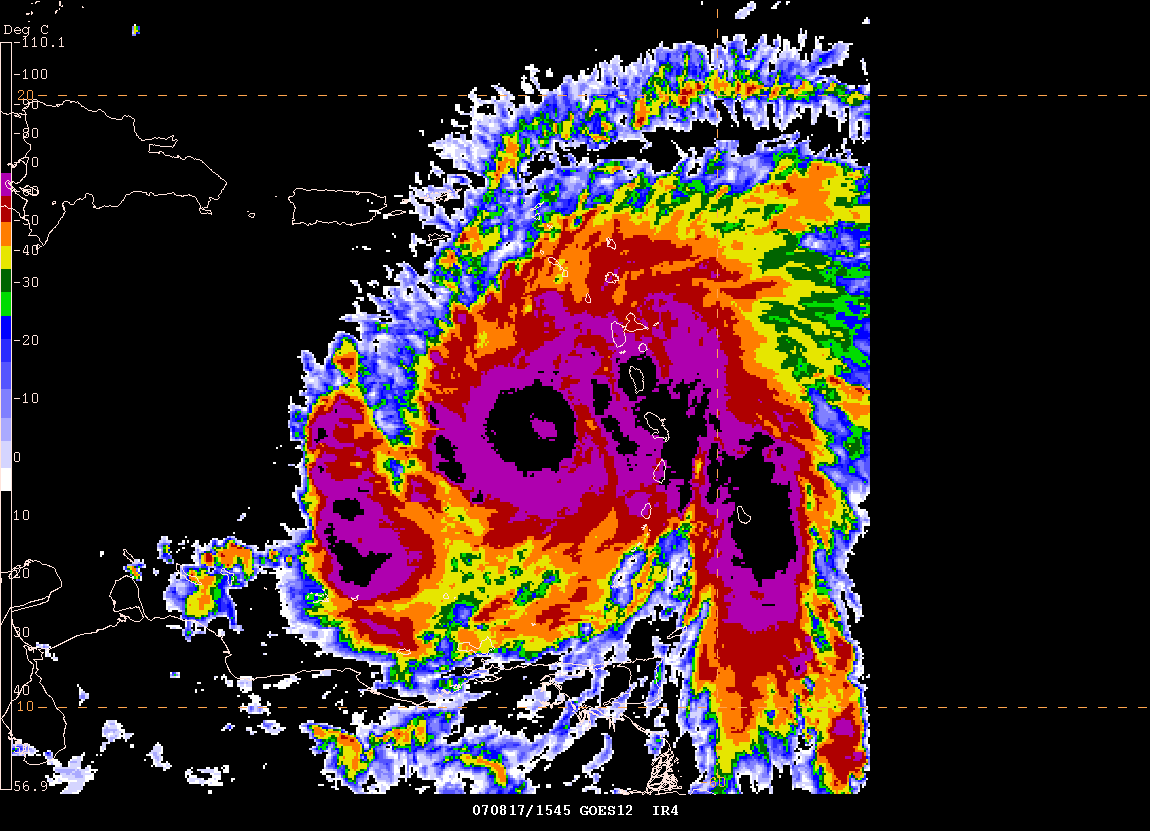
Noon - Satellite Images of Dean
Special Imagery of Hurricane Dean
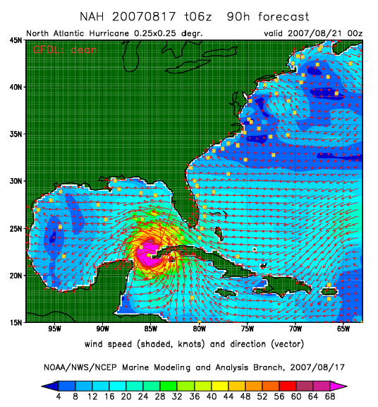
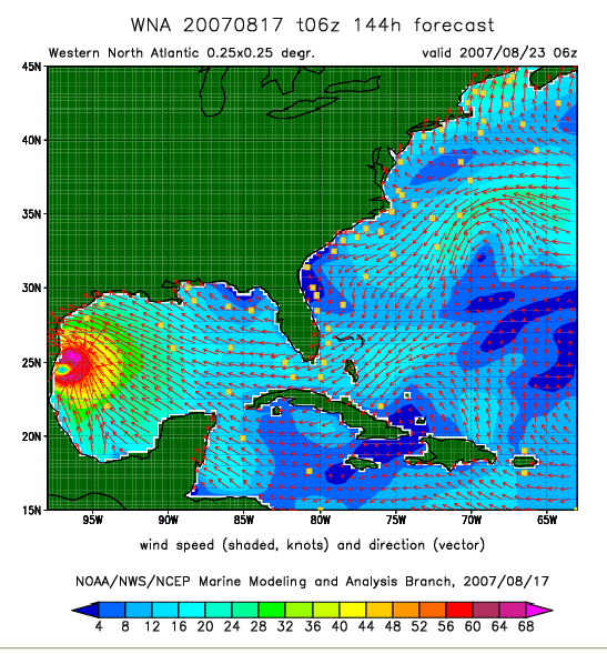
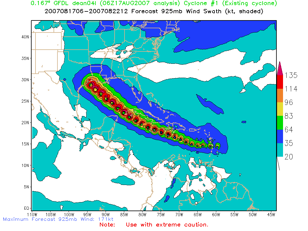
GFDL Possible Track for Hurricane Dean
Heat Wave Kills 41 People Across The South and Midwest...
Relentless heat continues to pound much of the Central and Southern United States. Early figures now place the death toll at more than 40 people. The toll is expected to be much higher - possibly into the hundreds. There were nine confirmed deaths in Missouri, eight in Illinois, four each in Arkansas and Georgia, three in Alabama, two in South Carolina and one in Mississippi and Tennessee. Many others likely have died from heat related illnesses - numbers are difficult to obtain due to how records are kept. Slightly cooler temperatures will prevail over the Ohio Valley today. Instead of 100+ temperatures we will see 90+ temperatures.
So how hot has it been in Paducah? The Paducah, Kentucky, National Weather Service Office has put together some statistics. You can view their information here.
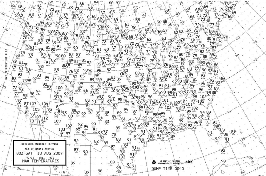
August 17th High Temps
Early Afternoon - Hurricane Dean Strengthens to a Category Three...
Hurricane Dean continues to gain strength...it is now a major hurricane with winds of 125 mile per hour winds. Barometric pressure is now down to 960 mb. Hurricane Dean will likely become a category 4 hurricane over the next 24 hours. There are discussions underway on how to evacuate the Gulf Coast. The State of Kentucky has agreed to take 5000 evacuees from Louisiana. The American Red Cross would be opening shelters in the event of this scenario. Hurricane Dean has caused major damage across Martinique and St. Lucia. At least one person has been killed.
Hurricane Dean - Afternoon Image
EasternUSwx
image grab
Evening - Hurricane Dean Strengthens to a Category Four Hurricane...
Hurricane Dean continues to gain strength...it is now a major hurricane with winds of 135 mile per hour winds with a pressure reading of 935 mb. This makes Dean a dangerous category four hurricane. Additional strengthening is possible. This is an extremely dangerous hurricane. Interests in the Caribbean, Mexico and along the Gulf Coast should keep abreast of the latest information on Hurricane Dean. Current projections are that Dean will strike the Yucatan Peninsula and then moves west/northwest and strike portions of Mexico or Southern Texas. There remains a lot of uncertainly as to the eventual path. The next island in the path of Hurricane Dean will be Jamaica. Unfortunately it appears that this will be a direct hit.
Here are some 7 p.m. images from Gempak of Hurricane Dean
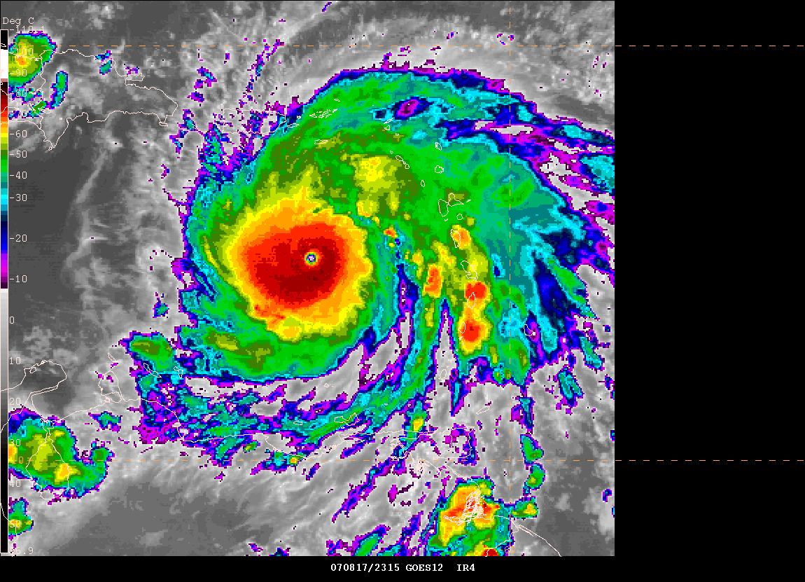
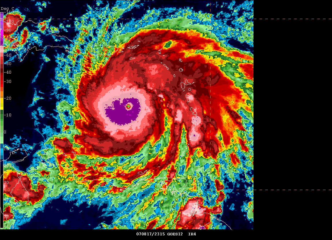
Hurricane Images - Click for full view.
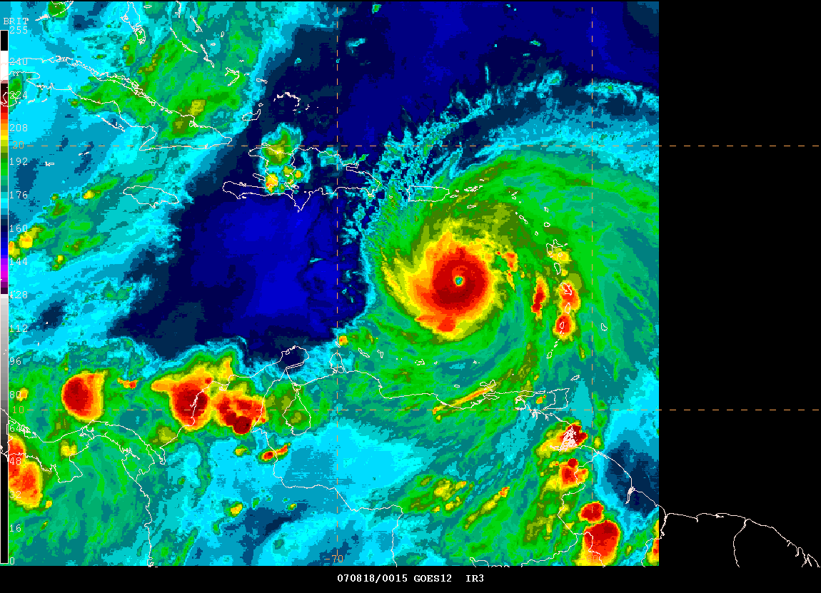
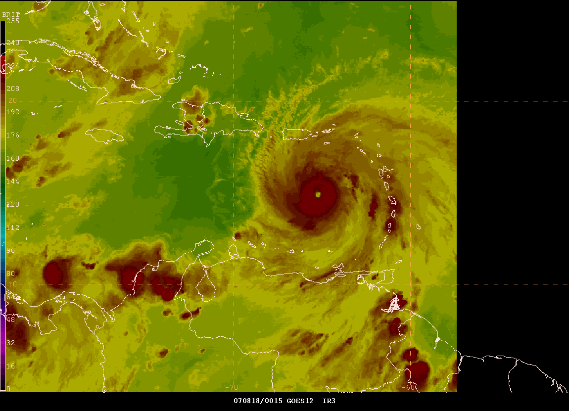
Hurricane Images - Click for full view.
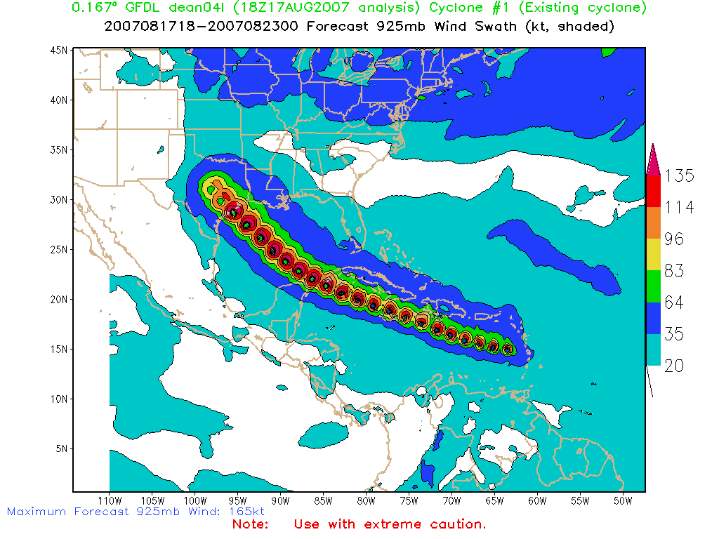
GFDL 18z Forecast Track
Mike Davis posted this report from the island of St. Lucia earlier this evening. The eye-wall passed across the southern portion of the island causing extensive damage.
Dangerous Dean: The most powerful hurricane to strike St. Lucia in 27
years.
Early this morning Hurricane Dean tore through St. Lucia with violent
winds and rains. The southern portion of the eyewall brushed the
northern part of the island resulting in very notable damage in certain
parts of the country.
Several reports indicate that many roofs in the northern part of the
island were blown off and a few homes were completely destroyed. The
roof of the Children’s Ward at the Victoria Hospital was blown off as
well as that of a few schools and churches. There were reports of
flooding caused by heavy rains and also by the storm surge. The
waterfront area of the city of Castries was littered with debris as the
large waves deposited the large boulders which were used along the shore
to serve as a protective barrier against high seas right onto the
street. Numerous road signs and billboards were blown down. There was an
island wide power failure from about 4am this morning leaving over 165
000 persons with no power. Most of the radio stations were knocked out
during the cyclone and the tower holding the antennae of Radio St. Lucia
which is located at Morne Fortune was almost completely destroyed.
Several power lines were ripped off and some poles were toppled over as
trees fell onto the lines. There has also been one fatality as a 62 yr
old man drowned in Sarot. The heavy storm surge has caused some beach
erosion and several boats have been reported to have sank. However, the
most severe damage was caused to the vegetation with many, many trees
uprooted and stripped bare of their leaves and branches. Everywhere is
just littered with leaves and broken branches to the magnitude that I
have never witnessed and similar sentiments are being shared by most
people.
All of this destruction and possibly more, was all caused by the
powerful winds generated by Dean which began to gusts violently from
about 2am this morning and worsened between 4:30am and 7am this morning
as the eye passed by. Gusts up to 77kts or about 90mph and 101.7mm of
rain were officially recorded at the George F. L. Charles Airport in
Castries. Even stronger winds have occurred in the Gros Islet area which
is the northern most district of the island. The situation there is very
grim based on the reports I have received. The famous Rodney Bay tourist
area has been heavily damaged with many roofs damaged and a lot of trees
and power lines down. Power has not been restored there as yet so it
could be a long night for persons living in the area not to mention the
tourists. Cap Estate, located at the very northern tip of the country
was probably brushed by the eye and the eyewall as a brief calm period
was reported by one of our correspondents.
Generally, St. Lucia was heavily impacted. I have never witnessed such
violent conditions on St. Lucian soil before but it could have been
worse had the eye passed about 20 or 30 miles further south. Martinique
was worse hit than us so I am keeping my fingers crossed for our
neighbors over there and I hope to hear from them soon.
Mike Davis, from St. Lucia Island, posted these photos of some of the storm damage. At least 1 person has been killed on the islands. Mike posted this report earlier this evening from the island:
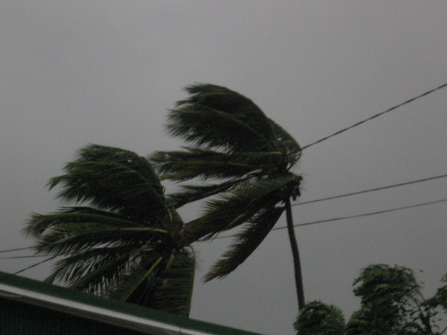
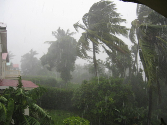

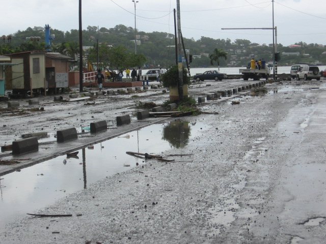
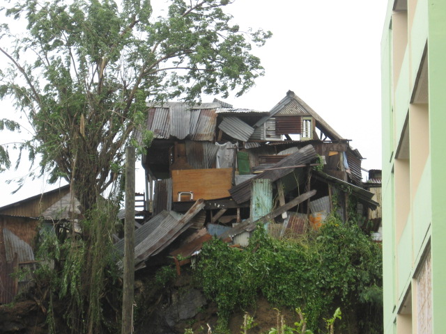
Photos by Mike Davis - St Lucia Island.
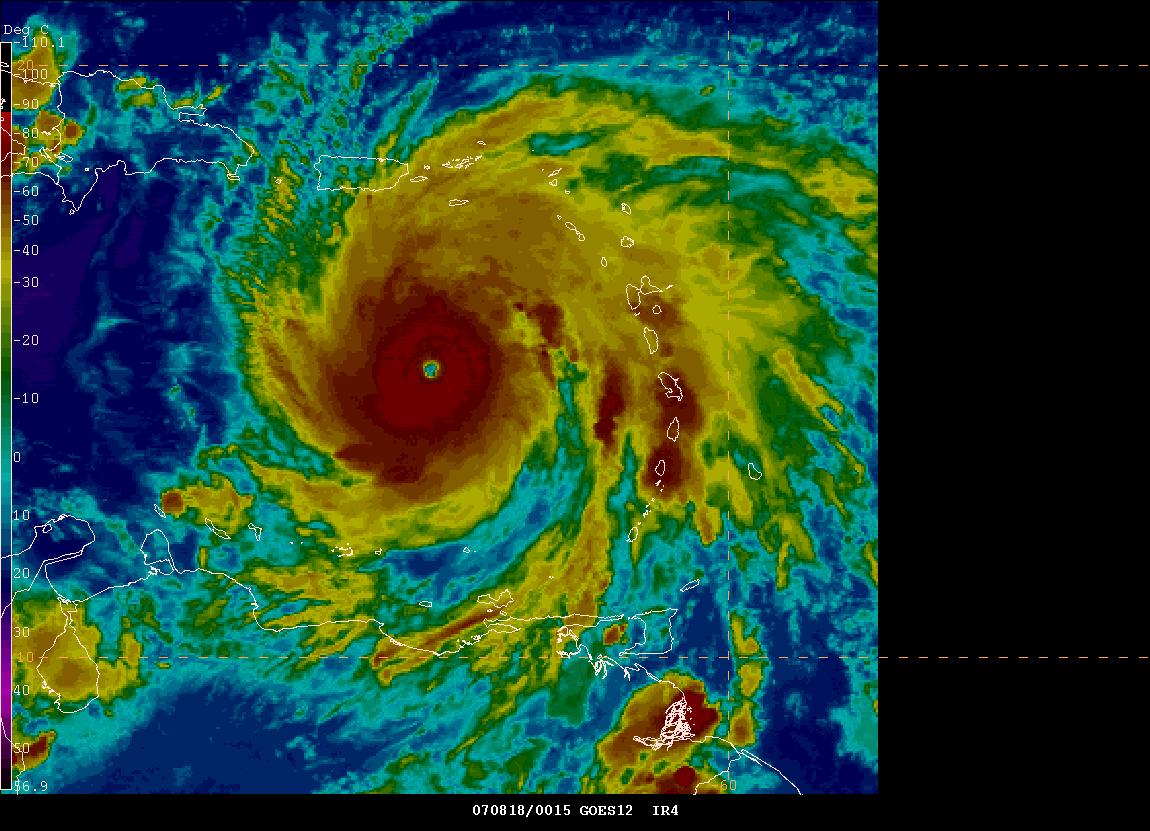
10 PM - Hurricane Dean Strengthens to a Strong Category Four Hurricane...
10 p.m. Recon Report - Winds are now sustained at 145 mph. Dean would only have to increase its winds by 10 mph in order to reach category five status. This is an extremely dangerous hurricane. The 11 PM advisory. Three people have been killed by Hurricane Dean. A State of Emergency has been issued for the State of Louisiana.
10 PM EDT - Hurricane Dean Gempak Images
At least one hurricane chaser is working on his final chase itinerary. Josh Morgerman could be heading for Jamaica, Cancun, Mexico or Brownsville, Texas. For updates on his chase you can visit this thread. You can also visit his web-site Icyclone.
11 PM - Recon has reported a wind gust of 179
mph...
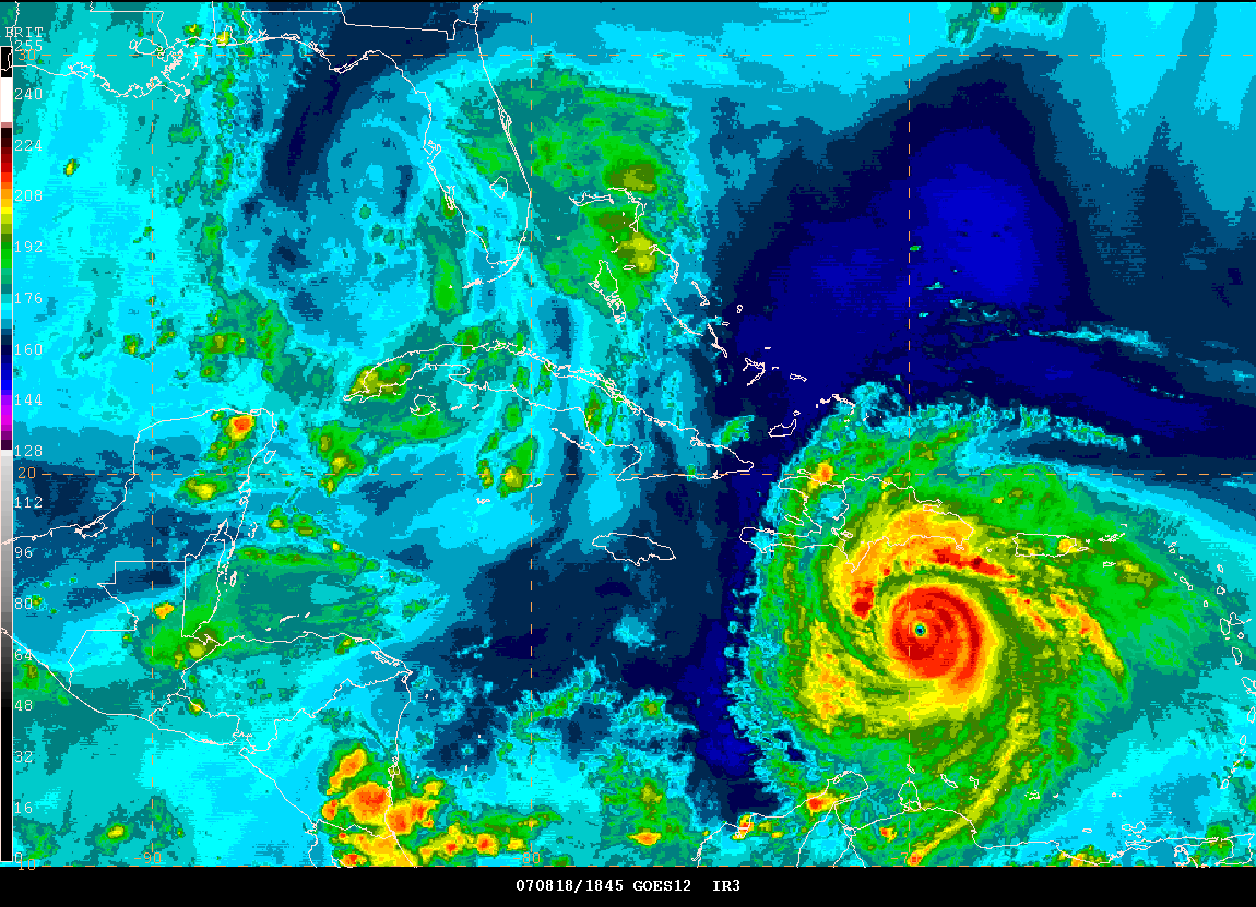
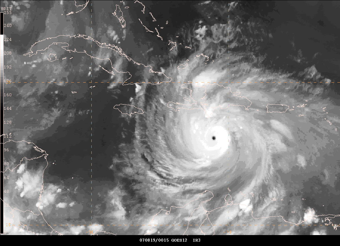
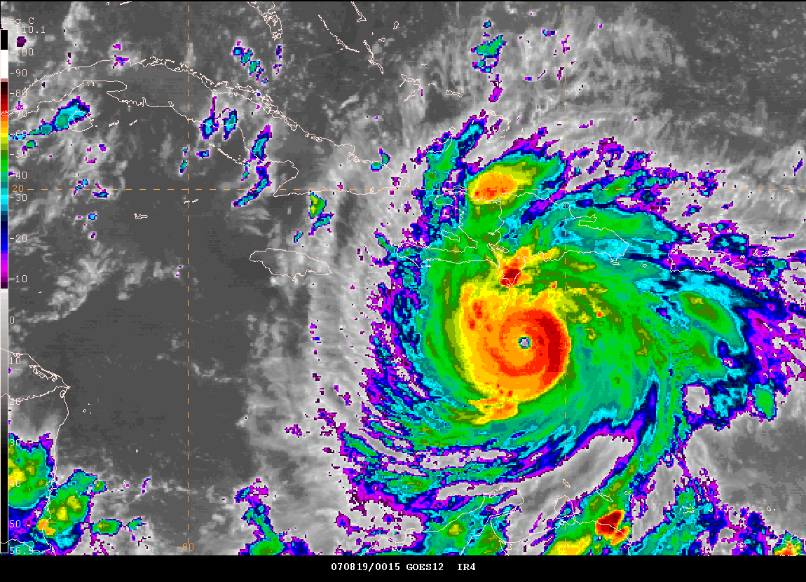
August 18, 2007
Dangerous Dean Churns Through The Caribbean...
12 AM - EDT - Hurricane Dean churns through the
Caribbean
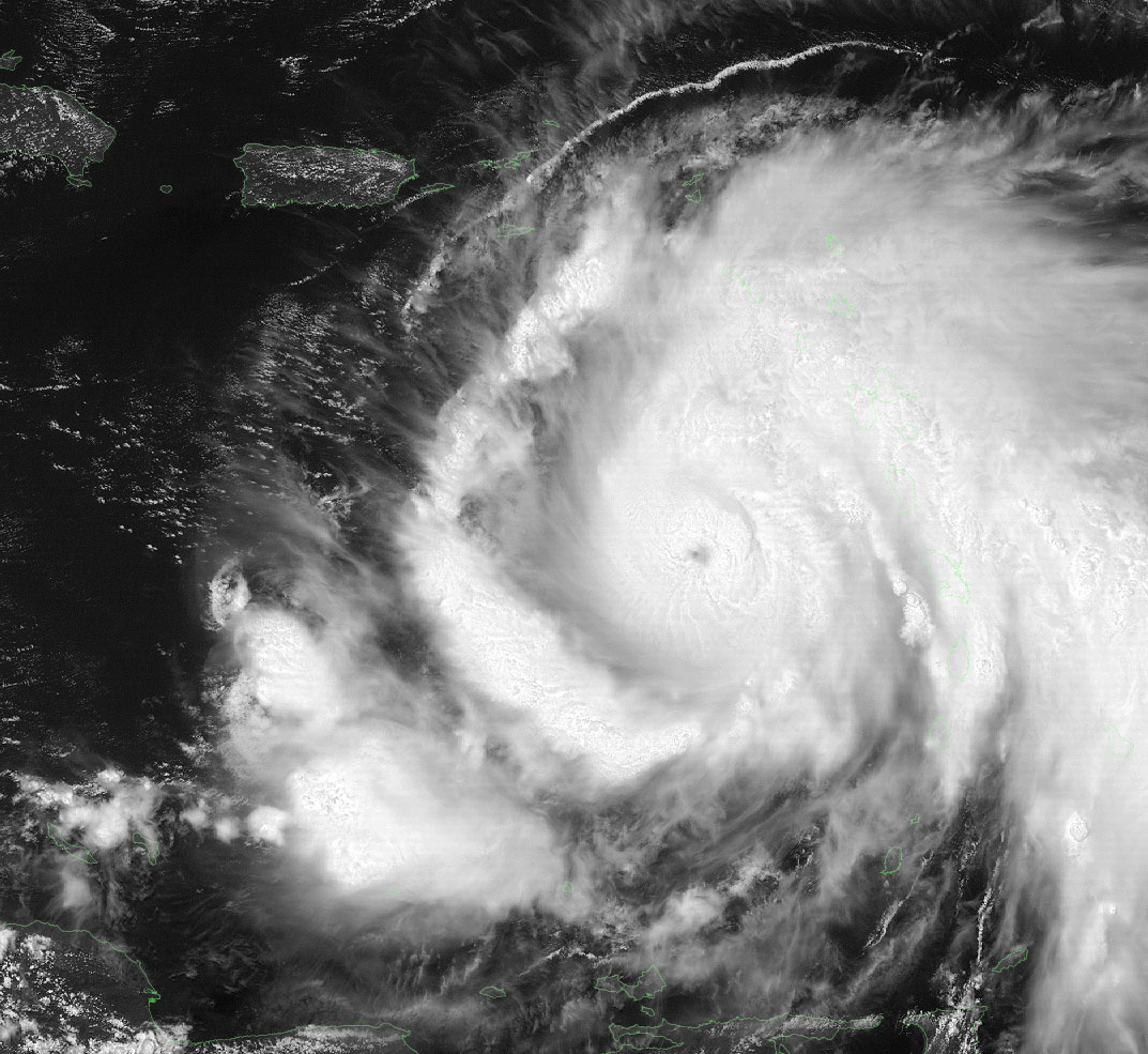
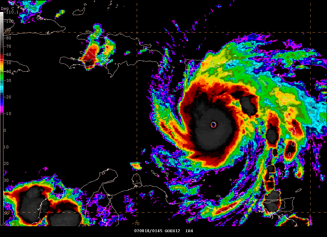
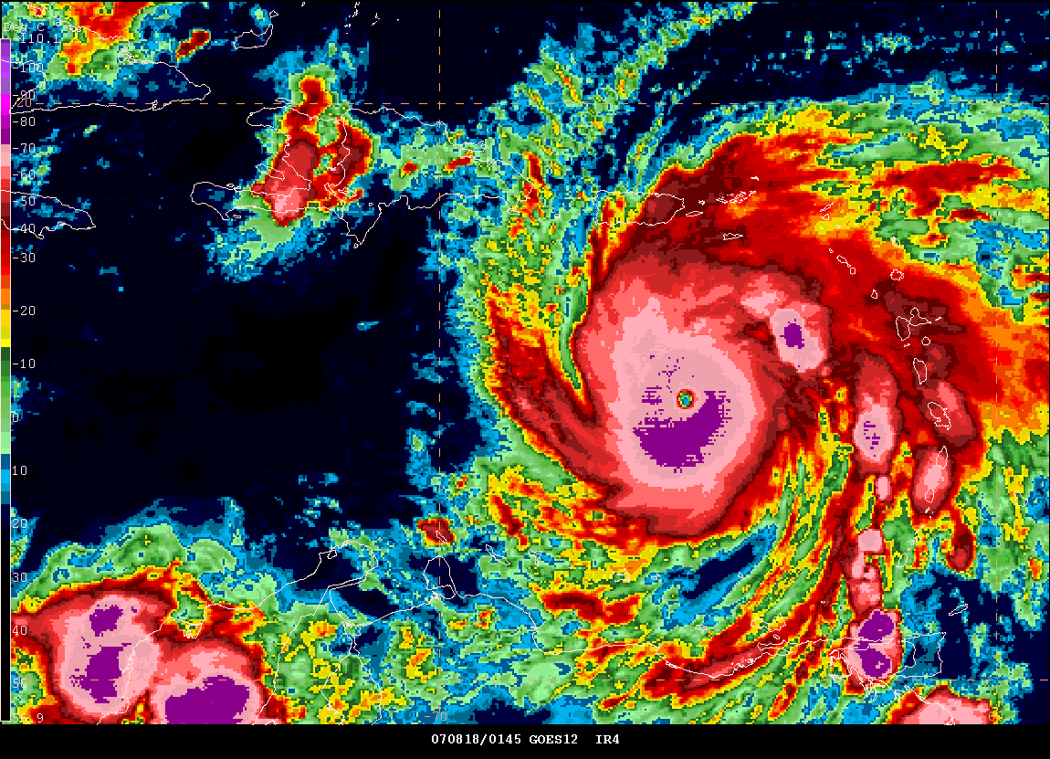
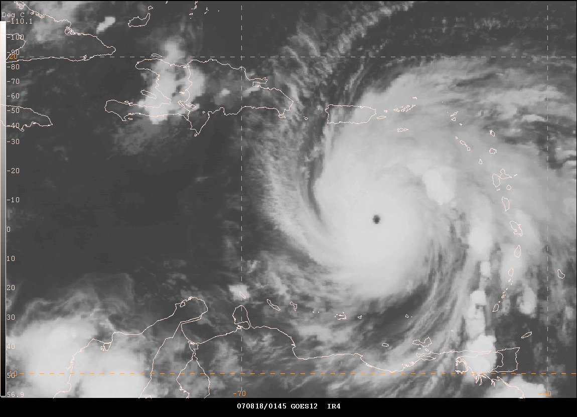
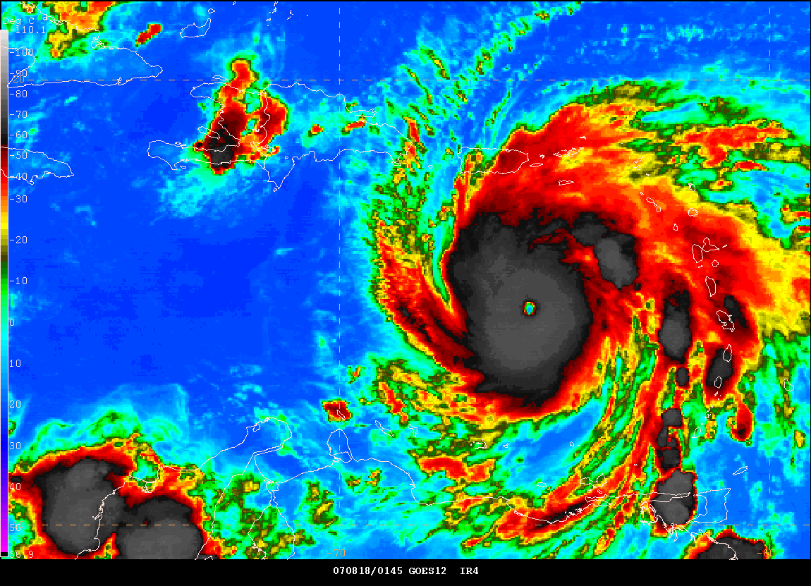
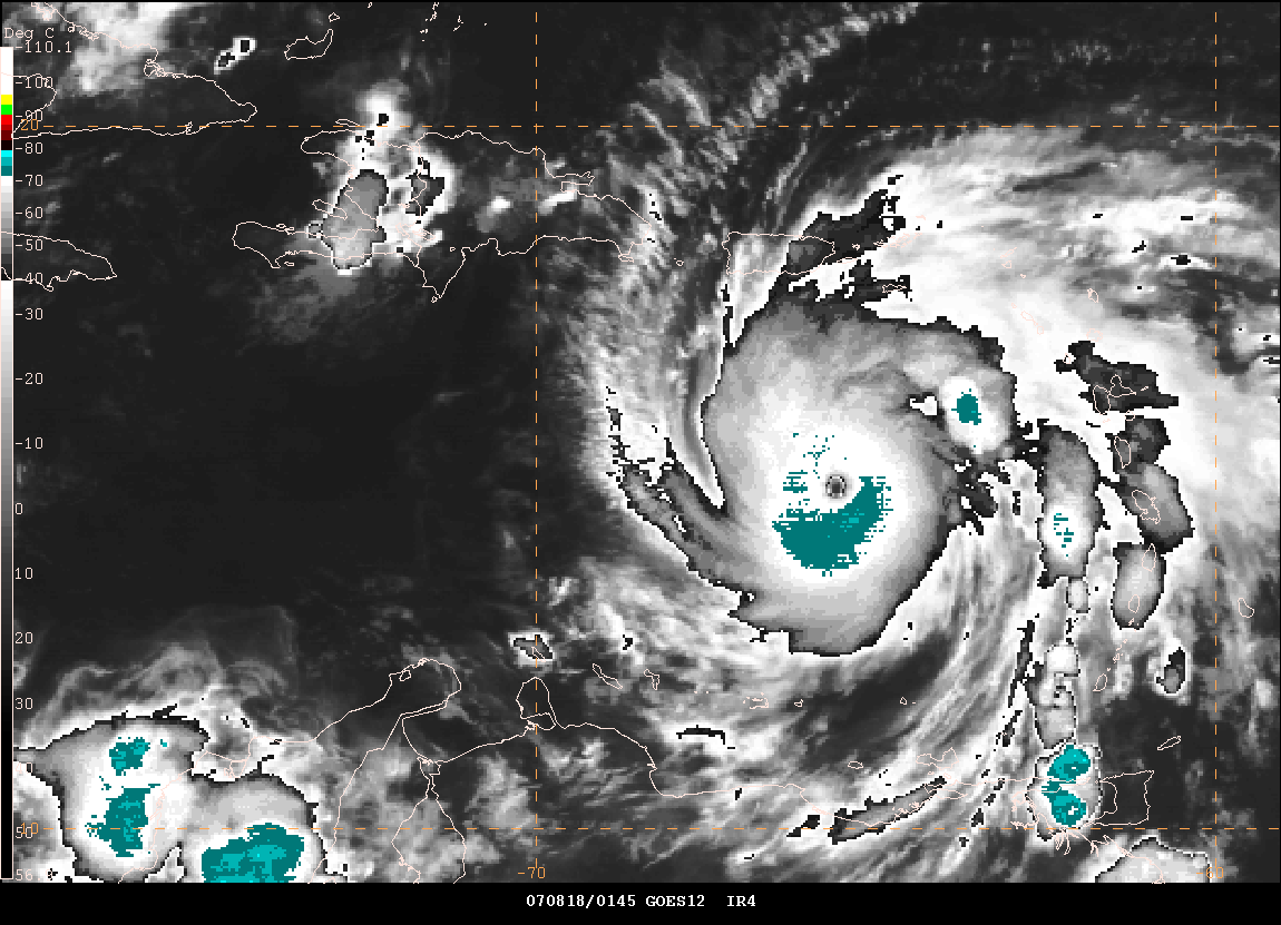
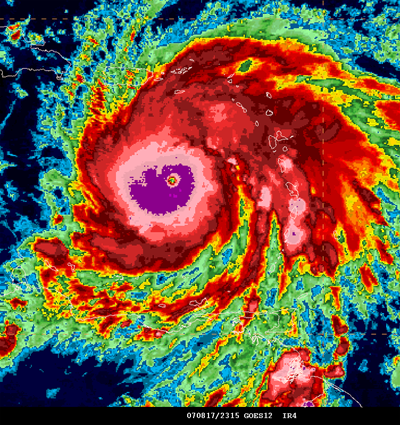
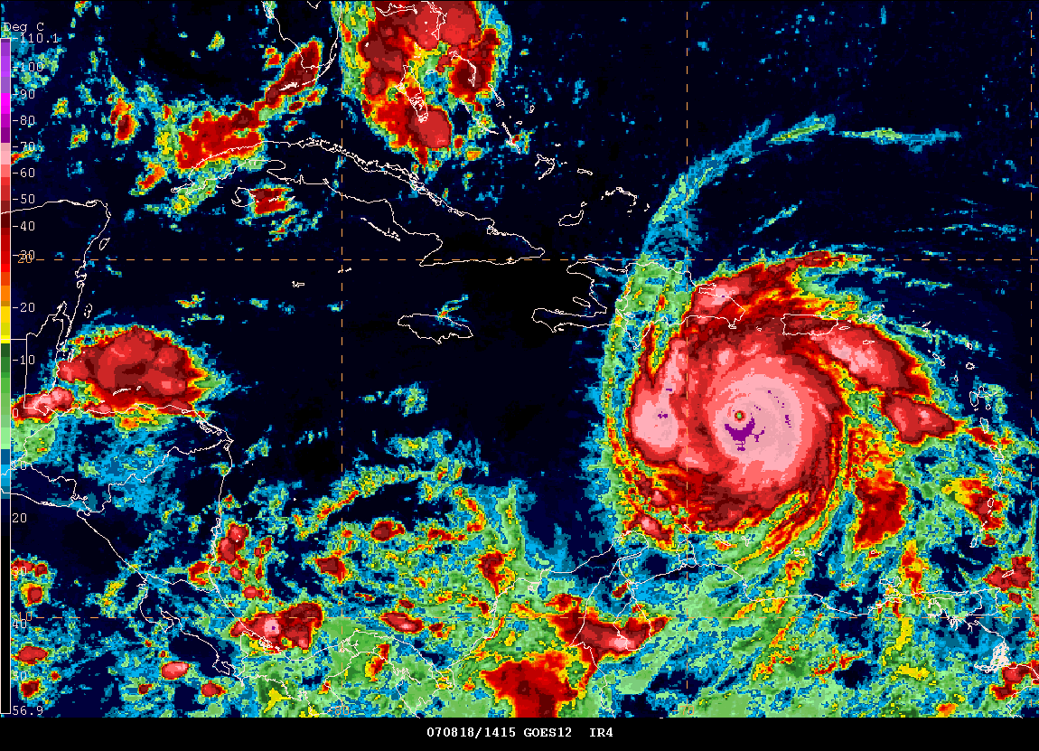
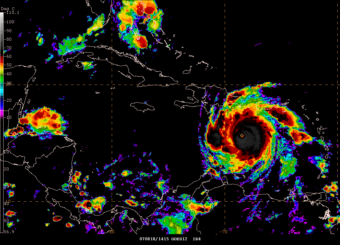
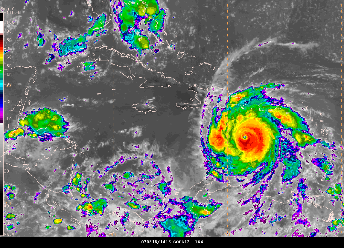
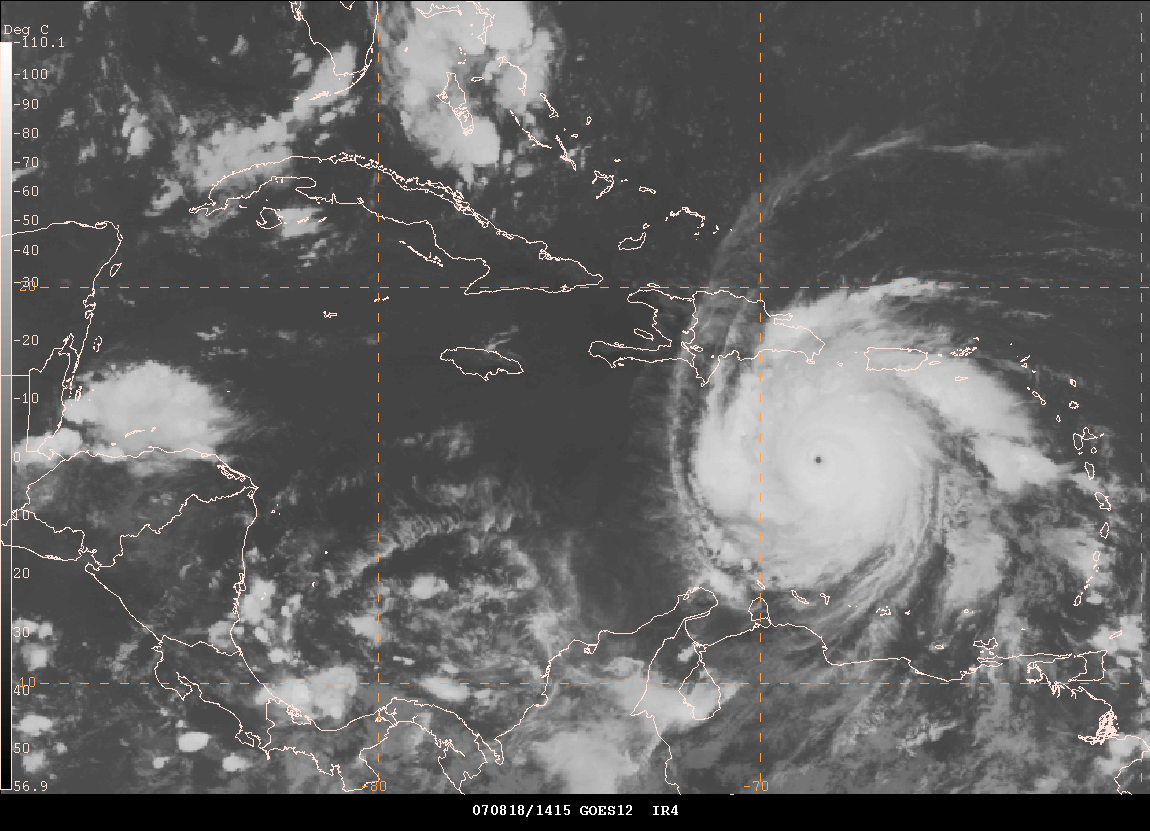
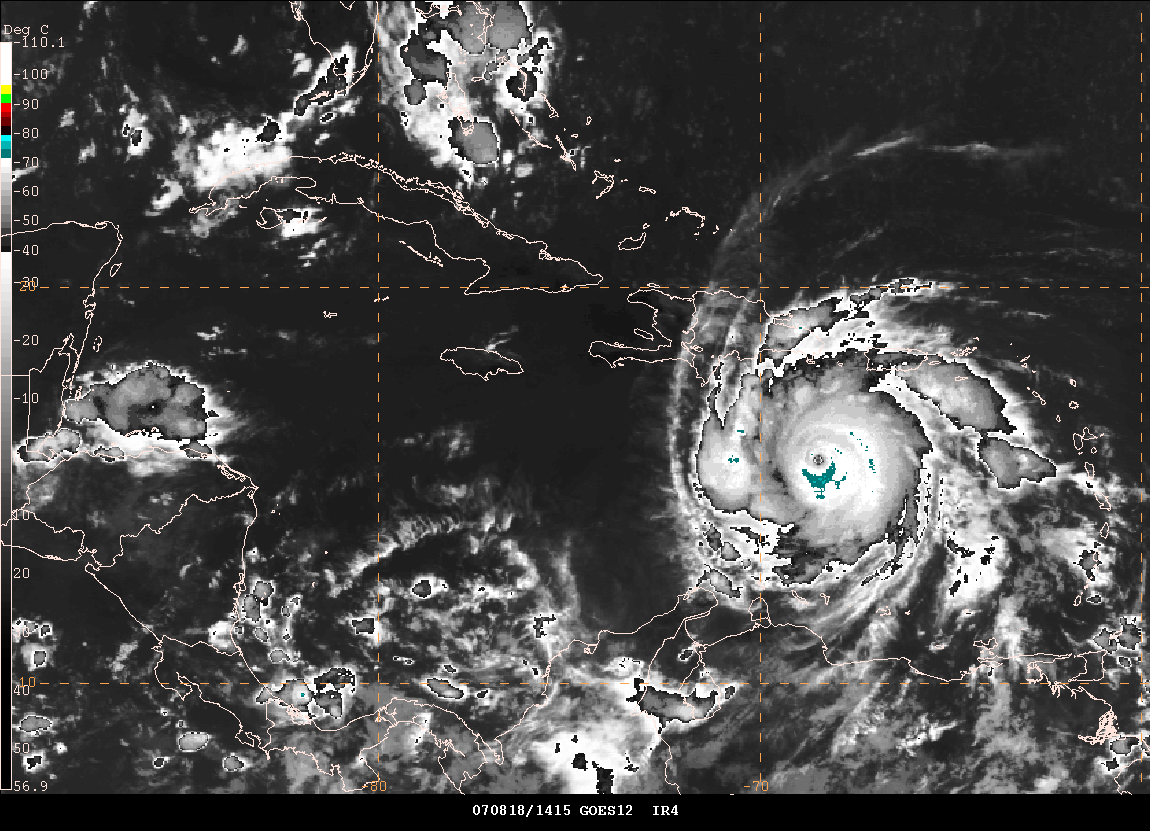
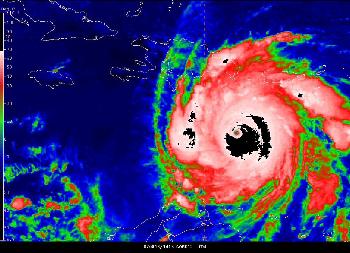
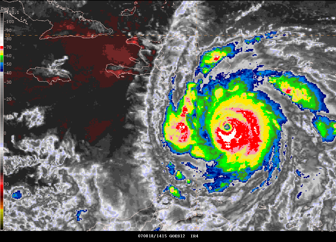
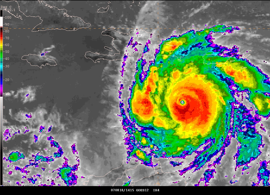
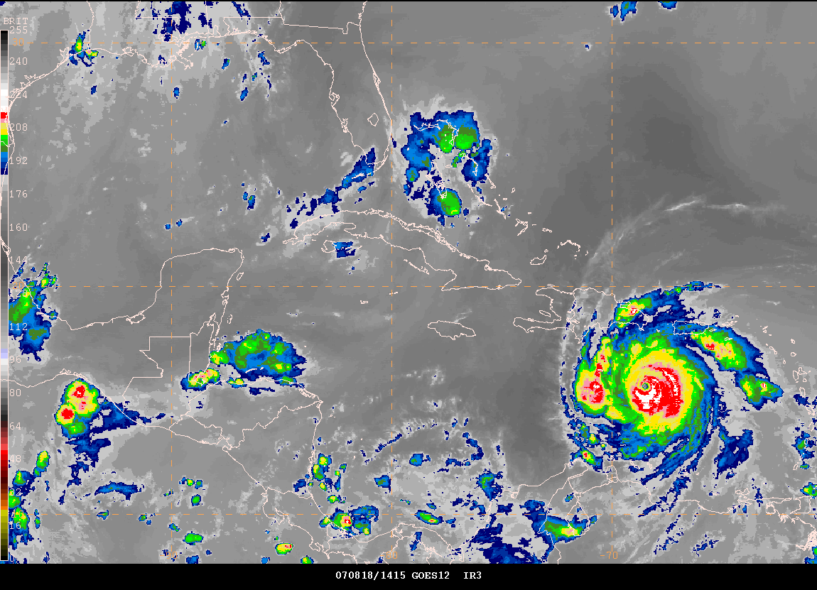
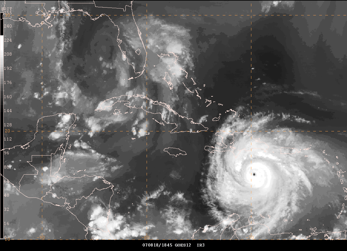
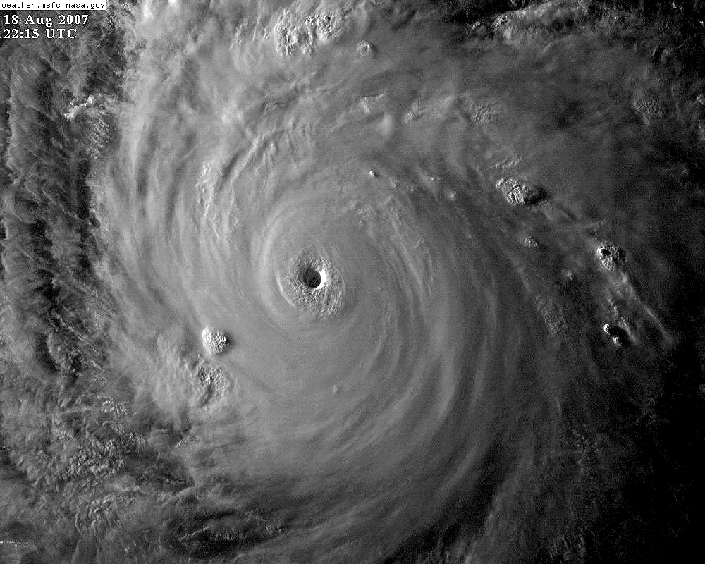
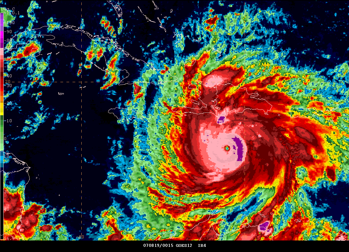
At 2 AM Hurricane Dean continues to strengthen. The National Hurricane Center has increased his winds to 150 miles per hour with gusts to 180 miles per hour. The pressure has fallen to 930mb. This is an extremely dangerous hurricane. View a large satellite image of Hurricane Dean here. Large loop of the same image (warning extremely large images).
20 Frame Loop of
Hurricane Dean passing south of Puerto Rico
Bobo and Annika Bergstrom have posted a few photos of the damage on St. Lucia. You can view all of their photos on this web site.
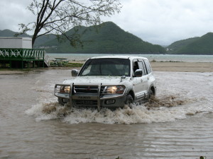
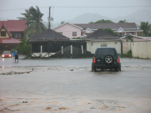
Photos from St. Lucia
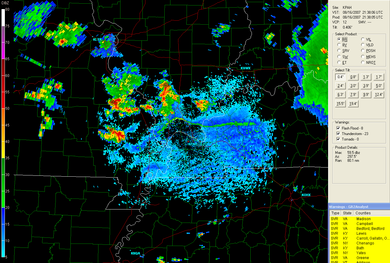
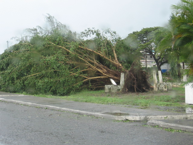
The remnants of Tropical Storm Erin
continue to spin over Southern Texas. Rainfall amounts in excess
of 5 inches have been reported in many areas. This has caused
flash flooding in numerous counties. Texas state officials reported four
deaths and three people missing following the storms impact on the
region. You can view all the
local
storm reports and rainfall totals here.
Long radar loop of the
remnants of Erin
Image from
Intellicast.com

If you would like to listen to
NOAA Weather Radio Live then visit this site. You can hear most of
the Gulf Coast NOAA Weather Radio Stations - including Brownsville,
Texas
Cuba radar has been updated and there are now numerous
radar locations. This is an improvement over the last few years.
You can visit the
Cuban Radar Sites at this web-site. You can also visit the
Jamaica Weather
Radar Site (may be down for maintenance). It may not stay up
long if the hurricane does strike the island.
Guantanamo Bay, Cuba Radar.
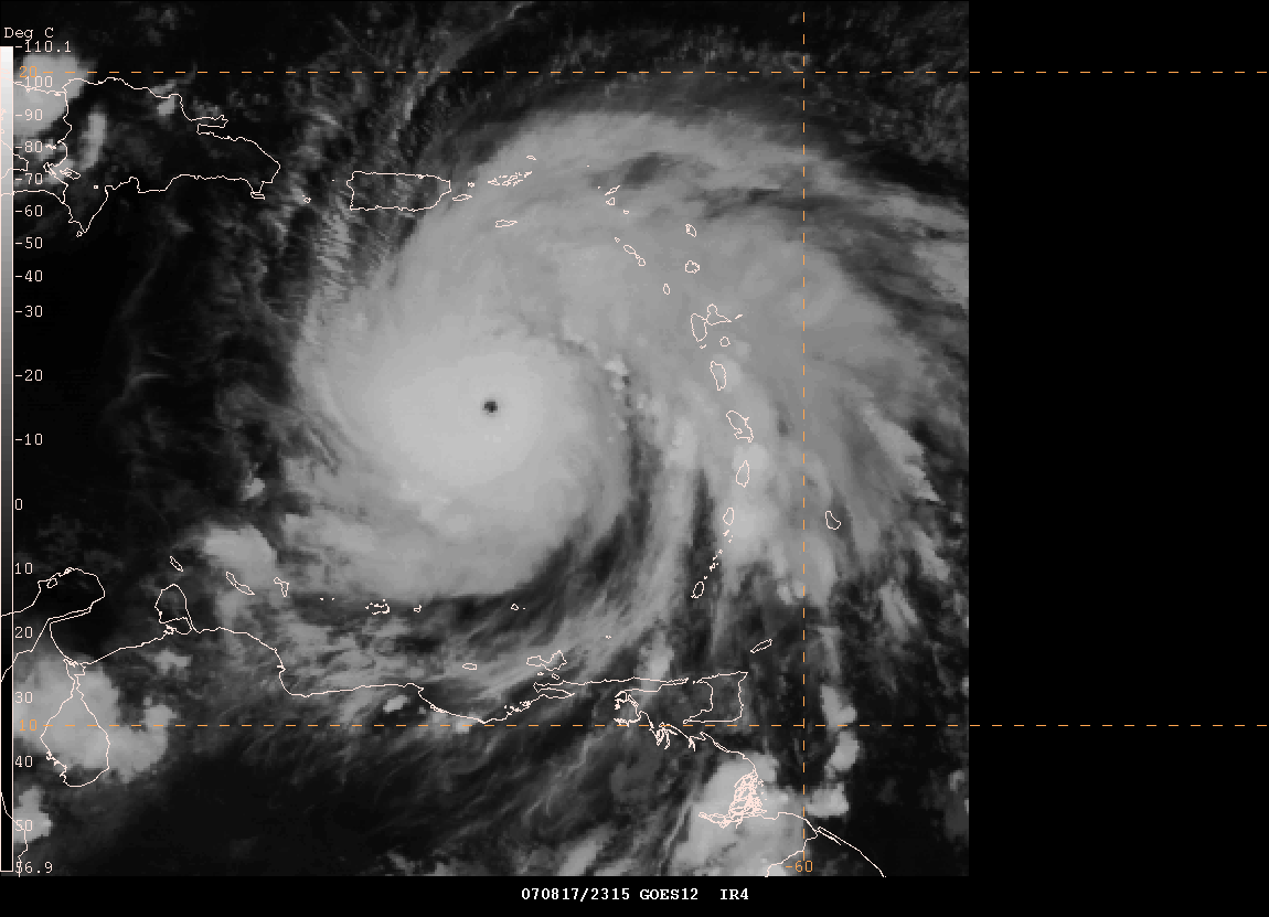
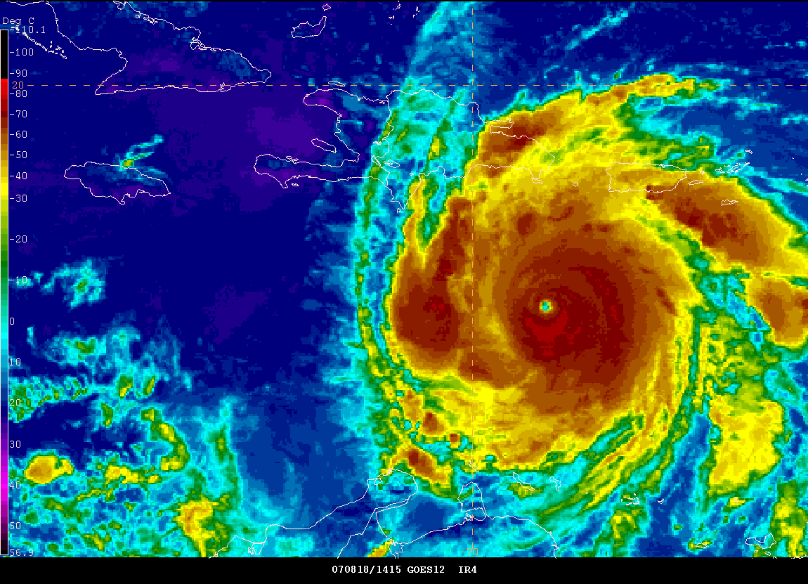
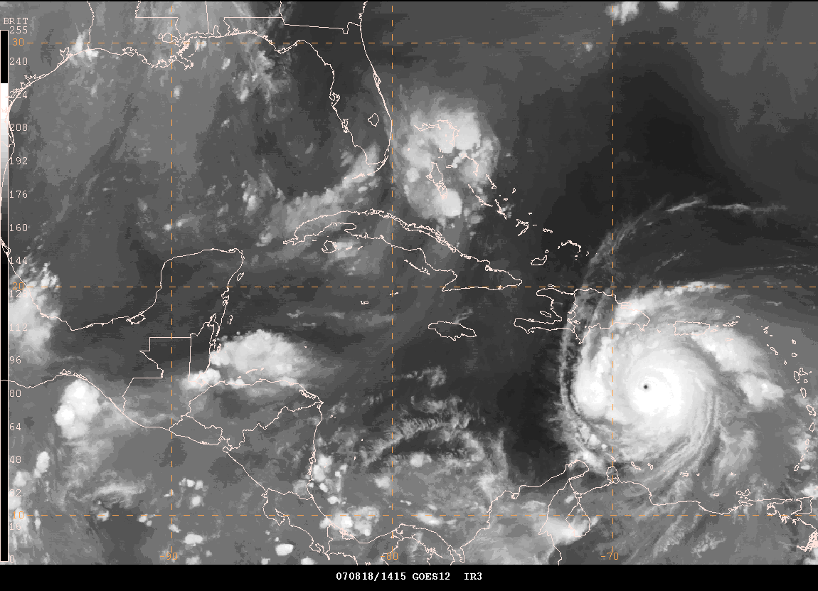
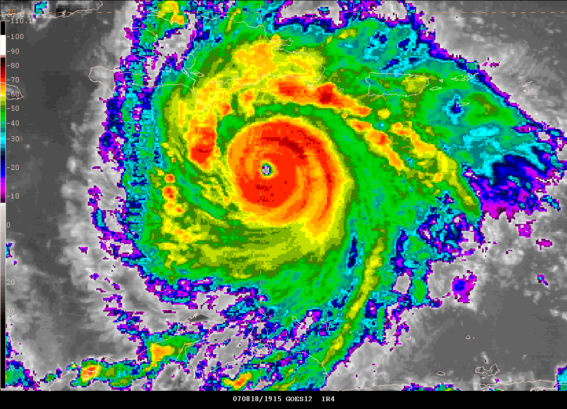
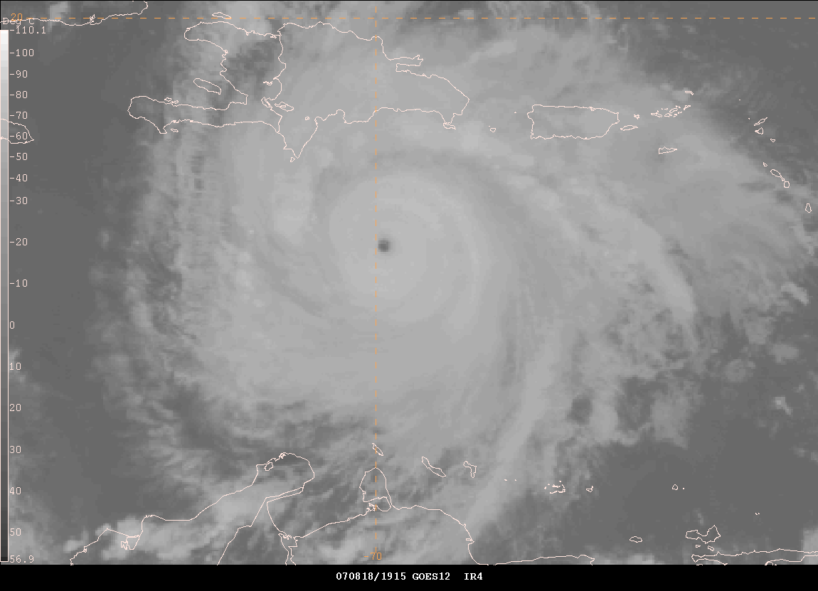
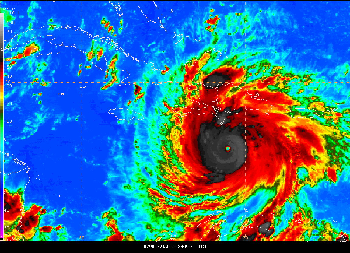
11 AM - Hurricane Dean Remains a Strong Category Four Hurricane...150 MPH Winds
11 AM Images of Hurricane Dean - Gempak Image Grabs. Click for large file - right click to save to your computer.
For those interested in watching some of the islands. Here is a link to multiple web-cams from the Grand Cayman Island. Live weather conditions as well. This was mentioned on the TalkWeather Forum by Drew. Map of the location of this island.
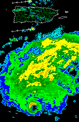
Animation using HurrTrack Software - you can see the northwest wobble. Here is a long radar loop from Puerto Rico as Hurricane Dean pulled away.
WIFI Internet for your vehicle? A reality now with AutoNet!

Are you a storm chaser? Wouldn't it be great to download Gibson Ridge Radar Images straight from your car? How about checking the latest Day 1 Severe Weather Outlook? Hurricane bulletins? Then I think you will be excited to know that a new service will be available, within the next few weeks, that will bring WIFI Internet to your car, hotel room, or anywhere else for that matter. AutoNet Mobile is the first device of its kind in the U.S. Market. It will allow you to turn your vehicle into a rolling WIFI Hotspot. The patent-pending technology allows for seamless transfer between cell towers. This means no more disconnects and reconnects. Reviews of this device have been excellent. You can read some lengthy chaser reviews at this site. Visit the AutoNet Website for full details.
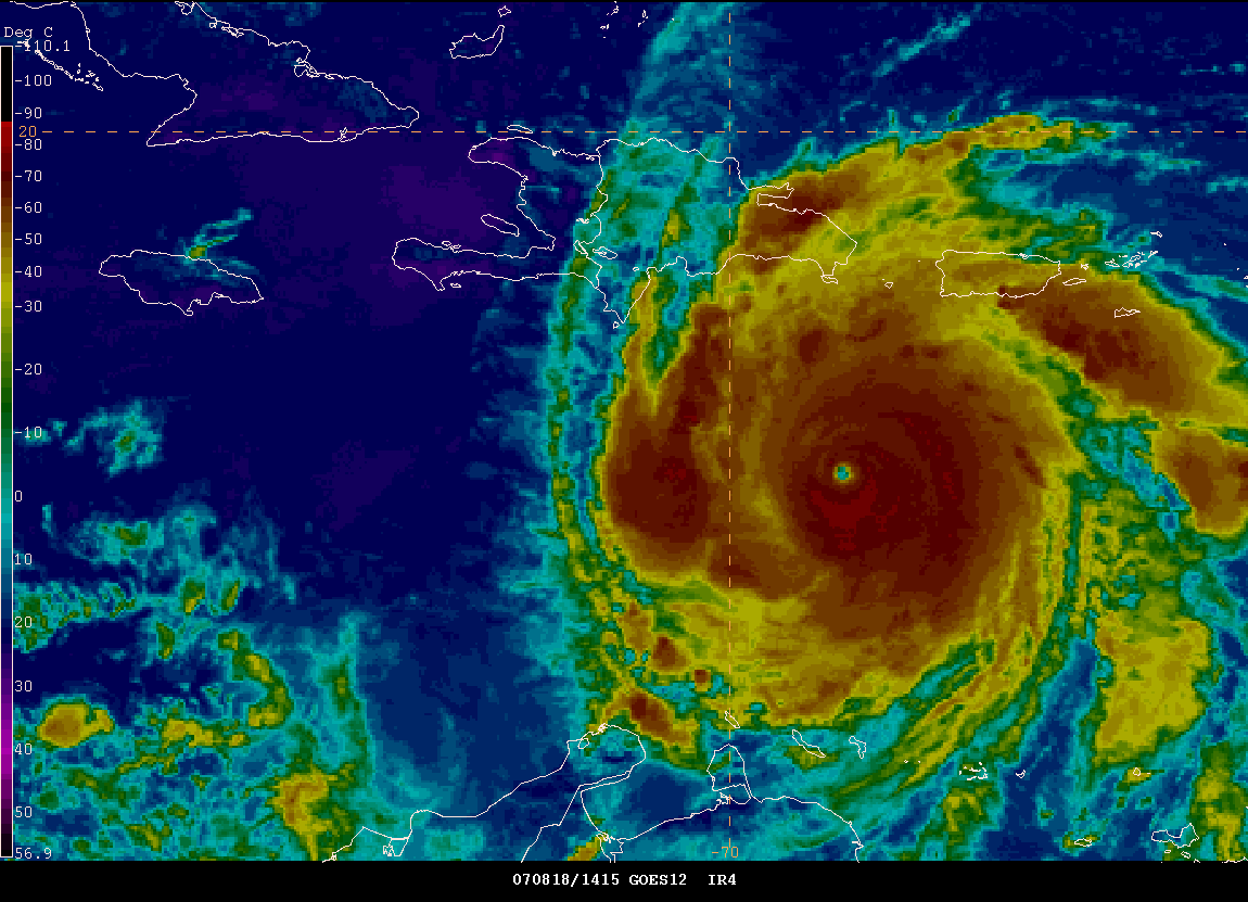
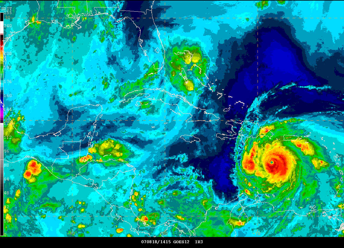
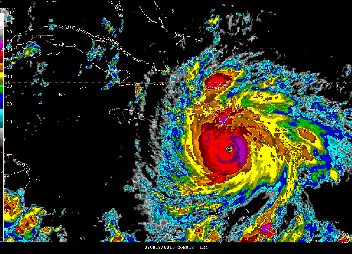
2 PM - Dean Remains A Strong Category Four Hurricane...

2 PM Gempak Image

HurrTrack is showing a powerful hit on the Yucatan Peninsula. This would be a category five hurricane if the model forecast holds true. The remnants of Erin continue to bring rain to portions of Texas. Tropical Storm Erin has already killed six people due to flash flooding.
Local radio stations across Jamaica for those who are interested in listening to live coverage.
Nationwide Radio
(Hurricane coverage and live reports
starting tonight.)
http://www.nationwidenewsnetwork.com/
Newstalk93 (Hurricane coverage starts tonight)
http://newstalk.com.jm/
Love101fm
http://www.love101.org/
Kool 97 fm
http://www.kool97fm.com/
Irie fm
http://www.iriefm.net/
Power106 FM
http://www.go-jamaica.com/power/
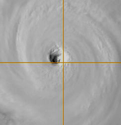
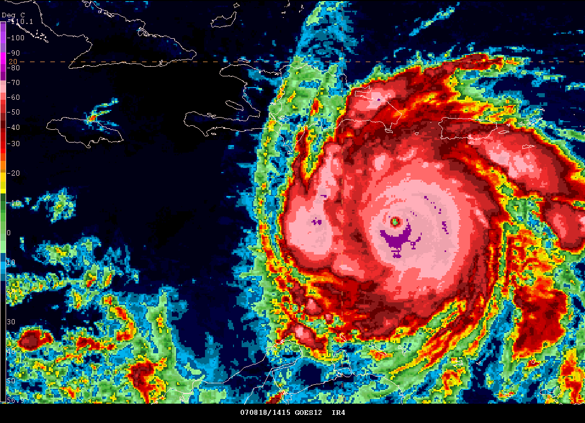
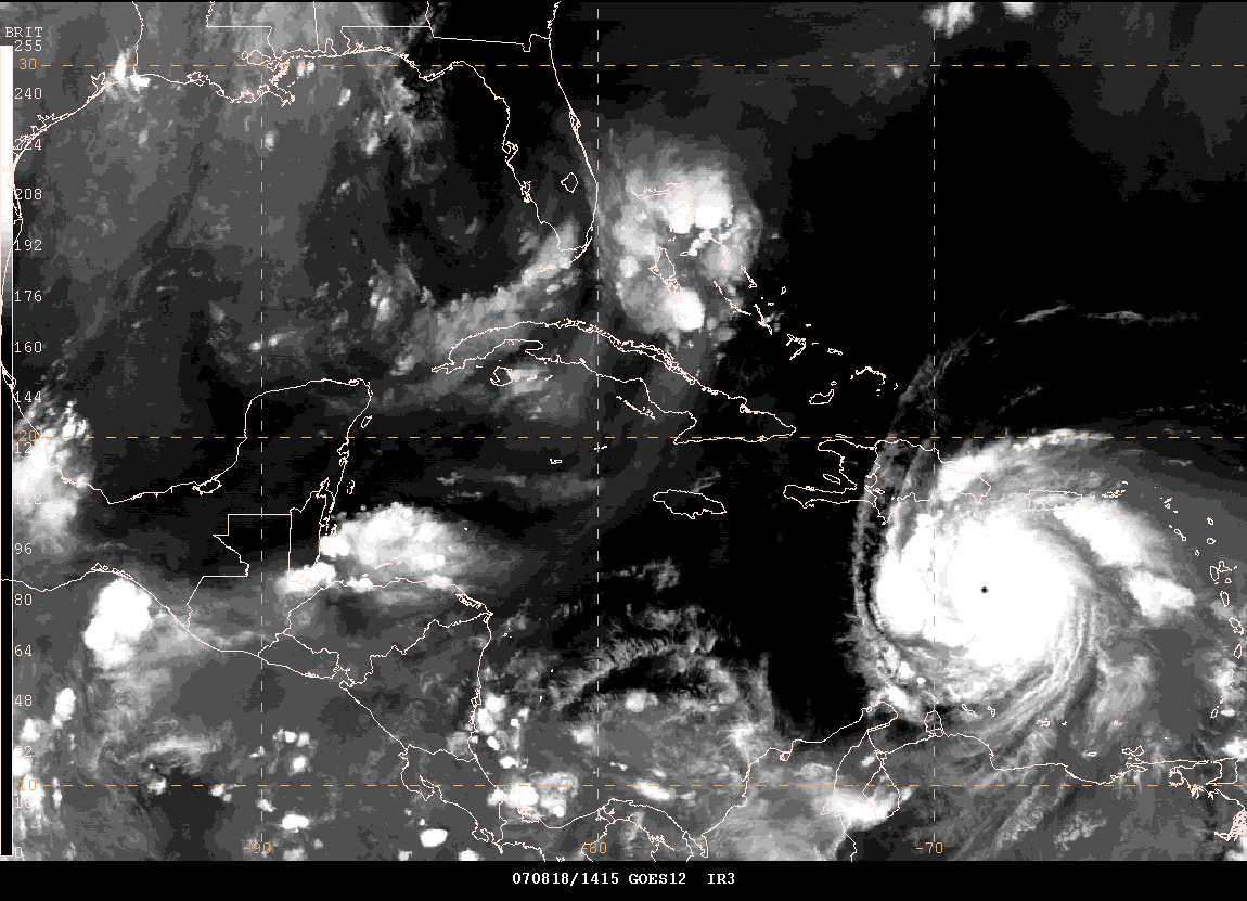
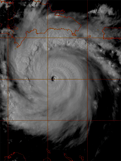
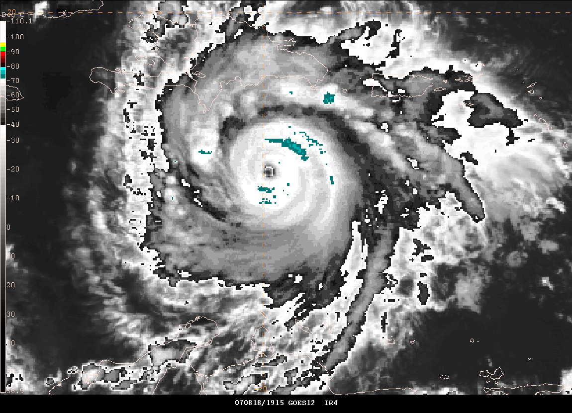
Eye of Hurricane Dean - August 18th - 4 PM
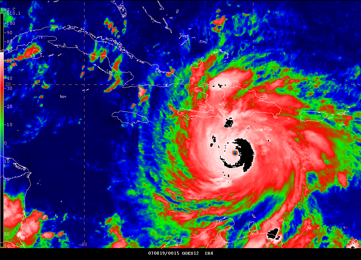
5 PM - Category Four Hurricane Dean.
Impressive Satellite Image
The heat has returned to our region. Temperatures of 100+ have spread across Western Kentucky this afternoon. We were in the nineties yesterday and had hoped to avoid the 100 degree weather over the weekend. Unfortunately the latest forecasts indicate that upper nineties and low one-hundreds will be likely through next Friday. The historic heat wave continues.
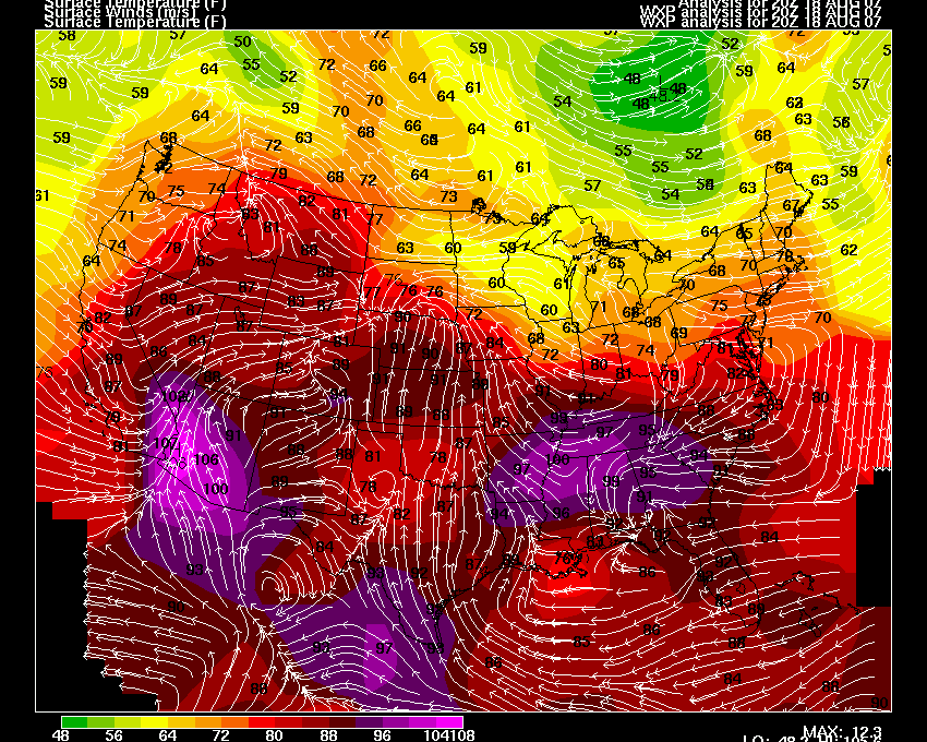
Temperatures at 4 PM Central
I just uploaded these images with Jamaican radio information in the background.
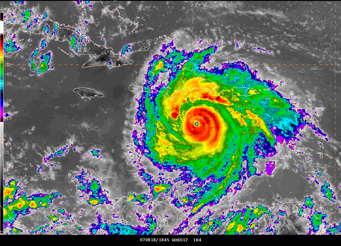
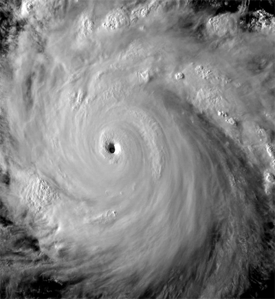
This is the last visible image of the evening. Hurricane Dean is a category 4 or 5 at this time. There has been a slight southwest movement over the last few hours.
Click for large image.
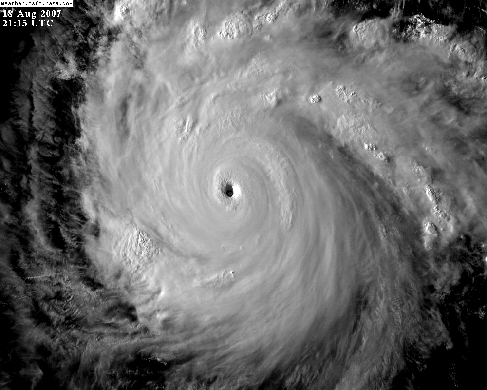
Hurricane Dean - Evening Images - 8 PM Central Time
Hurricane Dean
PRIME MINISTER ADDRESS TO THE NATION - Jamaica
I uploaded this at 9 PM - ADDRESS TO THE NATION
These are the top ten lowest hurricane pressure readings ever recorded in the Atlantic Ocean. Thank you to Ian and gkrangers, from EasternUSwx, for their help in putting this data together.
Rank Hurricane Season
Min. pressure
1 Wilma 2005 882 mbar (hPa)
2 Gilbert 1988 888 mbar (hPa)
3 "Labor Day" 1935 892 mbar (hPa)
4 Rita 2005 895 mbar (hPa)
5 Allen 1980 899 mbar (hPa)
6 Katrina 2005 902 mbar (hPa)
7 Camille 1969 905 mbar (hPa)
Mitch 1998 905 mbar (hPa)
9 Ivan 2004 910 mbar (hPa)
10 Janet 1955 914 mbar (hPa)
At 11 PM EDT, Hurricane Dean had a pressure reading of 917-918mb. This is an extremely powerful hurricane. The winds were down slightly and the National Hurricane Center has lowered the winds to 145 mph. Dean remains a category four hurricane. It appears more and more likely that Dean will not impact the United States with a direct hit. Portions of Southern Texas will feel some of the impact though. Strong winds and heavy rain would be the main threat. Mexico is going to take the brunt of Hurricane Dean in the coming days. As always, it is possible that the track could change. The above is the most likely scenario.
Turn the
page for more weather
Home | About | News | Upcoming Events| Photo Gallery | Video | Links | Contact
All Photos are copyrighted by Beau Dodson and are used on this site with his permission. Any use other than authorized by them is against the law. If you wish to contact him regarding use of these photos, please href="mailto:beaudodson@usawx.com">e-mail me and I will forward it.