July 2008
July 02, 2008
Well, July has arrived. There has been plenty of heat over the last few weeks. Hot and dry - that sums up the weather across West Kentucky. Areas to our north have received flooding rains. We just can't seem to bring it into this area.
A few lines of showers and thunderstorms will be possible over the next few days. A shortwave is approaching the region from the north and west. This will help spark storms. Some of the storms could be heavy. Frequent lightning will be a problem with any outdoor activities over the Fourth of July weekend.
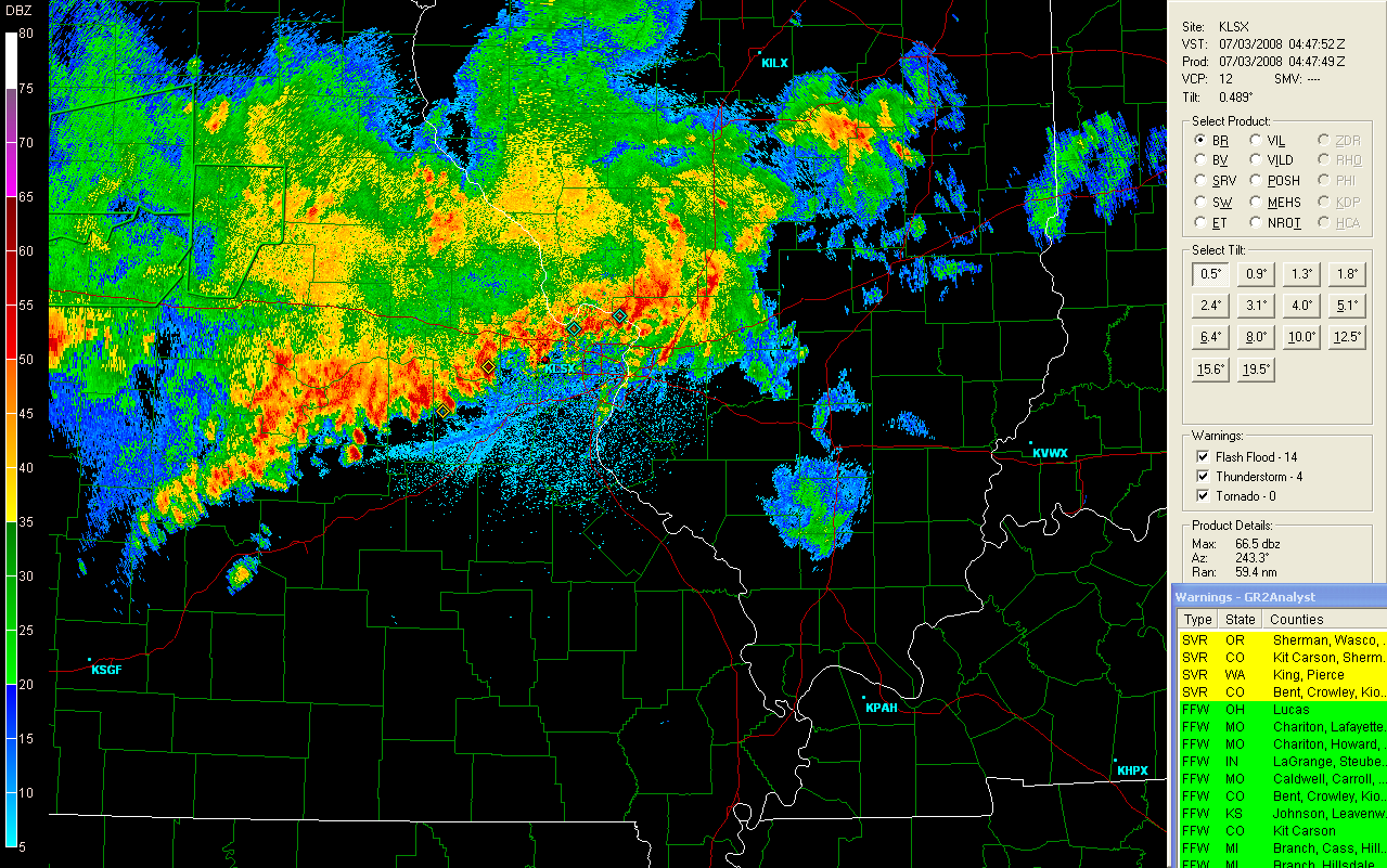
St Louis Radar - 11:40 PM
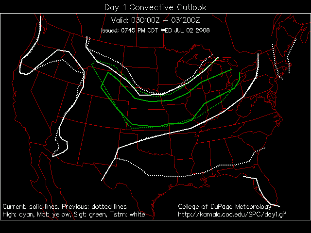
Day 1 Severe Weather Outlook
The Storm Prediction Center is forecasting severe weather to our north tonight and then again to our west on Thursday. Some isolated severe weather can't be ruled out across our counties. The main focus, though, will be on Fourth of July and the fireworks display. Any thunderstorms in the area could interfere with the show.
I am planning on attending the EasternUSwx Conference next week. It will be held in Washington DC. This will be my first year attending.
July 08, 2008
Heat anyone? Temperatures this afternoon are in the middle to upper nineties across the region. Dew points are near or above 70 degrees. TERRIBLE weather.
Thunderstorms have formed in southeast Missouri. The storms should move into South IL and West KY over the next few hours. We can hope that a few drops of rain will fall on Paducah.
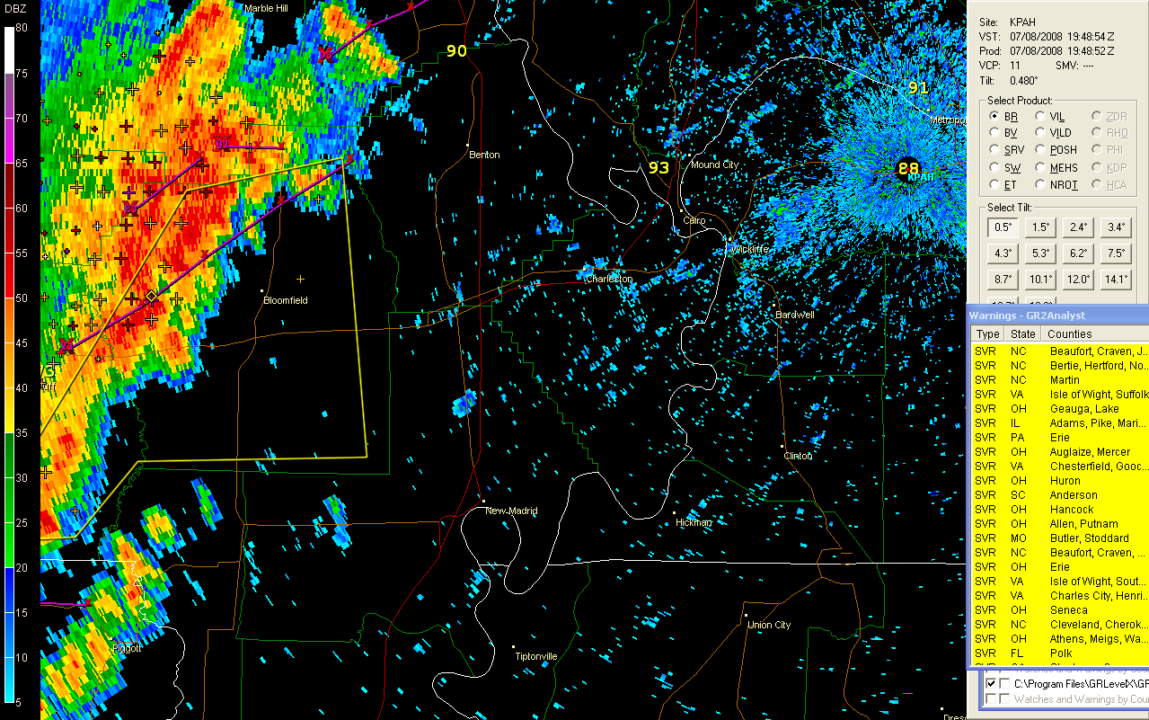
KPAH Radar - 3 PM
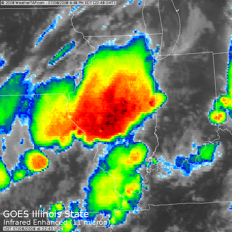
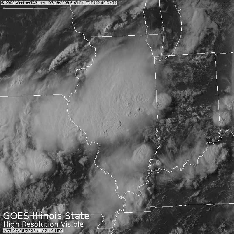
6 PM - Satellite Imagery
Lone Oak, Kentucky (near Paducah) received less than 0.10" of rain but winds did gust to over 40 mph here at my house. Winds of 50-60 mph were reported in portions of Lone Oak and the City of Paducah. Some wind damage - tree limbs and trees down were reported by OEM.
There were also damage reports in Mayfield, Kentucky. Power lines and trees limbs were downed. Below are a few of the local storm reports that were issued.
PRELIMINARY LOCAL STORM REPORT
NATIONAL WEATHER SERVICE PADUCAH KY
532 PM CDT TUE JUL 08 2008

..TIME...   ...EVENT...      ...CITY LOCATION...     ...LAT.LON...
..DATE...   ....MAG....      ..COUNTY LOCATION..ST.. ...SOURCE....
            ..REMARKS..

0500 PM     TSTM WND DMG     MAYFIELD                36.74N 88.65W
07/08/2008                   GRAVES             KY   TRAINED SPOTTER

            TREES AND POWERLINES DOWN AROUND MAYFIELD WITH POWER
            OUTAGES. REPORT FROM WPSD TV 6...RELAYED BY A SPOTTER.
PRELIMINARY LOCAL STORM REPORT
NATIONAL WEATHER SERVICE PADUCAH KY
530 PM CDT TUE JUL 08 2008

..TIME...   ...EVENT...      ...CITY LOCATION...     ...LAT.LON...
..DATE...   ....MAG....      ..COUNTY LOCATION..ST.. ...SOURCE....
            ..REMARKS..

0445 PM     TSTM WND GST     PADUCAH                 37.07N 88.64W
07/08/2008  E60.00 MPH       MCCRACKEN          KY   NWS EMPLOYEE

            OFF DUTY NWS EMPLOYEE REPORTED 60 TO 65 MPH WINDS AT HOME
            NEAR LOURDES HOSPITAL.
July 19, 2008
Typical summer type pattern across the Paducah area. Hot, humid, and hazy. It does appear that there will be a chance for thunderstorm on Monday. A storm system will approach from the northwest. High winds would be the primary threat.
July 19, 2008
The lack of weather continues. Is there such a thing? We have been having hot and humid days and warm muggy nights for some time now. Sprinkled amongst those days and nights are a few cooler and lower humidity events.
We did experience some thunderstorms on July 17th. Some amazing lightning and thunder moved over McCracken County. I was awoken at 5:30 AM by the intense thunder. We recorded more than 30 lightning strikes within 3 miles of my house, here in Lone Oak.
We picked up around 0.25" of rainfall with the storms. Winds gusted to 25 mph. Nothing severe but a rather impressive electrical event.
I attended the EasternUSwx conference in Washington D.C. It was great. Tom Skilling was one of the presenters, along with Greg Carbin from the SPC. Too many speakers to mention by name. All very interesting topics. I will definitely consider attending next year (if they have one).
Hurricane Dolly moved ashore, in Texas, yesterday. Winds gusted to over 100 mph along the coastline. Dolly intensified more than expected during the overnight hours of the 17th. She was a category two storm.
July 25, 2008
A beautiful lightning storm rolled through McCracken County this evening. We had over 40 lightning strikes within just a few miles of the house. Tremendous light show and loud thunder. Temperatures were in the 80s with dew points in the low to middle 70s. The rainfall came down in sheets. Visibility was less than 1/2 miles at time. Winds gusted to 40 mph here in Lone oak. The clouds were dark and threatening.
It was one of the heavier rainfalls we have received in the last few months. WPSD TV reported over .50" of rainfall in less than 30 minutes. I am sure we had the same here at my house. This was also one of the better lightning storms we have experienced so far this summer.
A severe thunderstorm warning was issued for the southeast portion of the county. I have not read of any storm damage.
July 31, 2008
A hot month? Seems that way. The last week or two has brought oppressive heat to this region. Temperatures into the 90s with dew points in the 70s. Miserable weather to be honest. I have never been a fan of heat and humidity. I would rather see snow and cold! I don't think that is a secret.
The National Weather Service office in Paducah hit 96 degrees on July 21, 29, and 30th. Rainfall for the month ended up at 6.94 inches. This was 2.49" above normal. Wet for some...dry in other areas. Lone Oak did not receive nearly that much rain. We missed several storm cells that passed directly over the Paducah office.
We have had several periods of thunderstorms over the last few days. Several of these storms have produced prolific lightning. Heavy rainfall fell across much of the area, as well. The KPAH Office picked up over 2 inches of rain on Thursday night and Friday morning.
It appears that more hot weather is on tap for the region in the coming days and weeks. Welcome to August!
Turn the page for more weather
Home | About | News | Upcoming Events| Photo Gallery | Video | Links | Contact
All Photos are copyrighted by Beau Dodson (unless otherwise clearly stated) and are used on this site with his permission. Any use other than authorized by them is against the law. If you wish to contact him regarding use of these photos, please e-mail me and I will forward it.