January 04, 2008
Calm weather prevails across the Ohio Valley. Temperatures will be above normal through much of the next seven days. Some areas of the Mississippi Valley will actually reach to near 70 degrees. Thunderstorms will be possible on Monday and Tuesday across the region. There could be a slight risk of some of the storms becoming severe.
A major storm system is pounding the Western United States. Snowfall of 8-10 FEET is expected across some of the mountain ranges of California. Heavy rainfall is also occurring at lower elevations. Winds have gusted over 100 mph across portions of California.
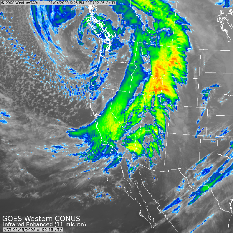
West Coast Storm System
A sample of the weather warnings on the west coast. Urgent messages being sent out in attempt to get people to stay home.
URGENT - WINTER WEATHER MESSAGE
NATIONAL WEATHER SERVICE RENO NV
411 PM PST FRI JAN 4 2008

...A MAJOR WINTER STORM AFFECTING THE REGION THROUGH SATURDAY
MORNING WITH STRONG WINDS AND HEAVY SNOW CAUSING BLIZZARD
CONDITIONS IN THE SIERRA...

.EXTREMELY HEAVY SNOW AND STRONG WINDS IN THE SIERRA ARE CREATING
DANGEROUS BLIZZARD CONDITIONS IN THE SIERRA AND LAKE TAHOE BASIN.
BLIZZARD CONDITIONS AR PASS LEVEL WILL CONTINUE THROUGH SATURDAY
MORNING. A BRIEF PERIOD OF BLIZZARD CONDITIONS WILL OCCUR BELOW
7000 FEET THIS EVENING.

STAY AT HOME! SEVERAL SIERRA ROADS HAVE BEEN CLOSED DUE TO
BLIZZARD CONDITIONS...NEAR ZERO VISIBILITIES AND POSSIBLE
AVALANCHE DANGER.

DO NOT ATTEMPT TO TRAVEL ACROSS THE SIERRA PASSES TONIGHT.
ATTEMPTING TO TRAVEL IN THE SIERRA WILL PUT YOUR LIFE AT RISK.
EXTREMELY HIGH SNOWFALL RATES WILL MAKE IT IMPOSSIBLE FOR ROAD
CREWS AND EMERGENCY PERSONNEL TO KEEP ROADS PASSABLE AND TO ASSIST
STRANDED VEHICLES.

IF YOU DO ATTEMPT TRAVEL IN THE SIERRA YOUR CHANCES OF BEING
STRANDED FOR MORE THAN A FEW HOURS IS VERY HIGH. REMAIN INDOORS
DURING THIS BLIZZARD...EVEN A SHORT WALK OUTDOORS COULD BE DEADLY
AS YOU WILL BECOME DISORIENTED IN THE WHITEOUT CONDITIONS.

BELOW 6000 FEET...PERIODS OF HEAVY SNOW AND GUSTY WINDS WILL
PRODUCE HAZARDOUS WINTER CONDITIONS IN LOWER ELEVATIONS OF EASTERN
CALIFORNIA AND WESTERN NEVADA THROUGH SATURDAY MORNING. SNOW
LEVELS WILL RAPIDLY DROP THIS EVENING AS A COLD FRONT NEAR
INTERSTATE 80 MOVES SOUTH.

STATE AND LOCAL EMERGENCY MANAGERS ARE WORKING WITH THE NATIONAL
WEATHER SERVICE AND ARE IN THE PROCESS OF PREPARING FOR EMERGENCY
RESPONSE...SHOULD IT BECOME NECESSARY. CITIZENS CAN ASSIST IN
THIS EFFORT BY STAYING INFORMED ON THE LATEST FORECASTS FROM THE
NATIONAL WEATHER SERVICE.

THE STAFF OF THE NATIONAL WEATHER SERVICE IN RENO WOULD LIKE TO
THANK OUR MANY DEDICATED WEATHER SPOTTERS WHO ARE CALLING IN
WEATHER REPORTS. PLEASE CONTINUE TO CALL IN YOUR VALUABLE REPORTS.
CAZ072-073-NVZ002-050800-
/O.CON.KREV.BZ.W.0001.000000T0000Z-080105T1800Z/
GREATER LAKE TAHOE AREA-MONO-
INCLUDING THE CITIES OF...SOUTH LAKE TAHOE...TAHOE CITY...
TRUCKEE...MARKLEEVILLE...BRIDGEPORT...COLEVILLE...LEE VINING...
MAMMOTH LAKES...GLENBROOK...INCLINE VILLAGE
411 PM PST FRI JAN 4 2008

...BLIZZARD WARNING REMAINS IN EFFECT UNTIL 10 AM PST SATURDAY...

A BLIZZARD WARNING REMAINS IN EFFECT UNTIL 10 AM PST SATURDAY.

HEAVY SNOW WILL CONTINUE ACROSS THE EASTERN SIERRA FROM LAKE
TAHOE SOUTH TO MONO COUNTY. SNOW LEVELS HAVE LOWERED BELOW 6000
FEET IN THE LAKE TAHOE AREA...AND WILL DROP BELOW 6000 FEET IN
MONO COUNTY THIS EVENING. SNOWFALL RATES NEAR 6 INCHES PER HOUR
ARE LIKELY THROUGH TONIGHT....WITH 1 TO 3 INCHES PER HOUR IN THE
LOWER ELEVATIONS.

TOTAL SNOW ACCUMULATIONS OF 3 TO 5 FEET ABOVE 7000 FEET WITH
HIGHER AMOUNTS ALONG THE SIERRA CREST WILL OCCUR BY SATURDAY
MORNING. BELOW 7000 FEET INCLUDING THE LAKE TAHOE BASIN...1 TO 2
FEET OF SNOW WILL ACCUMULATE BY SATURDAY MORNING WITH AMOUNTS UP
TO 3 FEET ALONG THE WEST SHORE OF LAKE TAHOE AND ALONG HIGHWAY
395 IN MONO COUNTY.

STRONG WINDS WILL CONTINUE THROUGH TONIGHT. GUSTS UP TO 70 MPH IN
MONO COUNTY AND GUSTS UP TO 40 MPH IN LAKE TAHOE WILL CONTINUE...WITH
GUSTS NEAR 110 MPH OVER THE SIERRA RIDGES. THESE STRONG WINDS WILL
COMBINE WITH THE HEAVY SNOW TO BRING BLIZZARD CONDITIONS OVER THE AT
SIERRA PASSES...WITH A PERIOD OF BLIZZARD CONDITIONS REACHING
LOWER ELEVATIONS THIS EVENING.

A BLIZZARD WARNING MEANS SEVERE WINTER WEATHER CONDITIONS ARE
OCCURRING. FALLING AND BLOWING SNOW WITH STRONG WINDS WILL
PRODUCE ZERO VISIBILITY. DO NOT TRAVEL IN THESE CONDITIONS. IF YOU
GET STRANDED...STAY WITH YOUR VEHICLE.
Wunderground Scitech photo - wind damage in
Oregon
Meanwhile, snow has been falling in FLORIDA!
PUBLIC INFORMATION STATEMENT
NATIONAL WEATHER SERVICE MELBOURNE FL
815 PM EST THU JAN 3 2008

..A BRIEF SUMMARY OF THIS MORNING'S OCEAN EFFECT SNOW EVENT

DURING THE EARLY MORNING HOURS OF THURSDAY...WEATHER CONDITIONS SET
UP IN MANNER VERY SIMILAR TO JANUARY 24, 2003...THE LAST TIME THAT
OCEAN EFFECT SNOW HAD BEEN OBSERVED IN EAST CENTRAL FLORIDA.

WHILE THE MECHANISM FOR PRODUCTION OF OCEAN EFFECT SNOW IS RATHER
COMPLEX...THE BASIC "INGREDIENTS" FOR A WINTER TIME OCEAN EFFECT
SNOW EVENT ARE LISTED BELOW...

1) A VERY COLD AIR MASS OVER CENTRAL FLORIDA THAT PRODUCES
TEMPERATURES NEAR OR BELOW FREEZING. IN ADDITION TO "SETTING THE
STAGE" OVER LAND...THIS COLD AIR WILL ALSO RESULT IN GENERATION OF A
LARGE MARINE STRATOCUMULUS FIELD OVER THE COMPARATIVELY WARM WATERS
OF THE ADJACENT ATLANTIC.

2) WINDS FROM THE NORTHWEST TO NORTH-NORTHWEST AT THE SURFACE...
NEEDED TO KEEP THE COLD AIR IN PLACE.

3) WINDS FROM THE NORTH TO NORTH-NORTHEAST FROM JUST ABOVE THE SURFACE
(FOR EXAMPLE 1,500 TO  2,000 FEET) UP TO CLOUD LEVEL...USUALLY ABOUT
3,000 TO 5,000 FEET. THIS WILL ALLOW THE MARINE CLOUD DECK TO PUSH
ONSHORE THE EAST COAST.

THE COLD AIR...WARMED AND MOISTENED FROM THE OCEAN BELOW...RISES AND
ALLOWS MOISTURE TO CONDENSE OUT OF IT IN THE FORM OF SNOW CRYSTALS
..OR OFTEN TIMES A MIXTURE OF DRIZZLE...SNOW
SLEET OR GRAUPEL
(ALSO KNOWN SNOW PELLETS).

WHEN ALL OF THESE FACTORS ALL COME TOGETHER AT THE PREFERRED TIME
(GENERALLY FROM THE OVERNIGHT UNTIL A FEW HOURS AFTER SUNRISE)...
FROZEN PRECIPITATION CAN FALL FROM THE CLOUDS. SUCH AN OCCURRENCE IS
RELATIVELY RARE IN THIS AREA...SINCE ALL THE "INGREDIENTS" NEEDED TO
PRODUCE "OCEAN EFFECT" SNOW NEED TO COME TOGETHER AT THE RIGHT TIME.

BASED ON REPORTS FROM SPOTTERS...LAW ENFORCEMENT...NEWS MEDIA...AND
THE GENERAL PUBLIC...IT APPEARS THAT THE NORTHERN EXTENT OF FROZEN
PRECIPITATION WAS FLAGLER COUNTY...WHERE REPORTS CAME IN FROM
BUNNELL AND PALM COAST. THE SOUTHERNMOST RELIABLE REPORT CAME IN
FROM THE FELLSMERE-SEBASTIAN AREA IF INDIAN RIVER COUNTY.

PICTURES FROM VOLUSIA COUNTY INDICATE THAT MUCH OF THE FROZEN
PRECIPITATION IN THAT AREA FELL IN THE FORM OF GRAUPEL...OR SNOW
PELLETS. GRAUPEL FORMS WHEN SUPERCOOLED WATER DROPLETS CONDENSE ON
THE OUTSIDE OF A PRE-EXISTING SNOW PELLETS. PELLETS OF GRAUPEL ARE
OPAQUE (WHITE COLORED)...WHEN COMPARED TO SLEET (ICE PELLETS)...
WHICH IS MORE TRANSLUCENT (CLEAR).

OTHER REPORTS INDICATE THAT THE FROZEN PRECIPITATION ALSO FELL IN
THE FORM OF SNOWFLAKES...AND WAS OFTEN MIXED WITH DRIZZLE AND
SPRINKLES OF LIGHT RAIN.

THUS FAR...REPORTS OF SNOW HAVE COME FROM THE FOLLOWING COMMUNITIES
NEAR AND JUST NORTH OF THE MELBOURNE COUNTY WARNING AREA...

FLAGLER COUNTY...
BUNNELL
PALM COAST

VOLUSIA COUNTY...
ORMOND BEACH
DAYTONA BEACH
HOLLY HILL
PORT ORANGE
EDGEWATER

BREVARD COUNTY...
SCOTTSMOOR
SHARPES
ROCKLEDGE
MELBOURNE
PALM BAY
SATELLITE BEACH

INDIAN RIVER COUNTY...
FELLSMERE/SEBASTIAN

TEMPERATURES QUICKLY WARMED INTO THE 40S AND 50S DURING THE MID
MORNING...CHANGING THE PRECIPITATION ENTIRELY OVER TO LIQUID AND
BRINGING THE EVENT TO AN END.
Now if we could just get some snow across Western Kentucky and
Southern Illinois.
January 05, 2008
A major snowstorm has paralyzed portions of Europe over the last few days. Some areas have measured snow in feet. Romania reported over 2 feet of snow. Here is a photo from Bucharest, Romania. The photograph was taken by Aurelian Oancea.
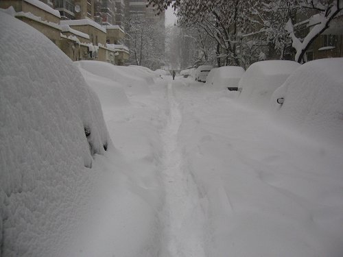
Bucharest, Romania. Heavy snowstorm paralyzes city. The BBC
reported total
snowfall of 19.5" to 23.0" at Bucharest.
Additional photos can be viewed here.
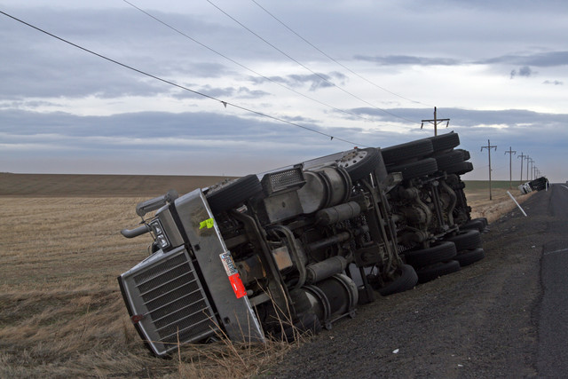
Meanwhile, East of the Sierra in Nevada's Lyon County, a levee broke about 4 a.m. Saturday along an agricultural canal, releasing water as much as 3 feet deep into the town of Fernley and stranding about 3,500 people, authorities said. Rescuers were using school buses, boats and helicopters.
A 30-foot section of the 150-foot wide canal ruptured, forcing a large volume of water into 800 homes.
This powerful storm system is moving eastward and could bring
severe thunderstorms to the Ohio Valley on Monday and Tuesday.
January 06, 2008
Strong winds across our region today. A storm system developing across the Central Plains will pump warm/moist air northward into the Ohio Valley. This will set the stage for a chance of thunderstorms on Monday and Tuesday. There will be a slight risk of severe weather across the region. Still some uncertainties as to the extent of this particular outbreak.
Colder air will spill into the region later this week.
Of interest from the Springfield, Missouri - NWS Office
CURRENTLY...STRONG SOUTHERLY WINDS CONTINUE ACROSS SOUTHEAST
KANSAS AND WESTERN MISSOURI THIS AFTERNOON. TEMPERATURES CONTINUE
TO CLIMB WITH THESE SOUTHERLY WINDS. THIS IS TRULY A RARE EVENT
TO HAVE TEMPERATURES IN THE 70S THIS TIME OF YEAR. RECORDS AS OLD
AS 100 YEARS HAVE BEEN SHATTERED BY AS MUCH AS 10-12 DEGREES.
SPRINGFIELD`S RECORD OF 70 HAS BEEN TIED SO FAR...A RECORD THAT HAS
HELD SINCE 1907. JOPLIN HAS REACHED 71 SO FAR TODAY...THE PREVIOUS
RECORD FOR THEM WAS 60 SET BACK IN 1967.
INCREDIBLE temperatures departures today! Check out these maps.
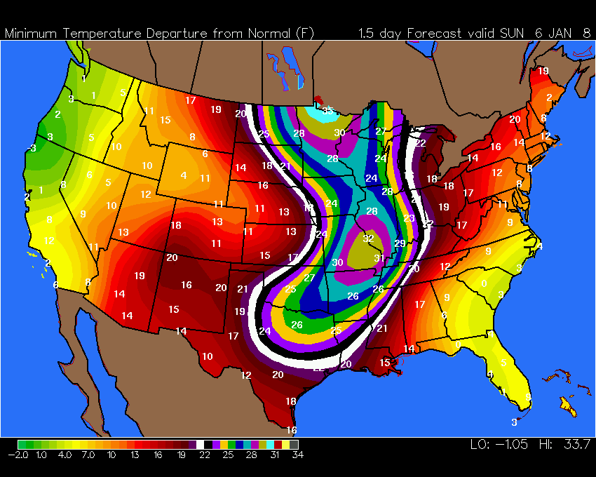
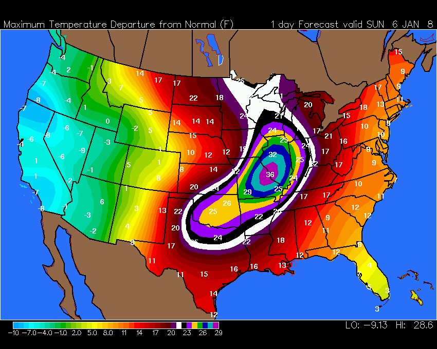
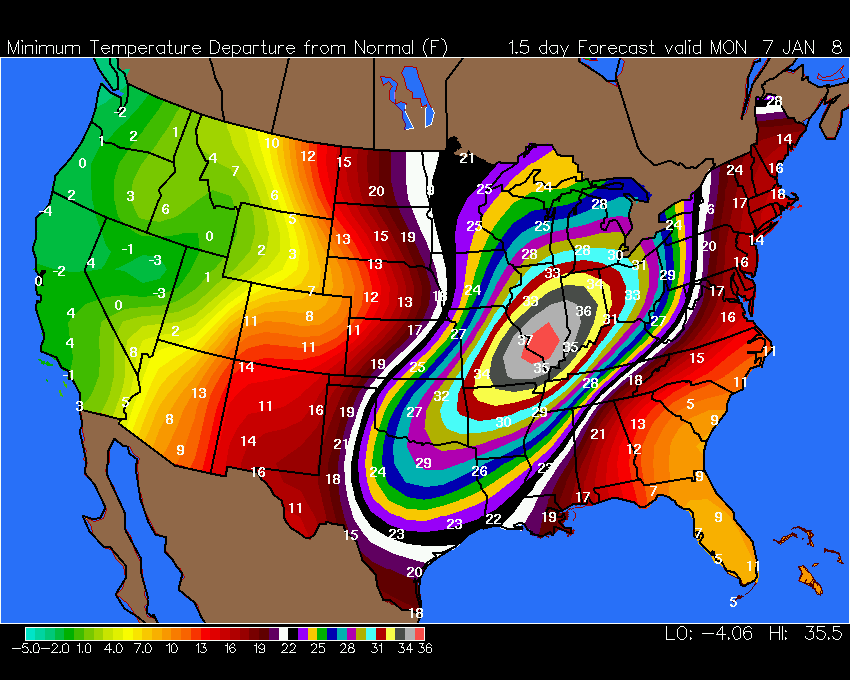
Click for large wright-weather image
SXUS73 KPAH 062225
RERPAH

RECORD EVENT REPORT
NATIONAL WEATHER SERVICE PADUCAH KY
0420 PM CST SUN JAN 06 2008

$$

...RECORD HIGH TEMPERATURE SET AT PADUCAH ASOS...

VERY MILD TEMPERATURES CONTINUED OVER MOST OF THE QUAD STATE
AREA...RIDING ON STRONG SOUTHERLY WINDS OVER THE PAST FEW DAYS. AT
THE PADUCAH ASOS...LOCATED AT BARKLEY REGIONAL AIRPORT RECORDED A
RECORD HIGH TEMPERATURE OF 68 DEGREES AT 357 PM TODAY. THIS BREAKS
THE OLD RECORD OF 65 SET IN 1998. THE AVERAGE TEMPERATURE FOR THIS
DATE IS ONLY 49 DEGREES.
January 07, 2008
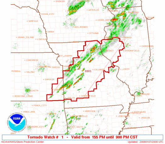
Concerns are rising about the potential for severe thunderstorms across our region on Tuesday Morning and Afternoon. A strong storm system will pull through the Missouri Valley later tonight and tomorrow. This will push a cold front through West Kentucky and Southern Illinois. CAPE Values indicate that there will be enough instability for severe thunderstorms. To what extent likely won't be known until tomorrow morning. Cloud cover will be an important factor on Tuesday. This could be a significant event for our region. Just too early to determine just how much severe weather will occur.
There will be a risk of severe weather today across portions of Oklahoma, Kansas, Missouri, Iowa, and Illinois. Tornadoes will be possible as shear is strong.
Another storm will produce showers and thunderstorms on Thursday and Friday. Snow is likely across portions of the Ohio Valley with this system. Right now it appears that we will remain in the warm sector.
Tornado Watch Number 001 For 2008:
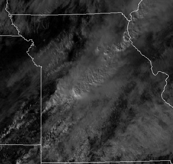
3 p.m. Satellite - Severe Storms Over Missouri
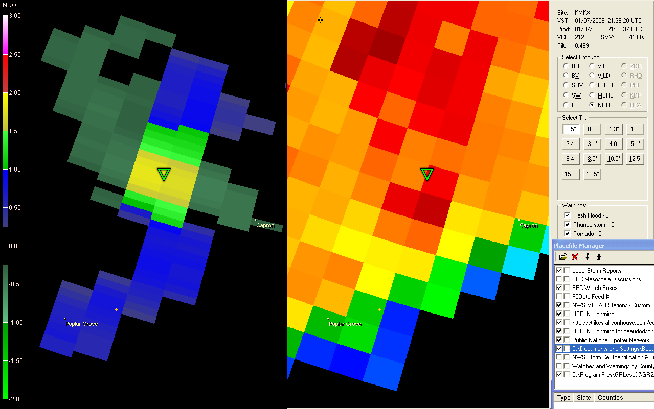
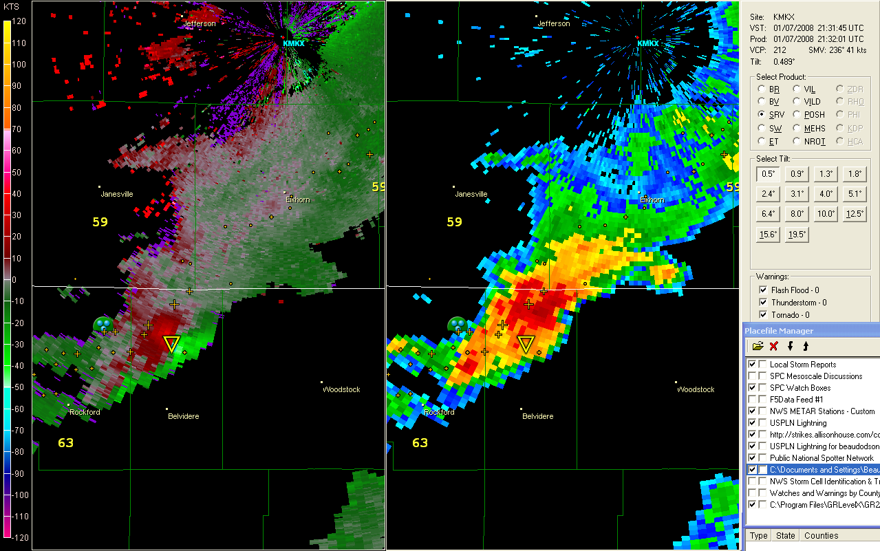
Tornadoes have been reported on the ground in NORTHERN ILLINOIS this afternoon. Extremely RARE event unfolding.
3:30 Rdar - Tornado
4 p.m. Radar WI
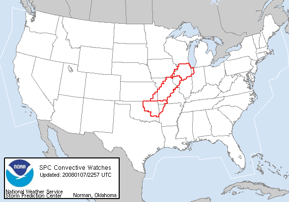
Watches
Extreme Temperature Departures for today...

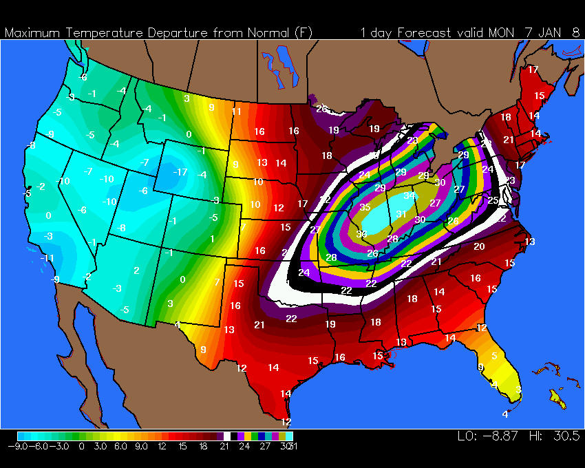
Temperature Departures - extreme
Evening Update:
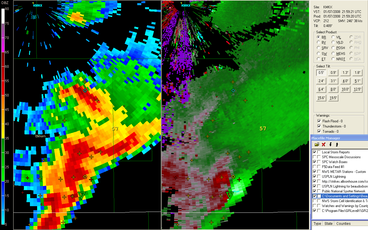
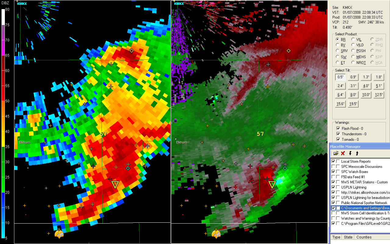
Significant severe weather outbreak is underway. An almost unheard of event for January across portions of Missouri, Illinois, Iowa, and Wisconsin. Damaging tornadoes have been reported in Illinois and Wisconsin. A VERY rare event.
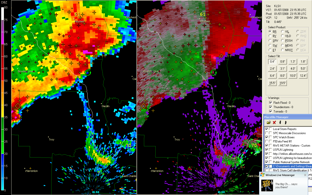
5:15 Supercell - St Louis
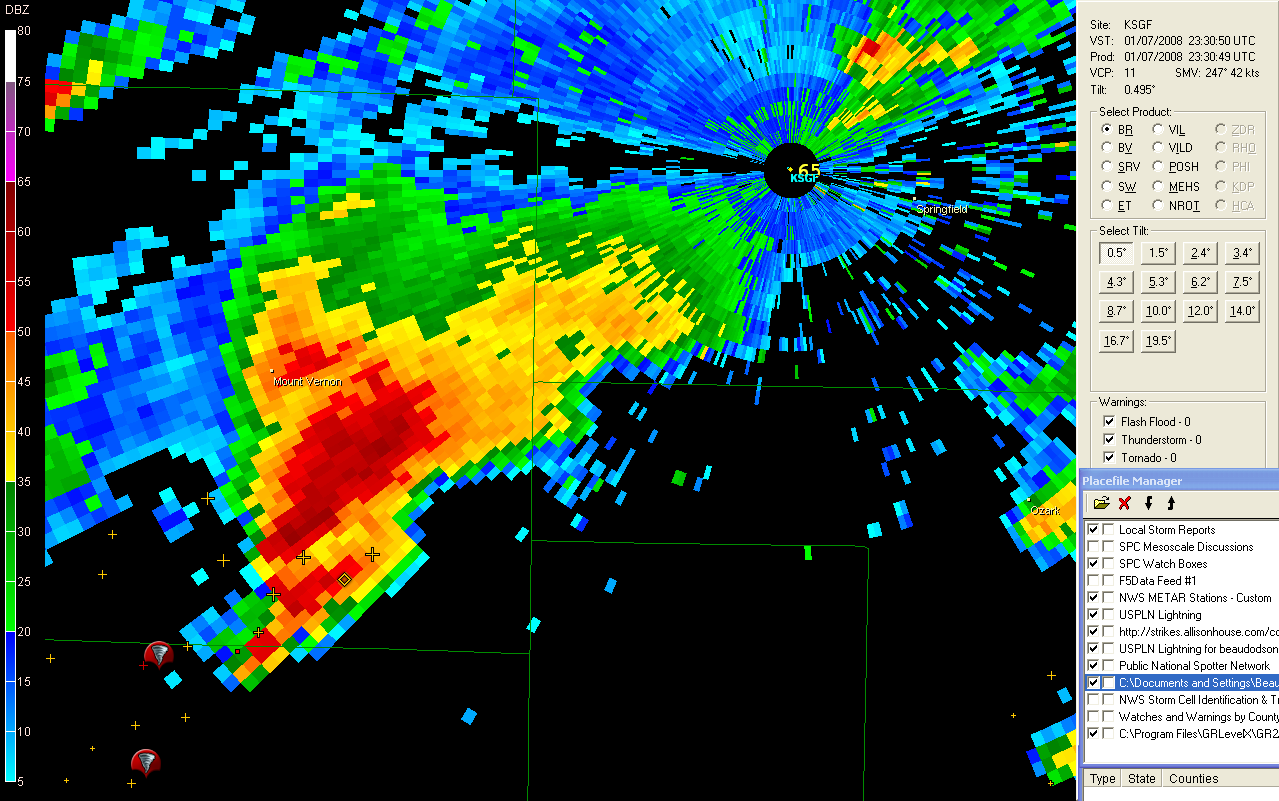
Springfield, MO Tornado
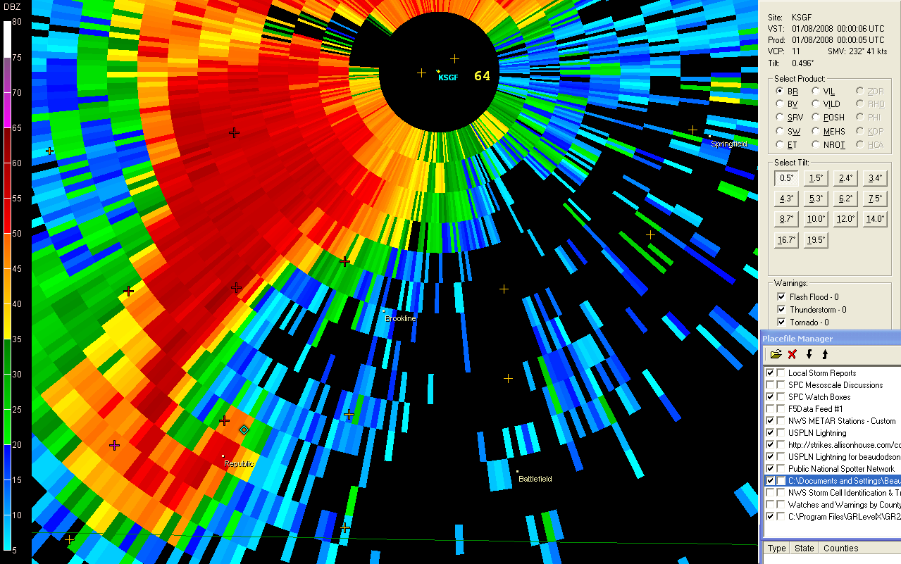
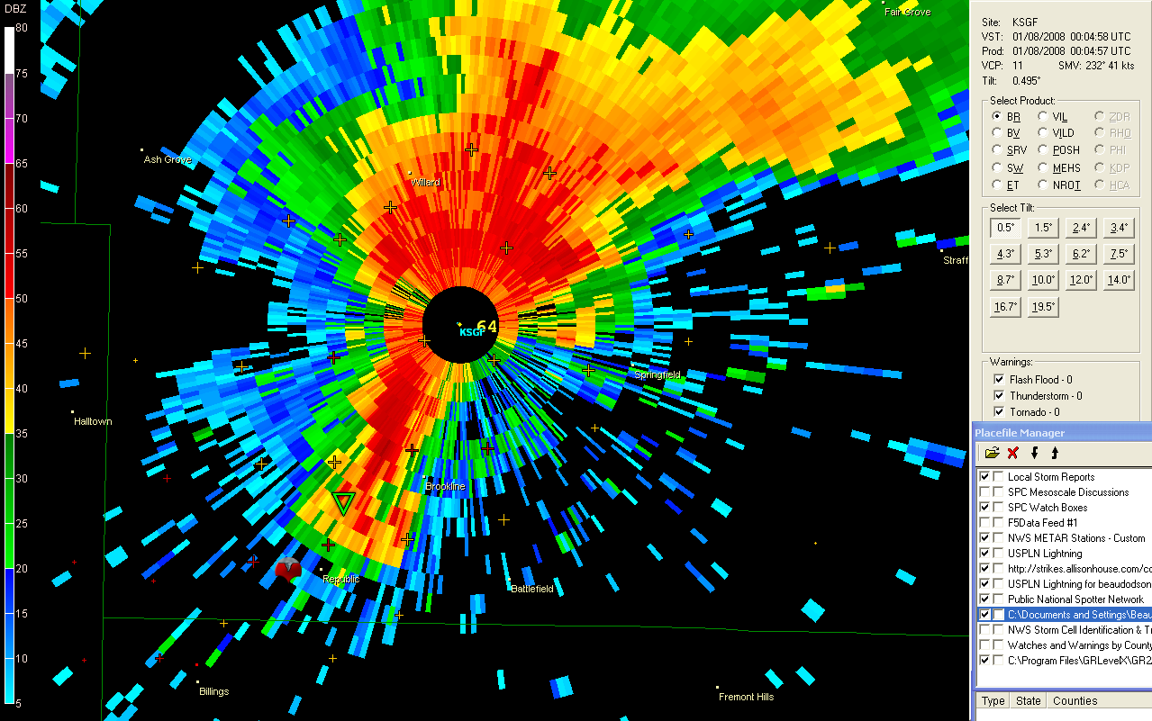
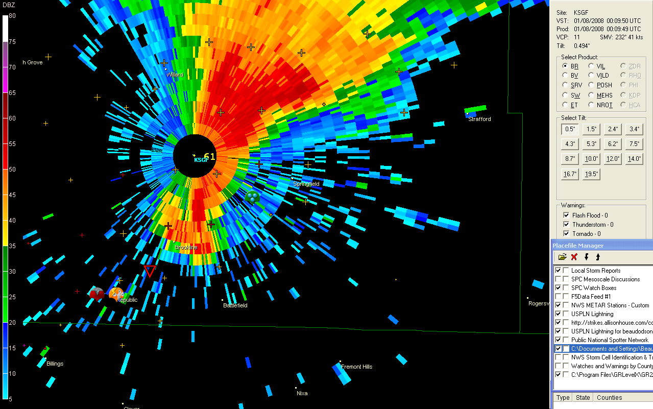
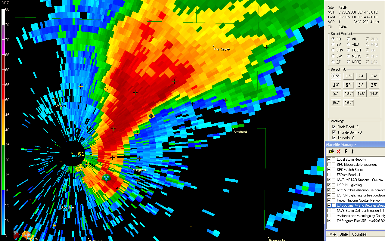
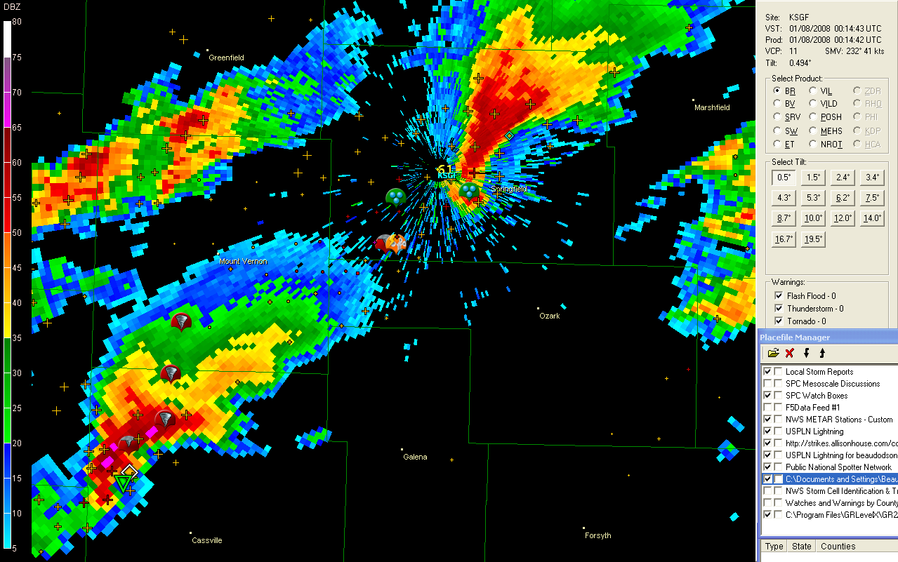
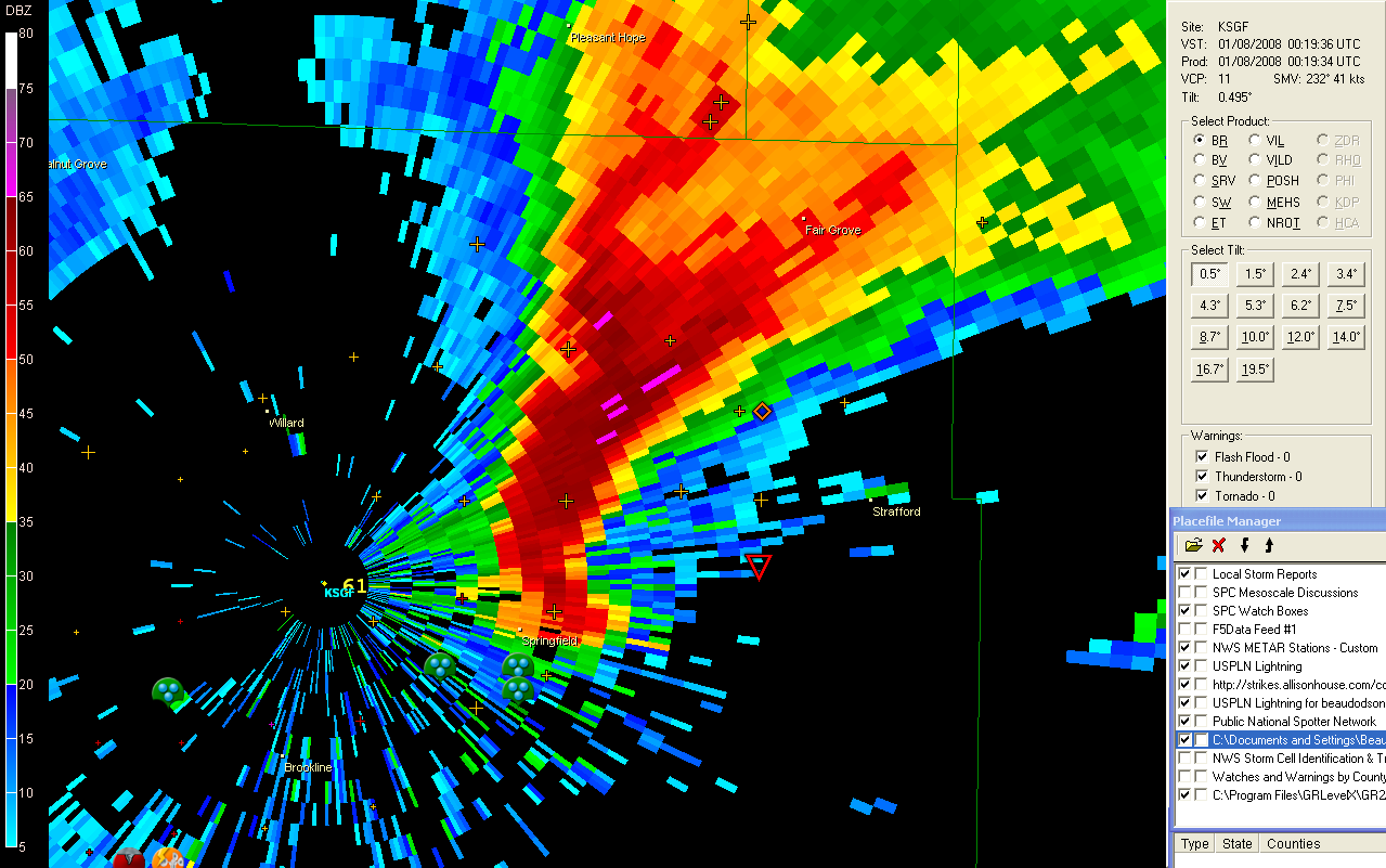
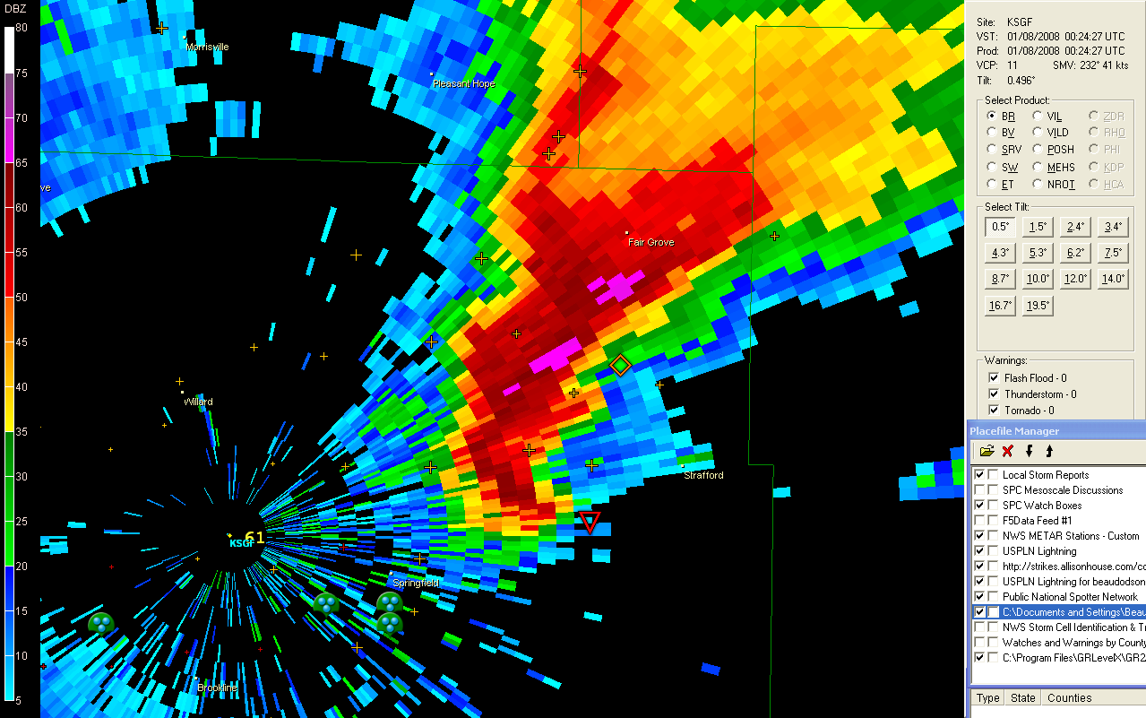
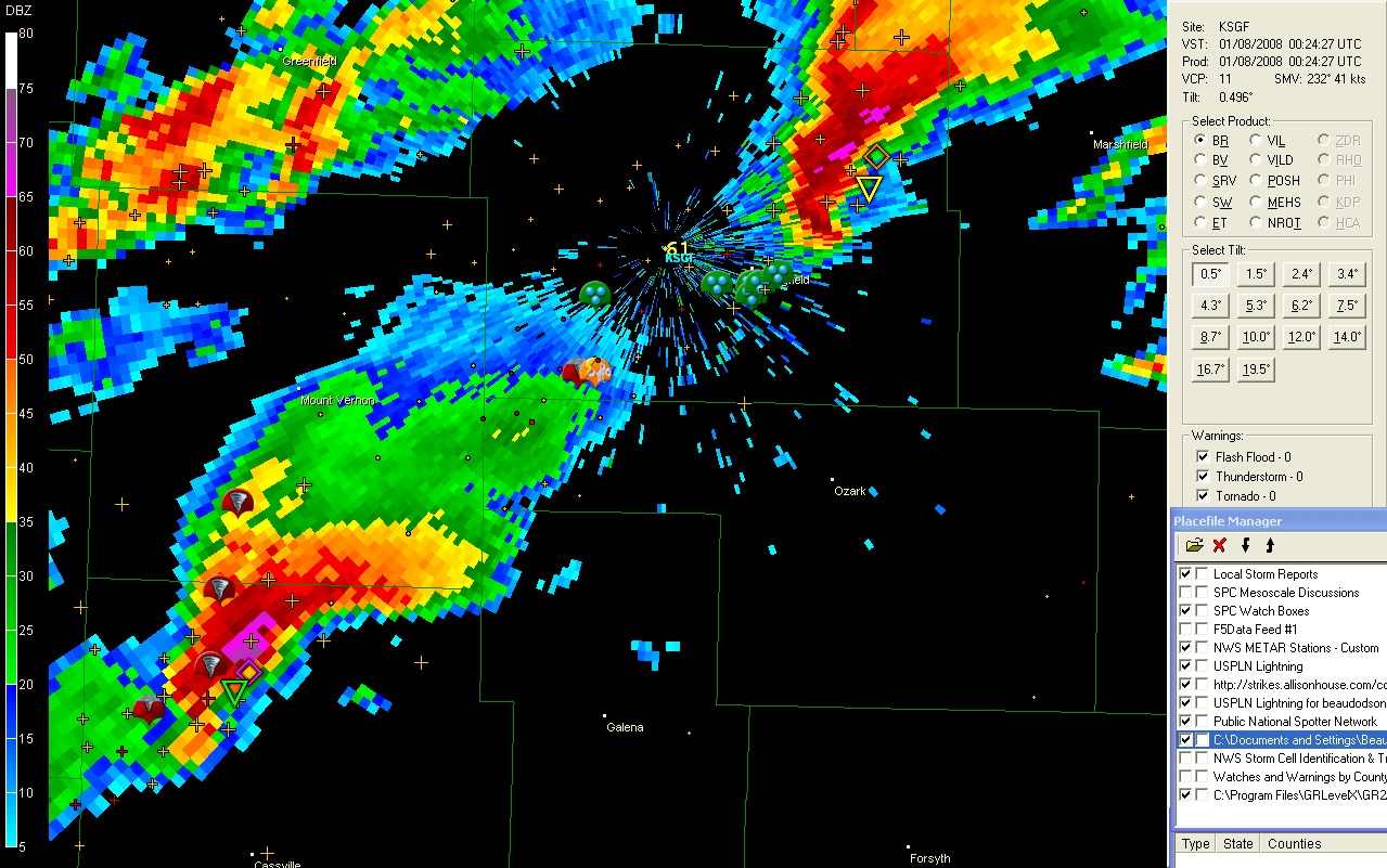
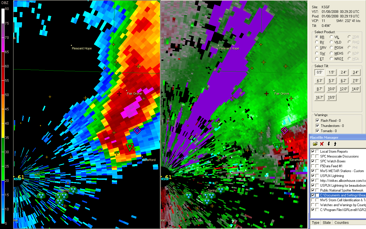
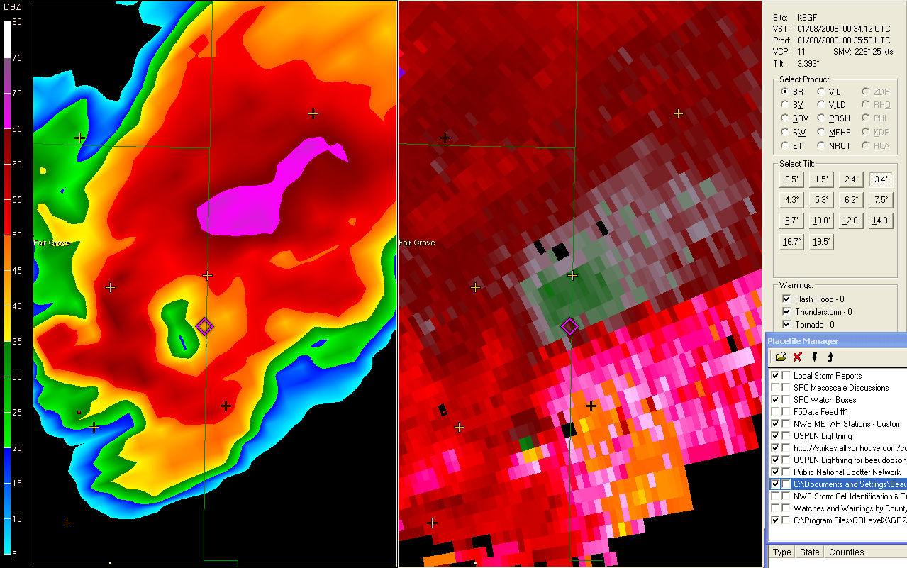
Springfield, MO Tornado
Way too many images to post tonight. Portions of Southwest, MO have been under tornado warnings for more than four hours now. Springfield, MO has been hit by several tornadoes. Numerous reports of damage and injuries across WI, IL, MO, AR, and OK. Looks like one of the bigger tornado outbreaks for the month of January. Historic for some areas.
You can view a long thread on the event on EasternUSwx.
January 08, 2008
After a stormy night it appears that a stormy day is on tap for the Tri-State Region. Tornado watches are already in effect. Looks like a long day ahead.
January 09, 2008
Our first tornado watch of 2008 was issued yesterday for the region. We had numerous tornado warnings across the Tri-State Area. So far the only damage reported was from an EF1 tornado in Southeast Missouri and some wind damage across Southwest Indiana. Tornado sirens blew in both Mayfield and Paducah. No touchdowns were reported. Several wall clouds were noted across Western Kentucky along with some funnel cloud sightings.
I originally started this blog to post about chases and local events. Somehow I managed to take that a bit off course. I am going to try and post less often but more local or chase oriented subjects. So, if there are less posts but more quality posts then you will know why!
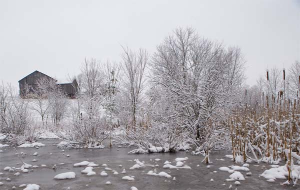
January 14, 2008
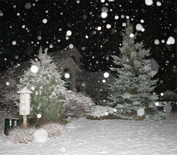
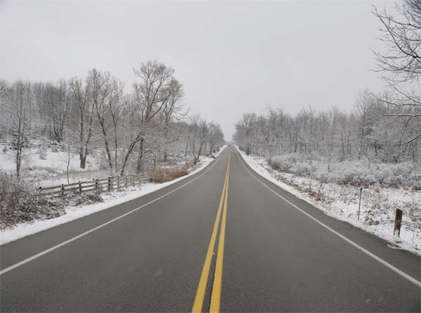
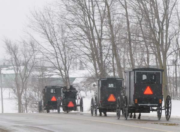
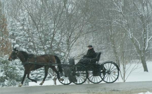
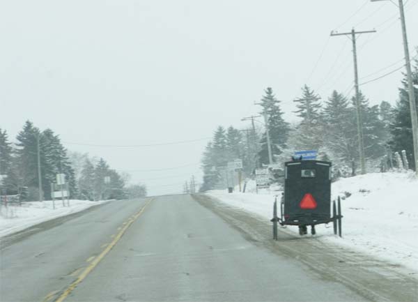
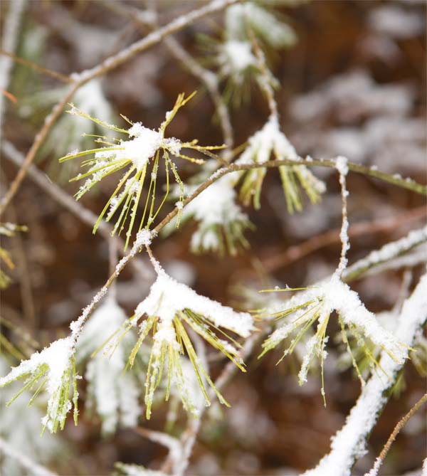
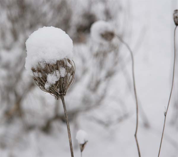
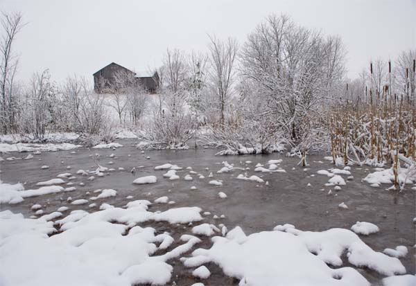
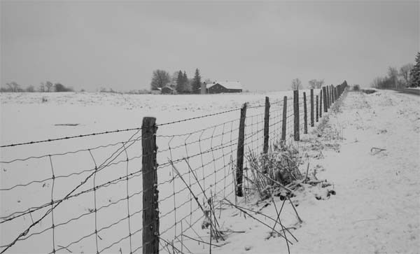
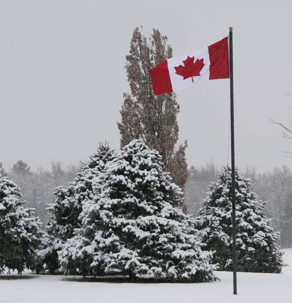
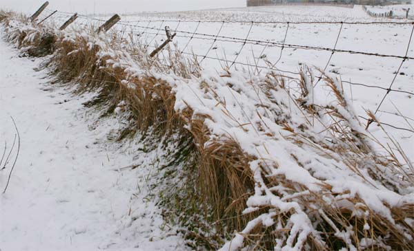
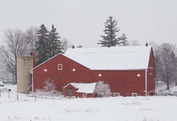
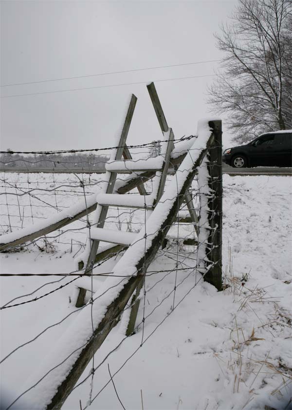
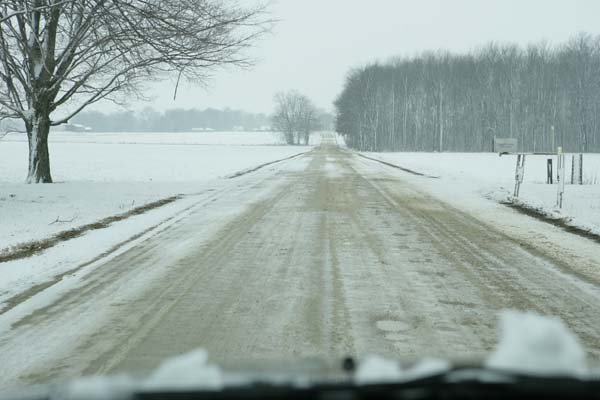
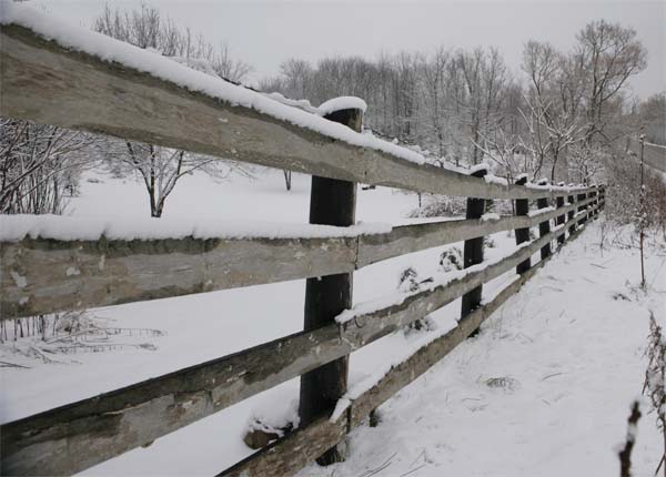
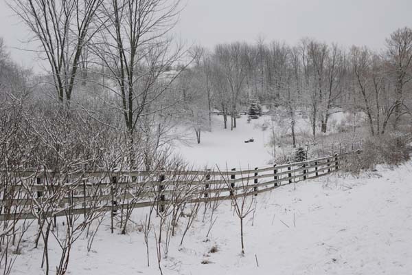
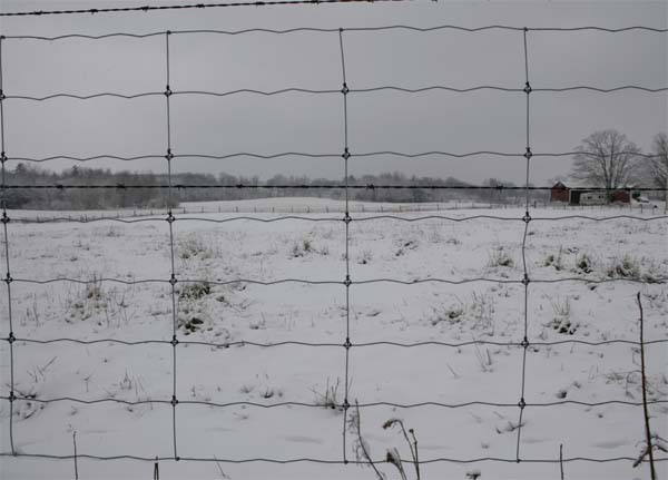
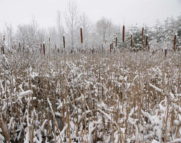
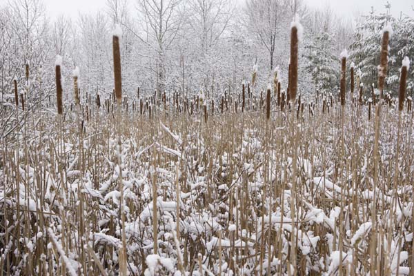
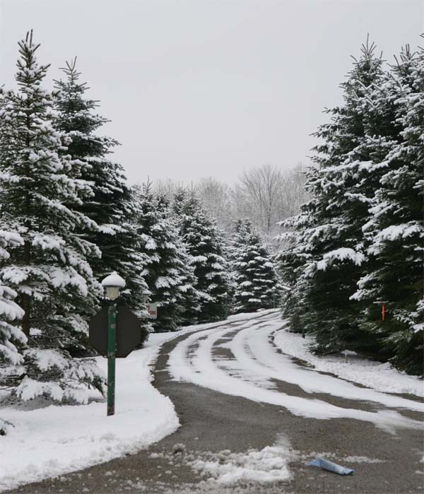
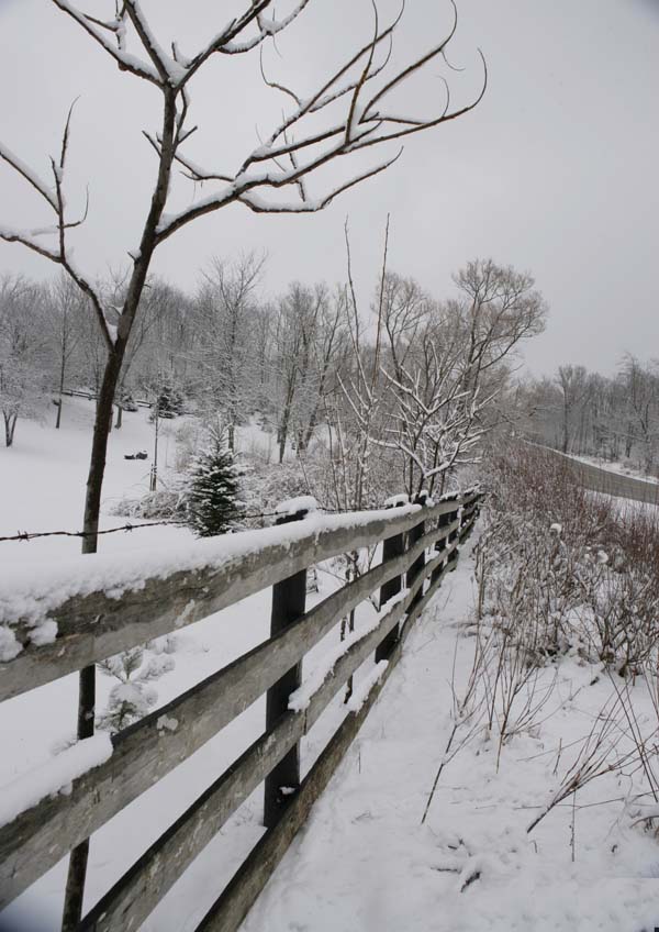
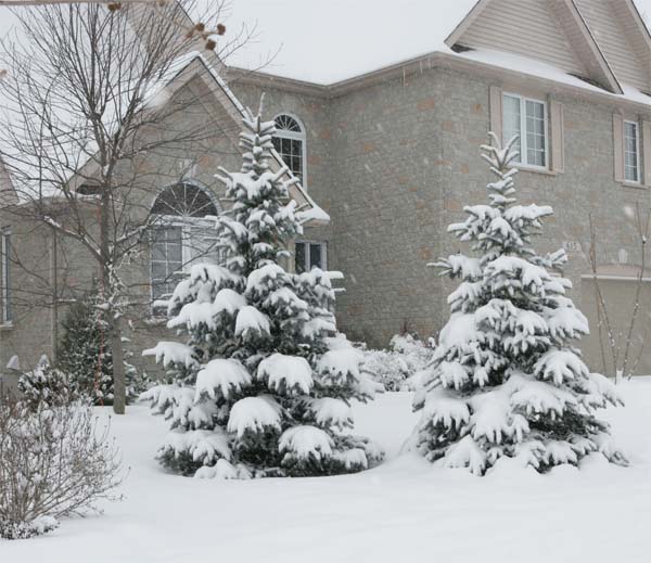
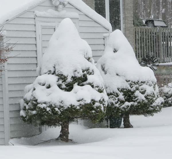
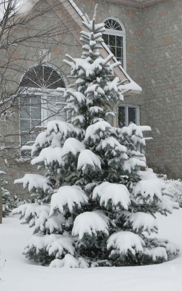
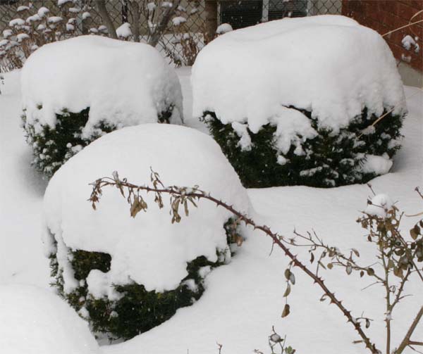
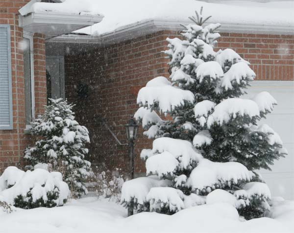
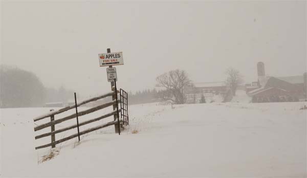
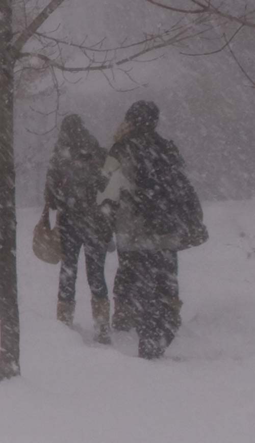
Snow fell across Waterloo, Ontario last night. This is my first snow of the season. It is sort of strange to go from tornado watches to snow! You have to love mother nature. Temperatures are not extremely cold across this region. We had overnight lows in the upper 20s and lower 30s. Temperatures today hovered around the freezing mark. It was a wet snow. The best kind of snow if you ask me. Sticking to everything.
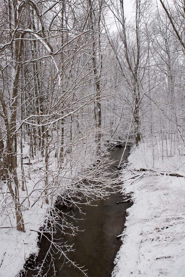
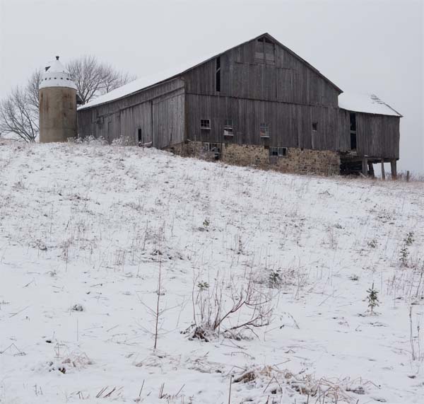
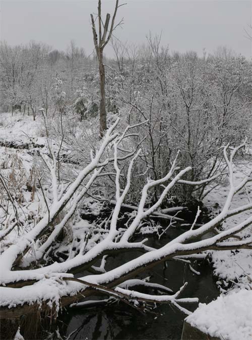
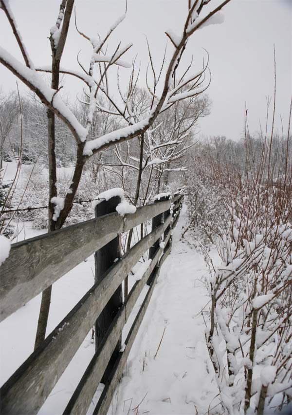
A true winter wonderland. Here are some photographs that I took around the Waterloo and St. Jacobs area earlier today. Enjoy.
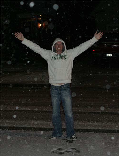
That would be me in the snow last night!
Snow falling in Waterloo, Ontario - Beau Dodson photograph
Beau Dodson - Waterloo, Ontario - Photography
Beau Dodson - Waterloo, Ontario - Photography
Beau Dodson - Waterloo, Ontario - Photography
Beau Dodson - Waterloo, Ontario - Photography
Beau Dodson - Waterloo, Ontario - Photography
Beau Dodson - Waterloo, Ontario - Photography
Beau Dodson - Waterloo, Ontario - Photography
Beau Dodson - Waterloo, Ontario - Photography
Beau Dodson - Waterloo, Ontario - Photography
Beau Dodson - Waterloo, Ontario - Photography
Beau Dodson - Waterloo, Ontario - Photography
Beau Dodson - Waterloo, Ontario - Photography
Beau Dodson - Waterloo, Ontario - Photography
Beau Dodson - Waterloo, Ontario - Photography
Beau Dodson - Waterloo, Ontario - Photography
Beau Dodson - Waterloo, Ontario - Photography
Beau Dodson - Waterloo, Ontario - Photography
Beau Dodson - Waterloo, Ontario - Photography
Beau Dodson - Waterloo, Ontario - Photography
Beau Dodson - Waterloo, Ontario - Photography
Beau Dodson - Waterloo, Ontario - Photography
Beau Dodson - Waterloo, Ontario - Photography
Beau Dodson - Waterloo, Ontario - Photography
Beau Dodson - Waterloo, Ontario - Photography
Beau Dodson - Waterloo, Ontario - Photography
Beau Dodson - Waterloo, Ontario - Photography
Beau Dodson - Waterloo, Ontario - Photography
Beau Dodson - Waterloo, Ontario - Photography

Beau Dodson - Waterloo, Ontario - Photography
Beau Dodson - Waterloo, Ontario - Photography
Beau Dodson - Waterloo, Ontario - Photography
Beau Dodson - Waterloo, Ontario - Photography
Beau Dodson - Waterloo, Ontario - Photography
Beau Dodson - Waterloo, Ontario - Photography
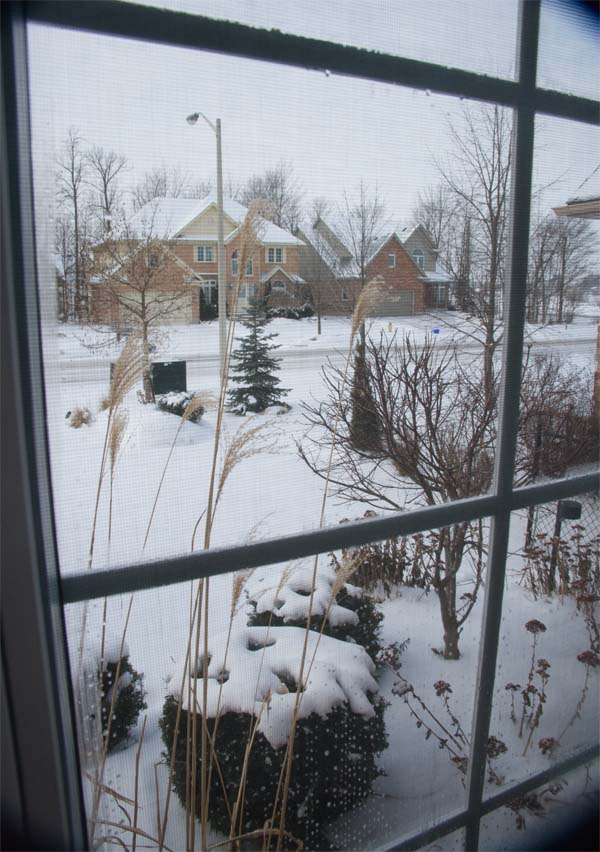
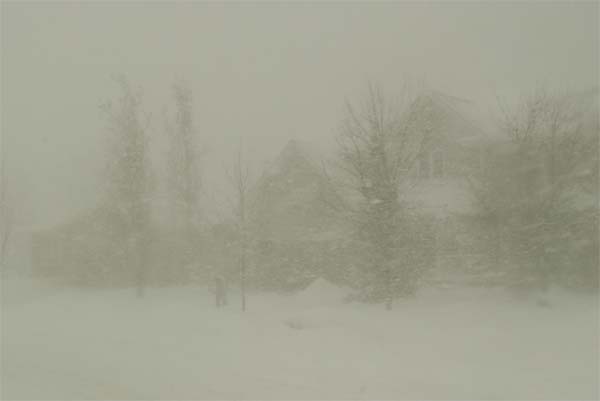
January 21, 2008
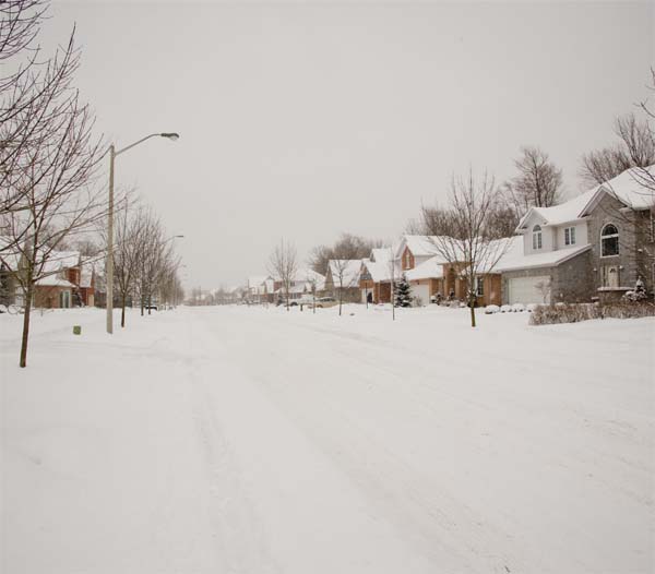
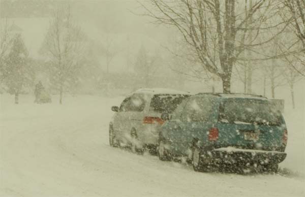
Cold weather has surged across much of the Eastern United States over the last few days. Temperatures here in Ontario have been in the single digits. Numerous snow squalls have also been reported around the Great Lakes.
Clouds are starting to lower across this area. This should continue through the evening and snow should develop later tonight. Looks like a few inches by tomorrow afternoon. High winds will be likely tomorrow as well. Could be a lot of blowing snow.
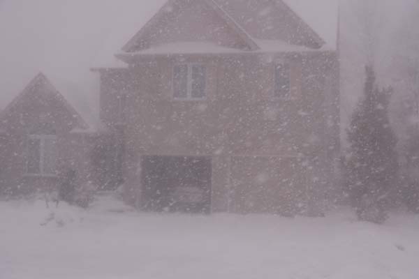
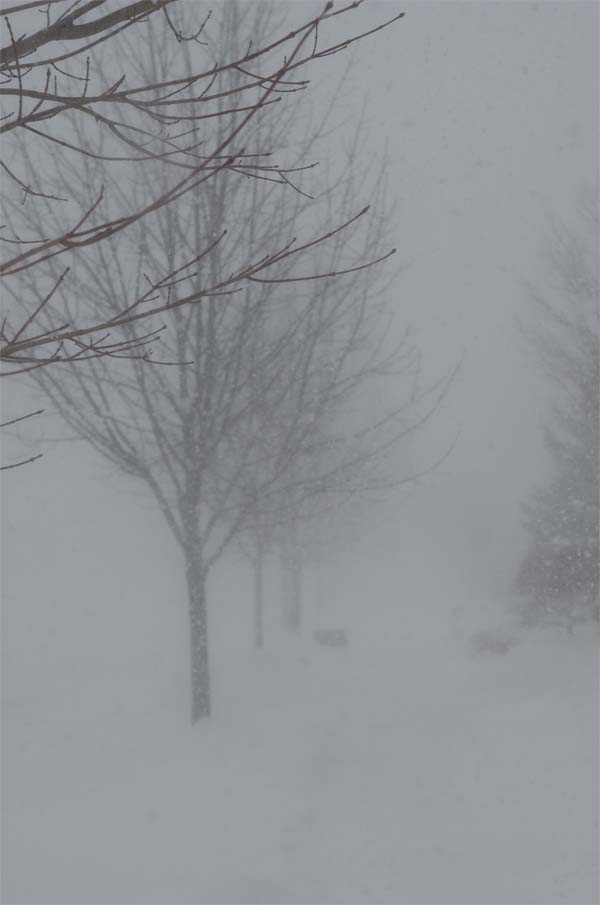
Here is a picture looking outside the window this morning here in Waterloo! Wintery scene.
Beau Dodson - Waterloo, Ontario - Photography
The nation is cold! From Coast to Coast.
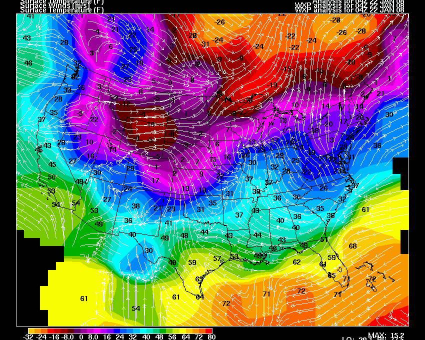
Click for large image
Snowing in Waterloo tonight. Snow should increase throughout the
overnight hours.
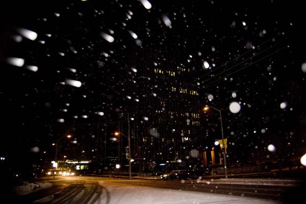
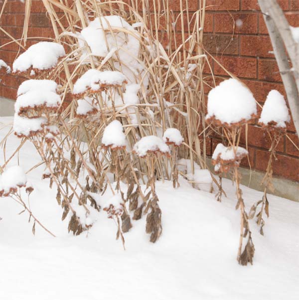
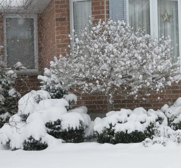
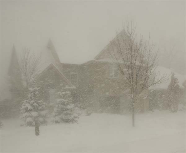
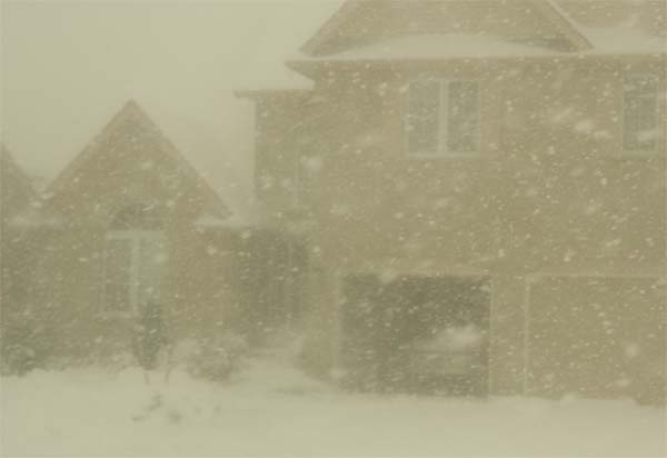
January 22, 2008
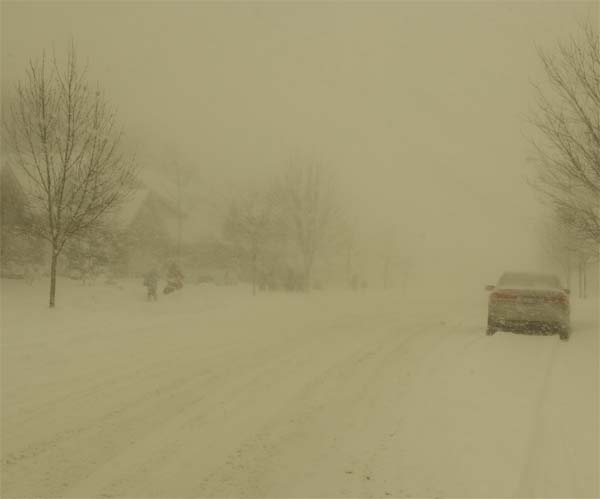
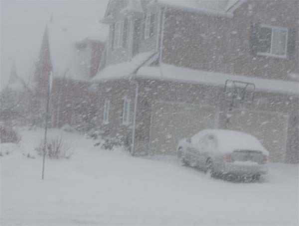
SNOWY WATERLOO!
Temperatures are in the 20s this morning here in Waterloo, Ontario. It is SNOWING! Light - fluffy snow. Looks like we have picked up a few inches overnight. Strong winds are expected this afternoon. This should cause some blowing and drifting snow.
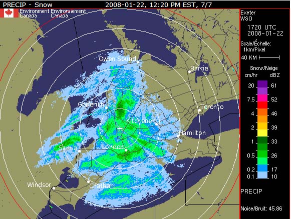
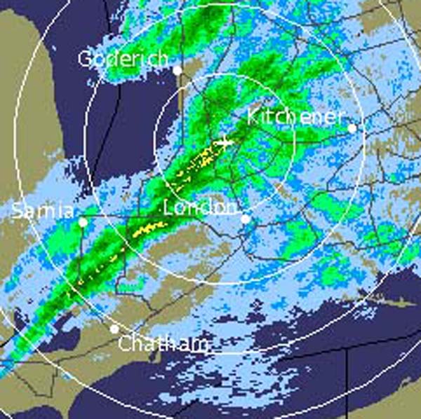
Noon Radar - Waterloo, Ontario
Beau Dodson - Waterloo, Ontario - Photography
Beau Dodson - Waterloo, Ontario - Photography
Beau Dodson - Waterloo, Ontario - Photography
Beau Dodson - Waterloo, Ontario - Photography
Beau Dodson - Waterloo, Ontario - Photography
Beau Dodson - Waterloo, Ontario - Photography
Beau Dodson - Waterloo, Ontario - Photography
Beau Dodson - Waterloo, Ontario - Photography
Beau Dodson - Waterloo, Ontario - Photography
Beau Dodson - Waterloo, Ontario - Photography
Beau Dodson - Waterloo, Ontario - Photography
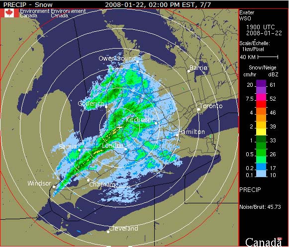
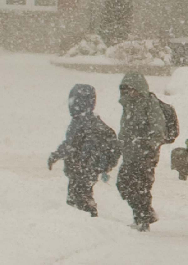
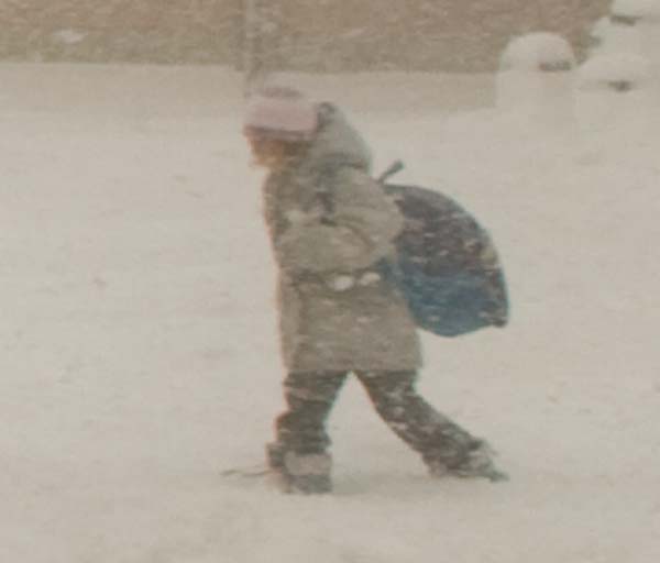
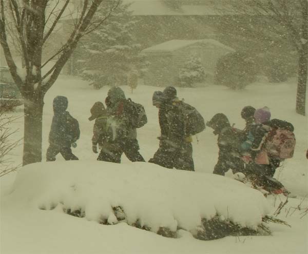
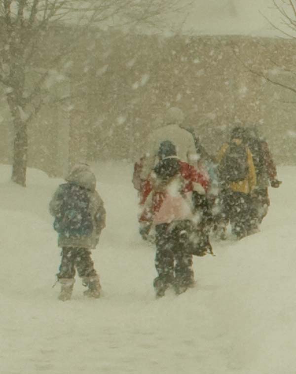
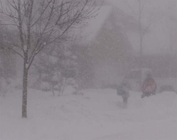
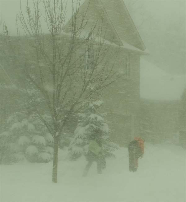
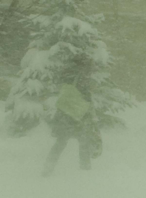
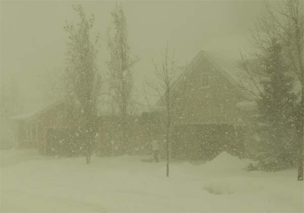
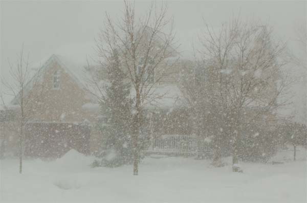
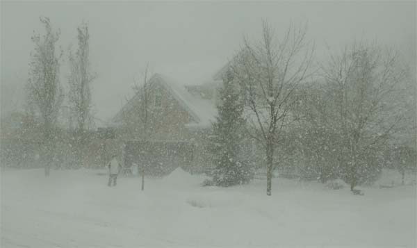
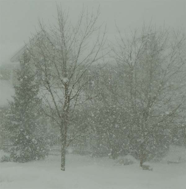
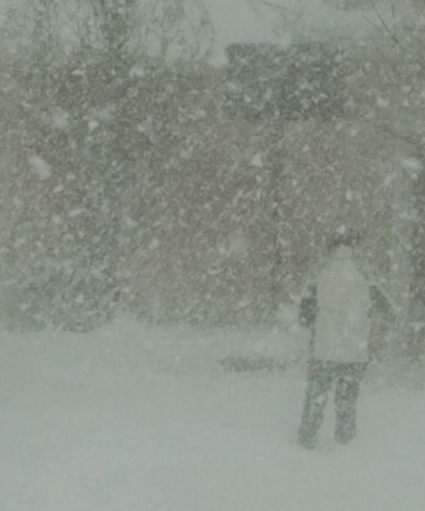
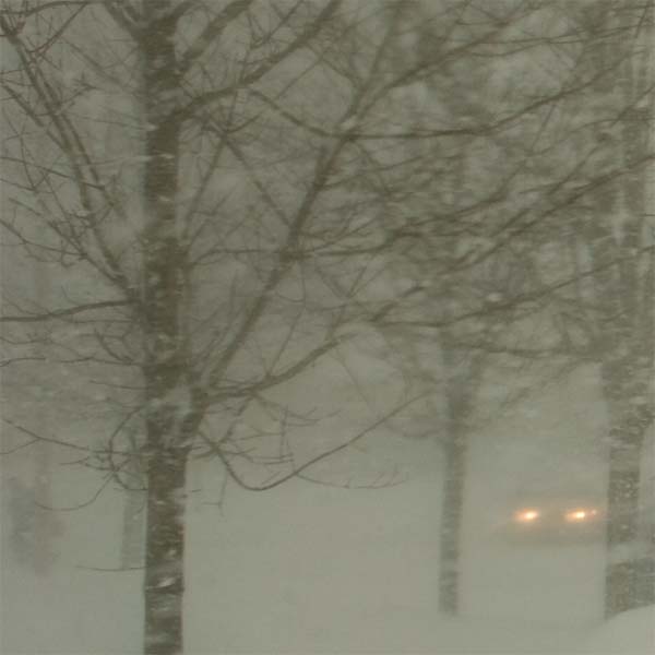
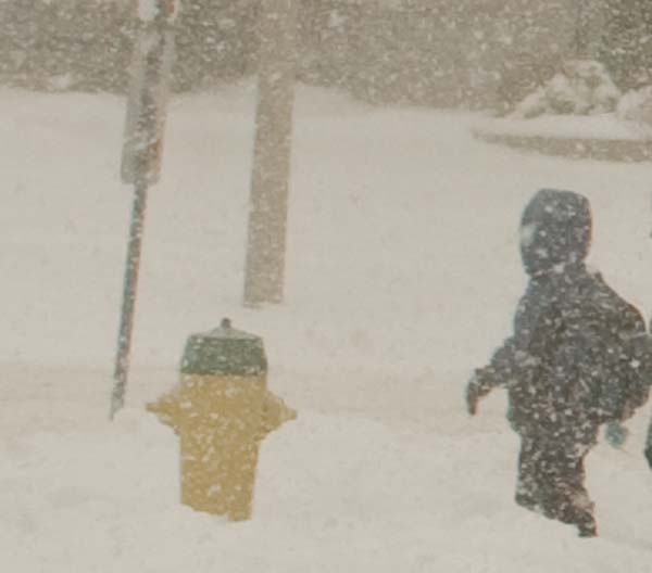
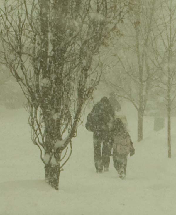
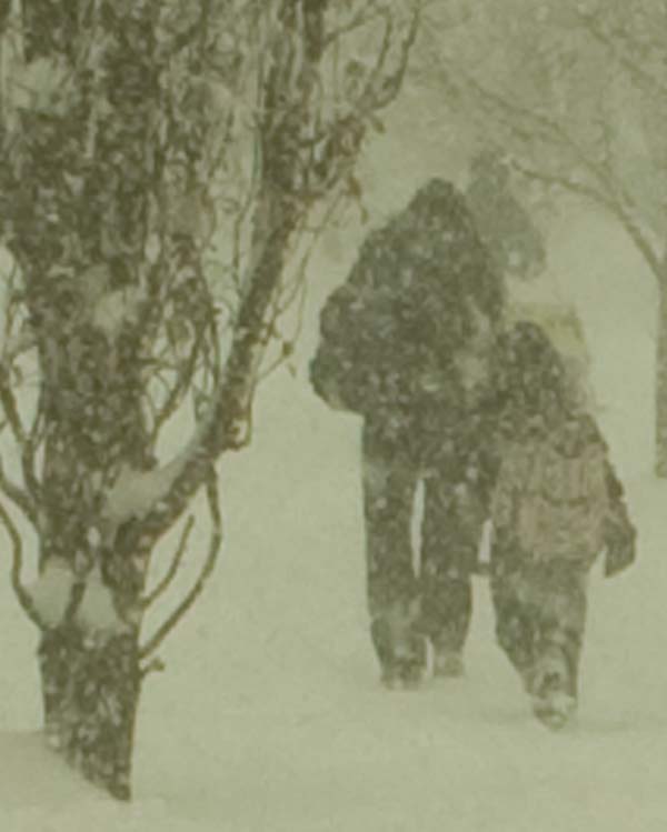
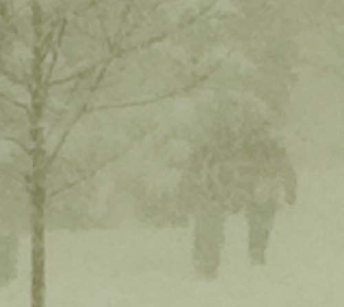
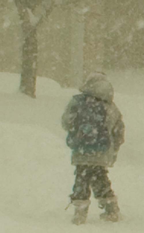
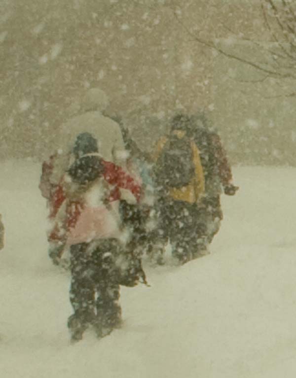
WHITE OUT CONDITIONS THIS AFTERNOON:
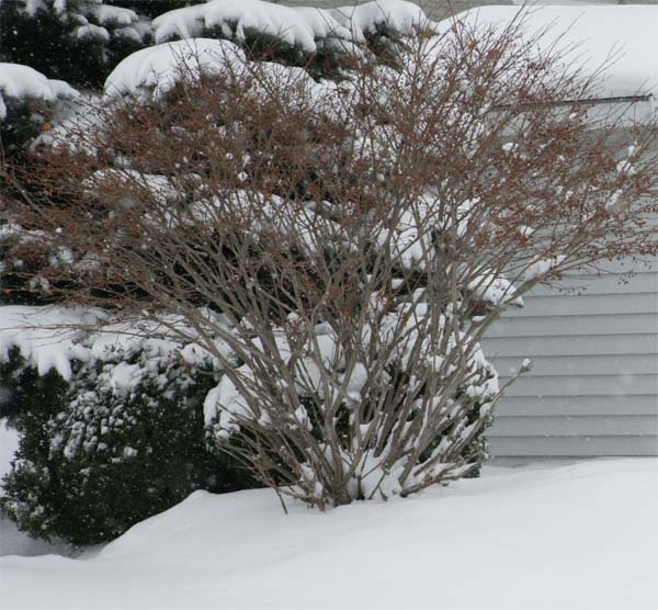
Waterloo experienced whiteout conditions this afternoon as a snow squall crossed Southern Ontario. Heavy snow with snowfall rates of 2-3" per hour were reported with the snow squall. Winds gusted to near 40 mph. I went out to photograph the snow squall as it passed through this area. The kids were just getting out of school and were caught in the heavy snow.
The Buffalo, NWS issued this statement on the squall
OFF LAKE ONTARIO...THE ARCTIC FRONT WILL MOVE THROUGH BY 10
PM...ACCOMPANIED BY A BRIEF PERIOD OF HEAVY SNOW AND NEAR BLIZZARD
CONDITIONS. AS FLOW VEERS LATER THIS EVENING LAKE BAND WILL MAKE
IT ALL THE WAY INTO SOUTHERN OSWEGO AND NORTHERN CAYUGA
COUNTIES...MAYBE EVEN NORTHEAST WAYNE COUNTY BEFORE MOVING QUICKLY
BACK NORTH TOWARDS WATERTOWN LATE TONIGHT.
These are some of the photos I took of the event...
Beau Dodson - Waterloo, Ontario - Photography
Beau Dodson - Waterloo, Ontario - Photography
Beau Dodson - Waterloo, Ontario - Photography
Beau Dodson - Waterloo, Ontario - Photography
Beau Dodson - Waterloo, Ontario - Photography
Beau Dodson - Waterloo, Ontario - Photography
Beau Dodson - Waterloo, Ontario - Photography
Beau Dodson - Waterloo, Ontario - Photography
Beau Dodson - Waterloo, Ontario - Photography
Beau Dodson - Waterloo, Ontario - Photography
Beau Dodson - Waterloo, Ontario - Photography
Beau Dodson - Waterloo, Ontario - Photography
Beau Dodson - Waterloo, Ontario - Photography
Beau Dodson - Waterloo, Ontario - Photography
Beau Dodson - Waterloo, Ontario - Photography
Beau Dodson - Waterloo, Ontario - Photography
Beau Dodson - Waterloo, Ontario - Photography
Beau Dodson - Waterloo, Ontario - Photography
Beau Dodson - Waterloo, Ontario - Photography
Beau Dodson - Waterloo, Ontario - Photography
Beau Dodson - Waterloo, Ontario - Photography
Beau Dodson - Waterloo, Ontario - Photography

Beau Dodson - Waterloo, Ontario - Photography
Beau Dodson - Waterloo, Ontario - Photography
Beau Dodson - Waterloo, Ontario - Photography
Beau Dodson - Waterloo, Ontario - Photography
Beau Dodson - Waterloo, Ontario - Photography
Beau Dodson - Waterloo, Ontario - Photography
Beau Dodson - Waterloo, Ontario - Photography
Snow squall passing through Southern Ontario
Turn the page for more weather
Home | About | News | Upcoming Events| Photo Gallery | Video | Links | Contact
All Photos are copyrighted by Beau Dodson (unless otherwise clearly stated) and are used on this site with his permission. Any use other than authorized by them is against the law. If you wish to contact him regarding use of these photos, please e-mail me and I will forward it.