September 2008
September 02, 2008
Hurricane Gustav came ashore on Labor Day as a category two storm. Earlier forecasts had called for a category four. Thankfully, that did not materialize. Damage is estimated in the billions of dollars across Louisiana and Mississippi. Additional flooding is likely all the way into Arkansas and Missouri.
It appears that our region will be spared the worst of the flooding. Rainfall amounts across western Kentucky will likely remain below one inch. Rainfall totals over portions of Missouri and Illinois will range from 2-6 inches.
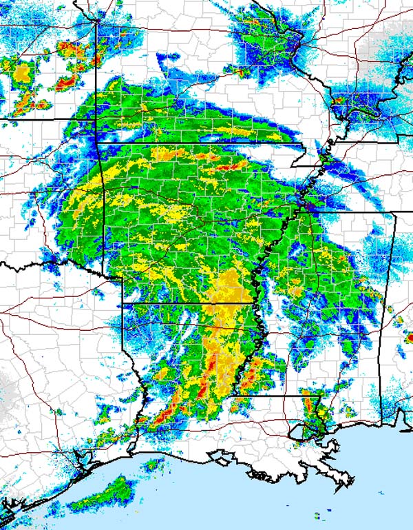
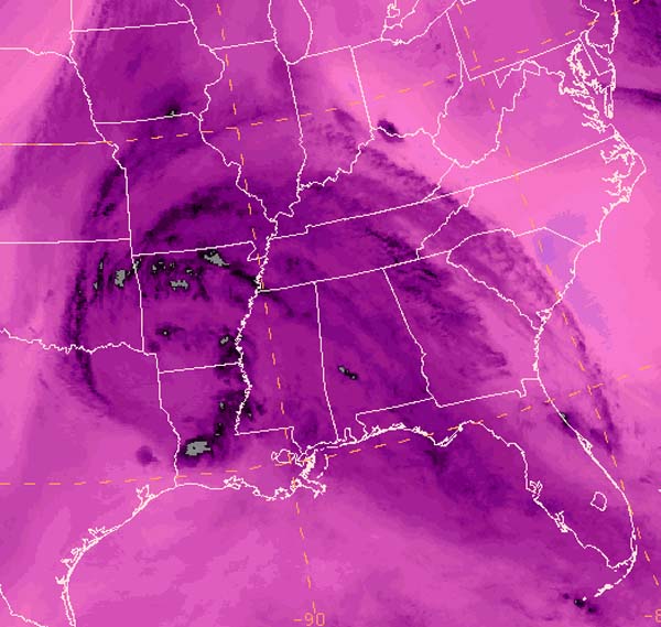
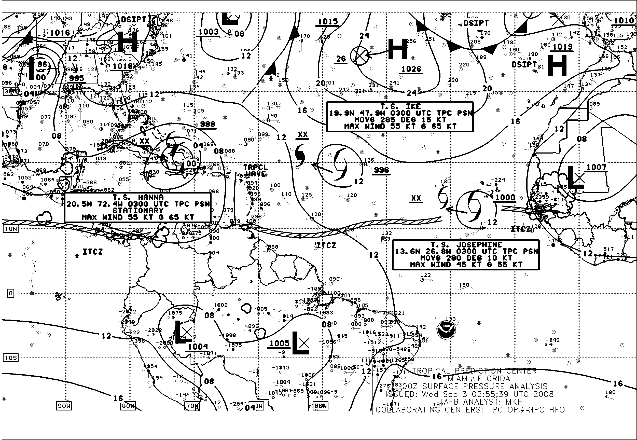
Evening Radar/Water Vapor/Atlantic Wx Map
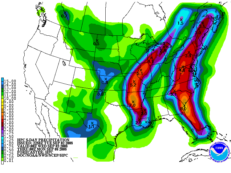
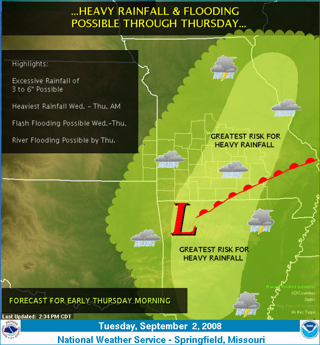
Rainfall Forecast/NWS Springfield, MO Graphic
September 10, 2008
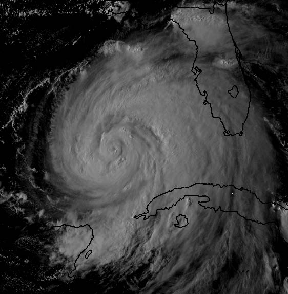
Ike continues to move into the Gulf of Mexico, this evening. Winds are now over 100 mph. Additional strengthening is likely. It appears landfall will be somewhere near Corpus Cristi - NHC takes it further north. There is a wide window of opportunity for landfall. So, I will have to fine tune my thoughts as we get a bit closer.
A large hurricane watch has been issued for Texas.
This is a powerful and dangerous hurricane.
September 14, 2008
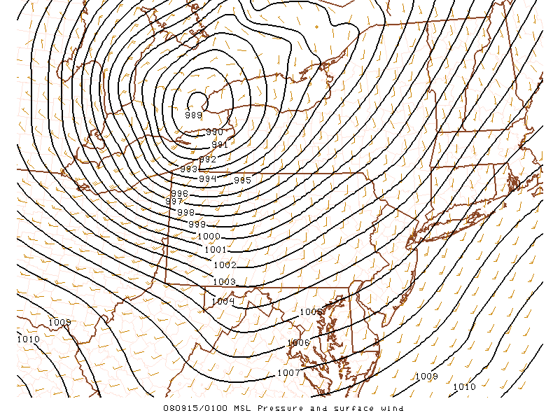
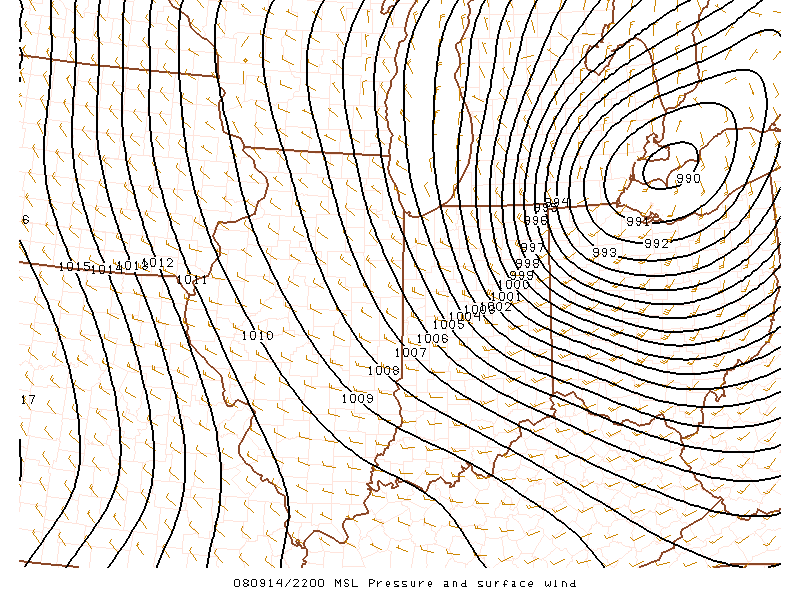
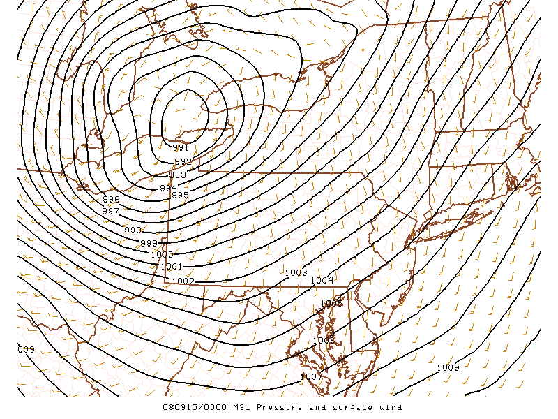
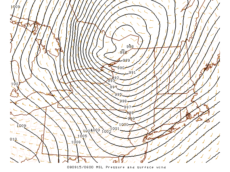
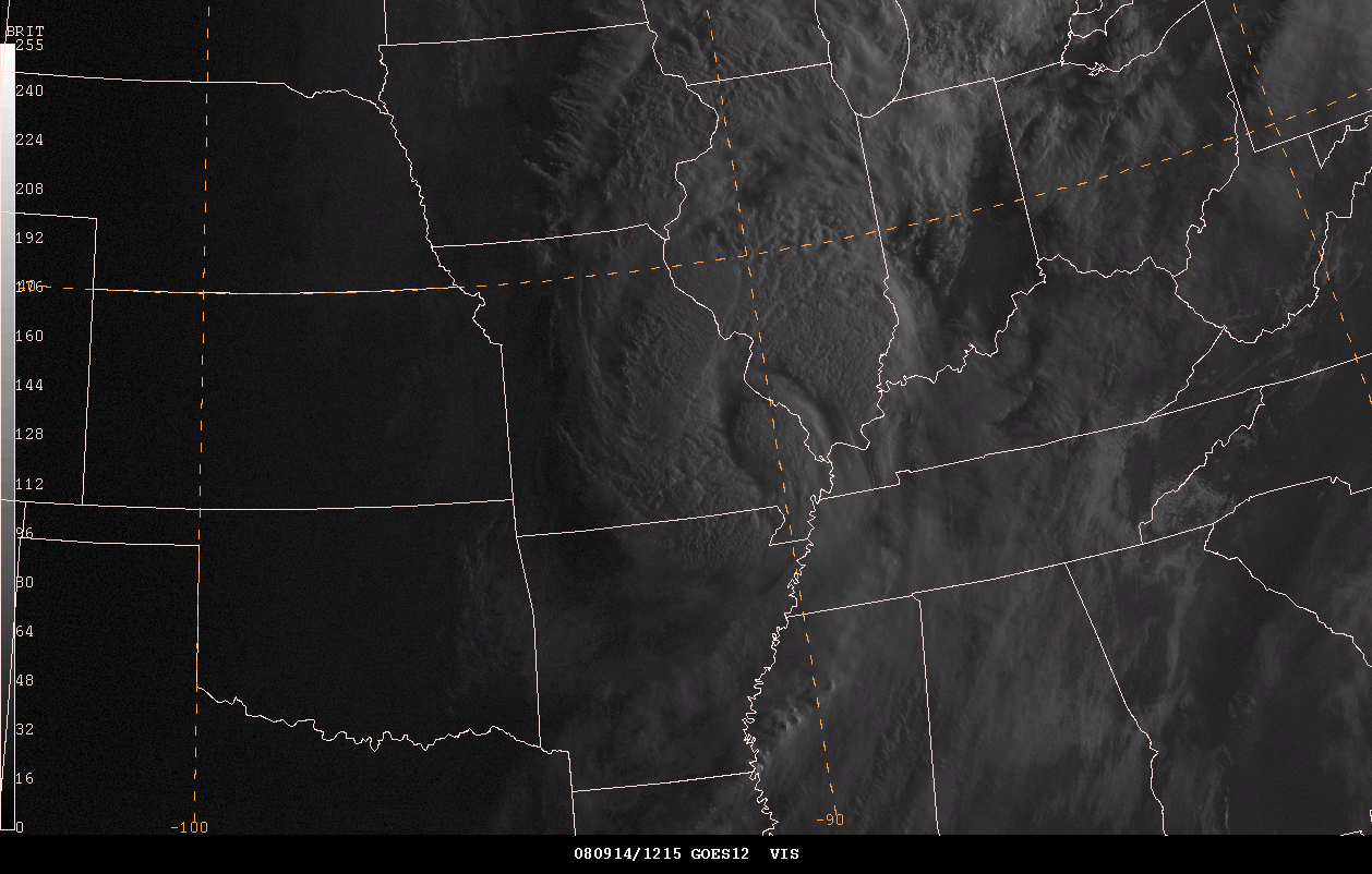
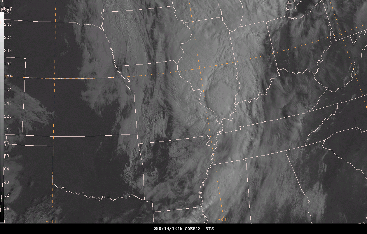
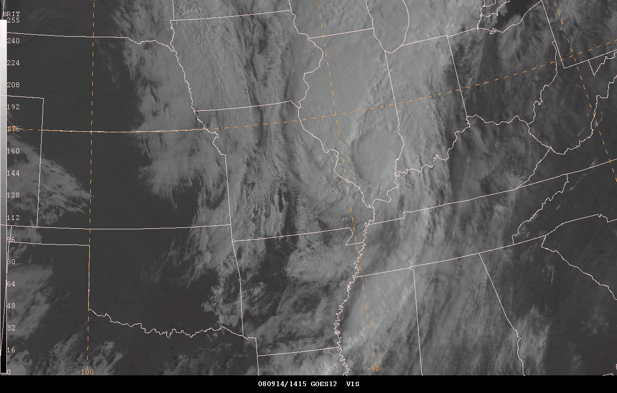
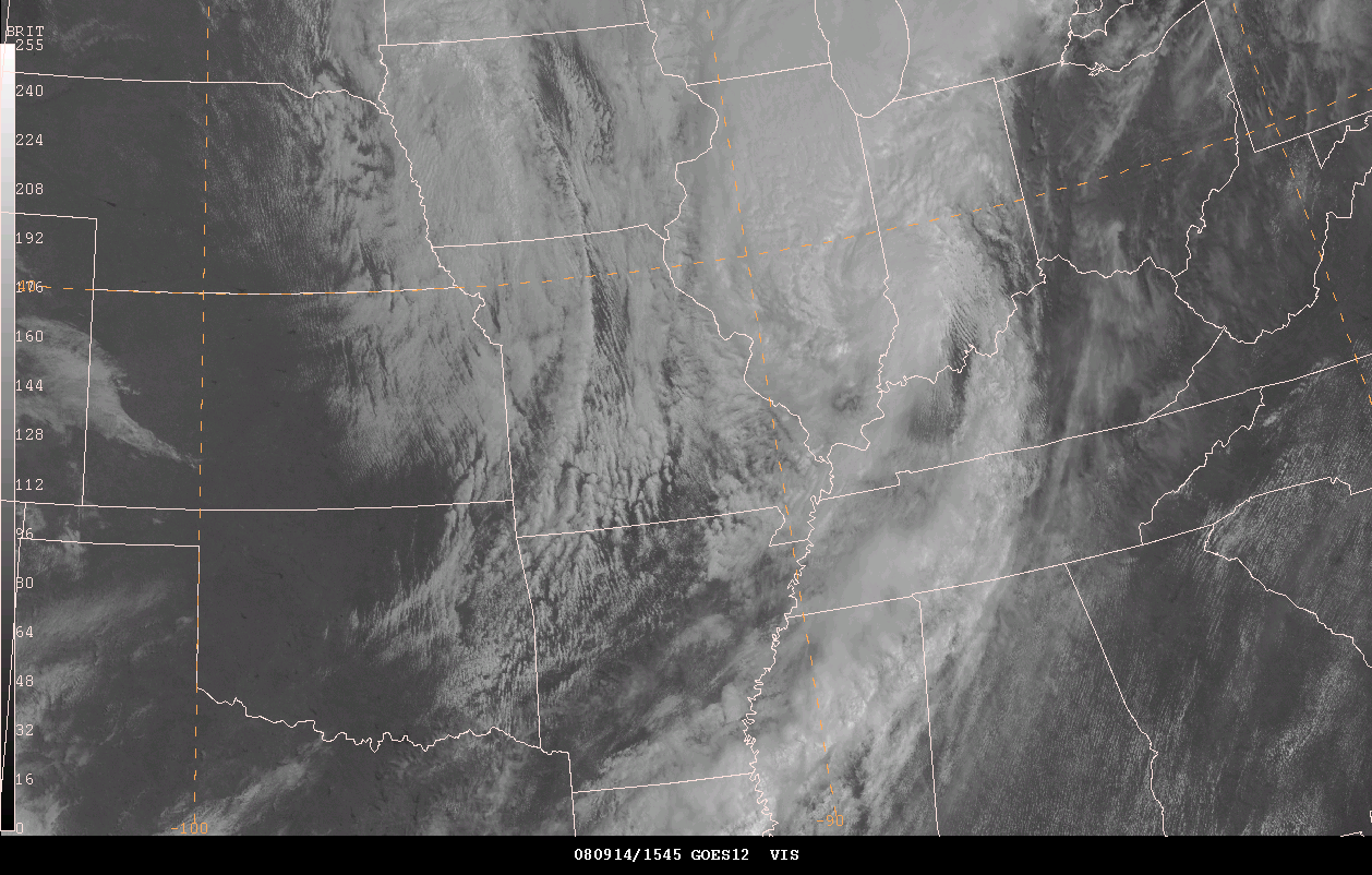
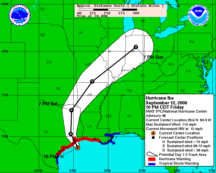
A powerful hurricane has destroyed portions of the Texas Coastline. Ike moved ashore on September 12th. Winds of 100+ mph were reported near and north of Galveston. Damage amounts are unknown - early estimates are that damage will exceed 30 billion dollars. The death toll is unknown as well.
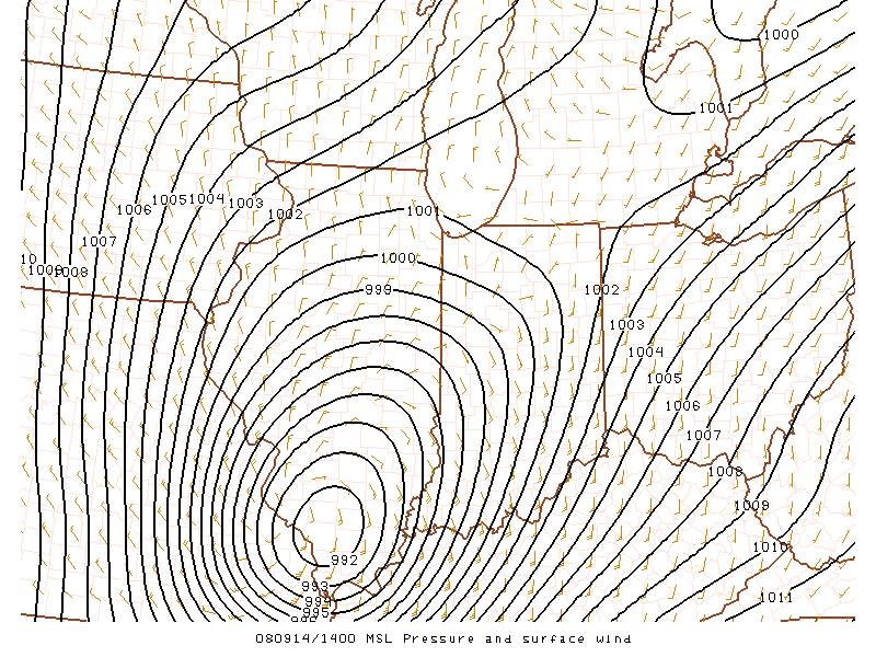
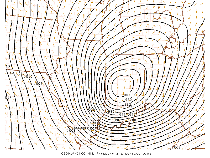
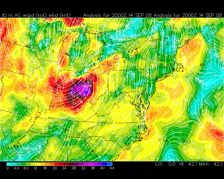
The storm moved into Arkansas on Friday Night and Saturday. The low continued to weaken as it moved northeast, until it reached Southeast Missouri. After that the storm seemed to re-intensify as it was swept into a storm system moving in from the Central Plains.
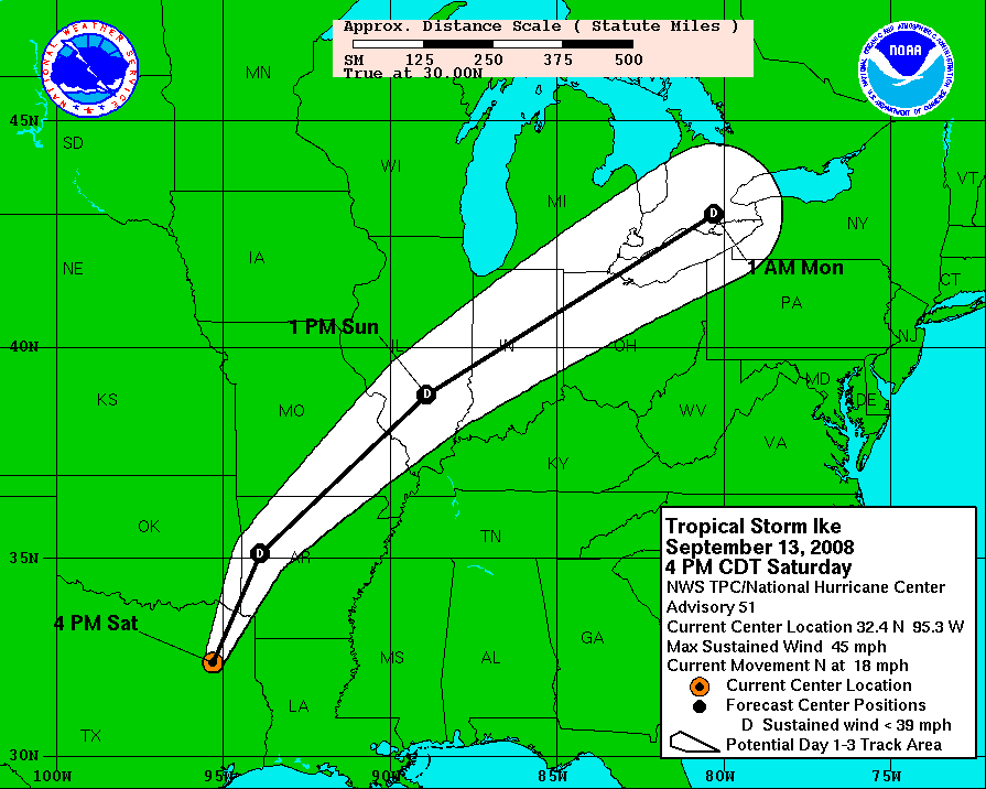
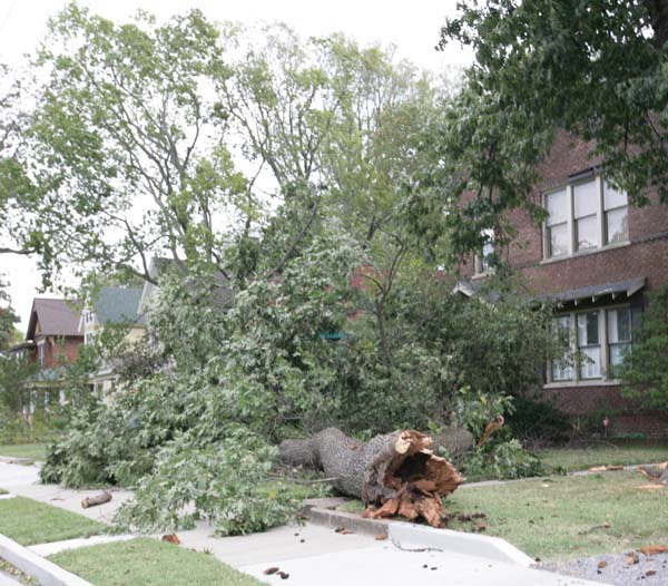
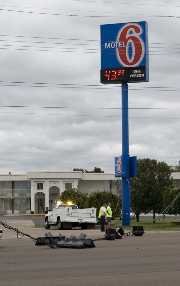
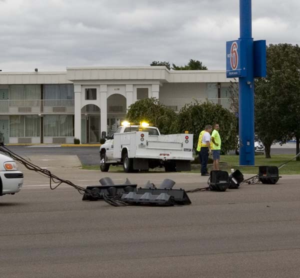
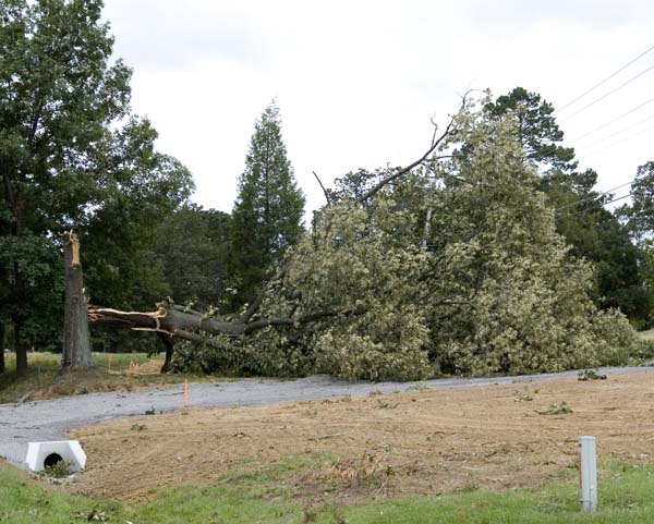
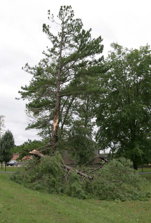
During the early morning hours high winds began to develop across this area. Winds continued to increase all morning. Between 7 AM and 11 AM winds gusted over 70 mph several times. Numerous gusts over 60 mph occurred. We experienced sustained winds of tropical storm force.
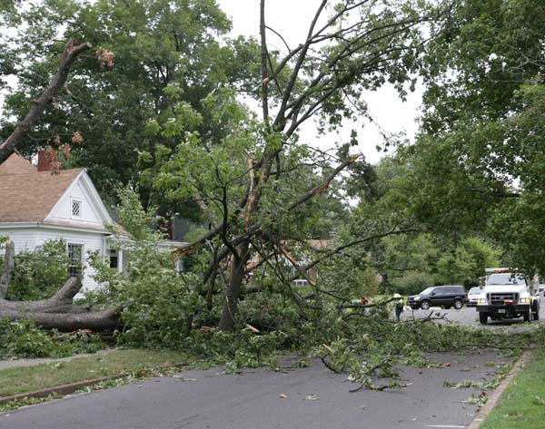
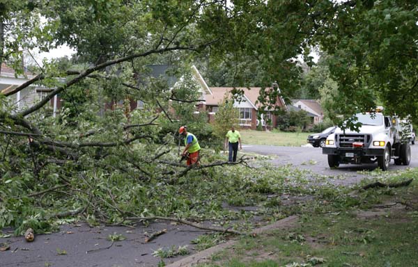
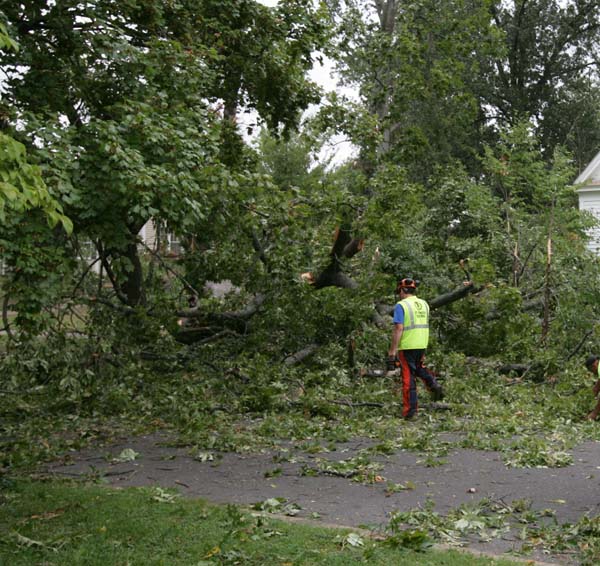
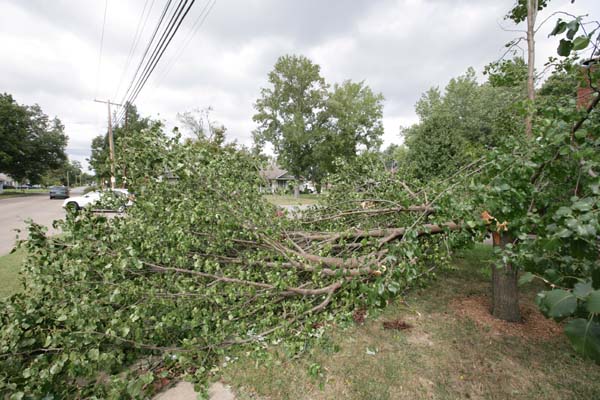
I have personally never witnessed so much widespread tree damage over so many counties in our area. Hundreds of homes were damaged, trees downed, fires reported before of barns being blown apart (then catching on fire), windows blown out of businesses, and power lines down. Several homes and businesses had their roofs blown off.
Certainly one of the more dramatic storms in recent memory. Damage has been reported all the way to the Canadian border.
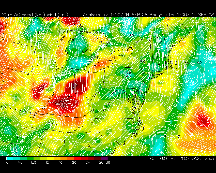
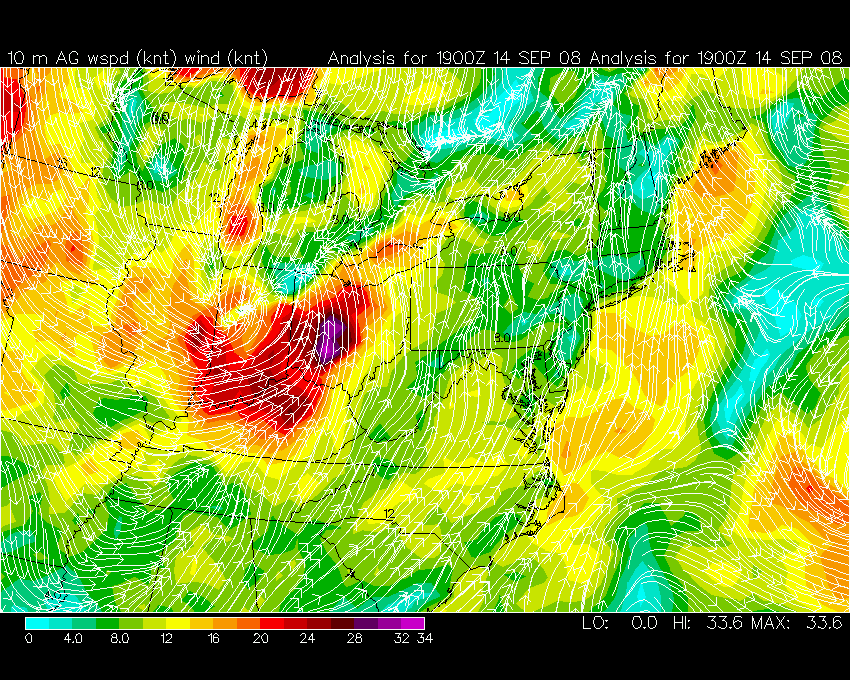
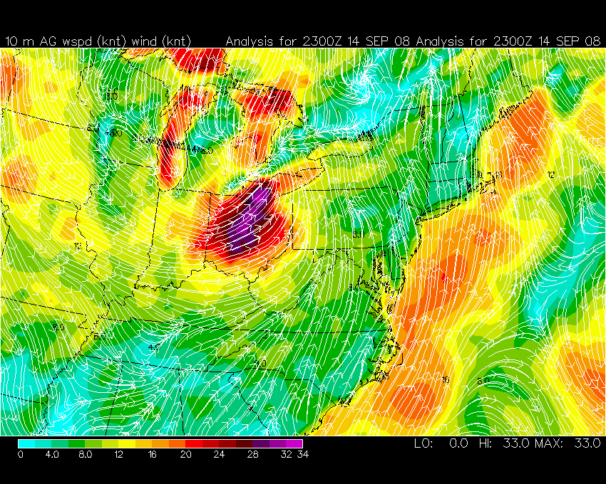
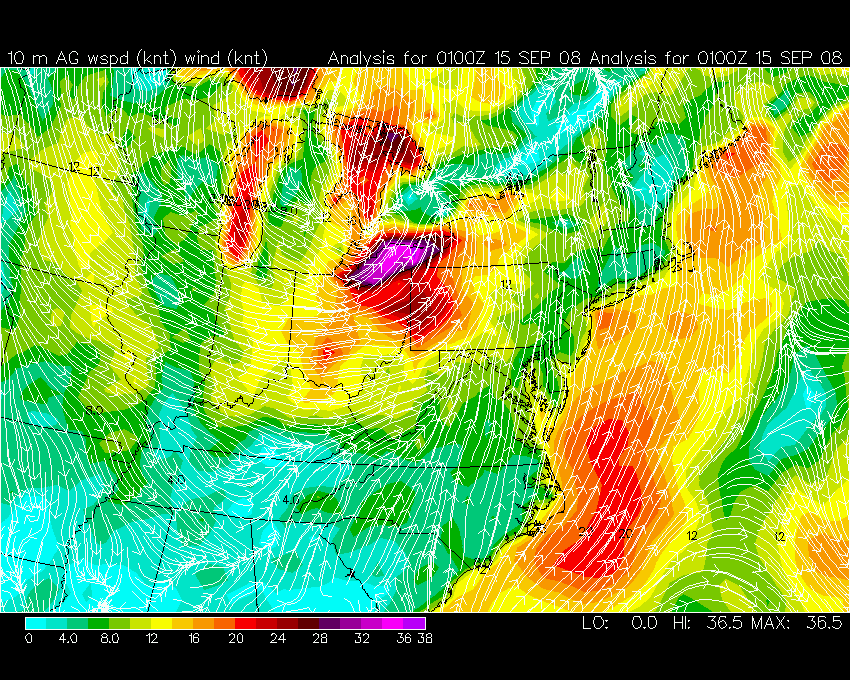
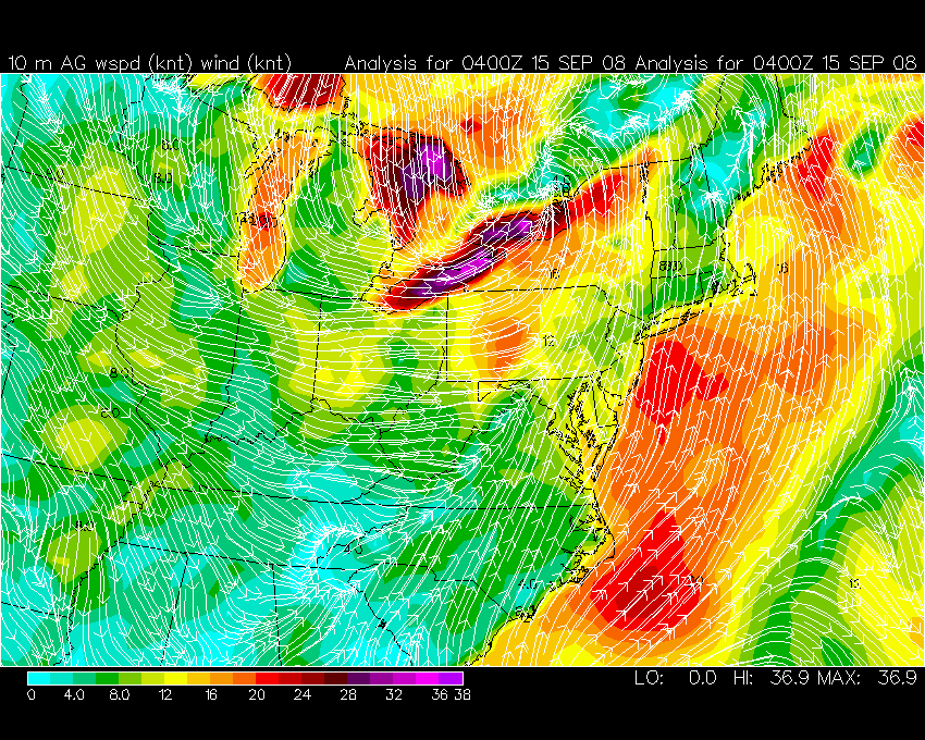
Here are some of the pressure maps from this morning

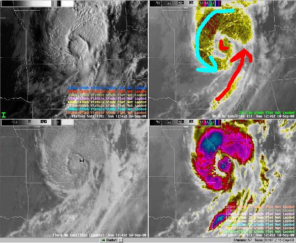
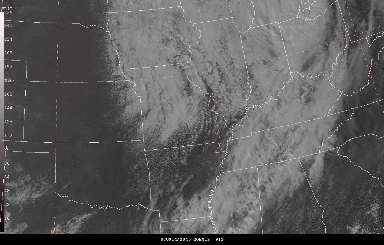
KPAH Satellite
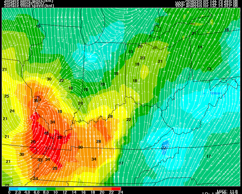
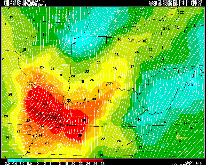
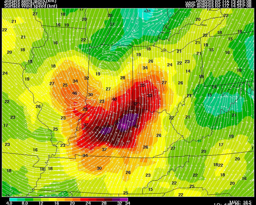
Here are some wind maps provided by Wright-Weather.com
Here are some satellite images provided by Jason Darnall
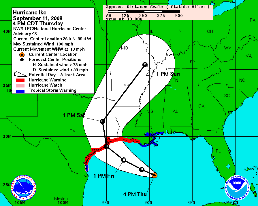
NHC Forecast Track
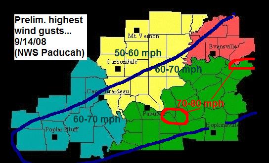
This wind map was produced by the Paducah, Kentucky - National Weather
Service Office
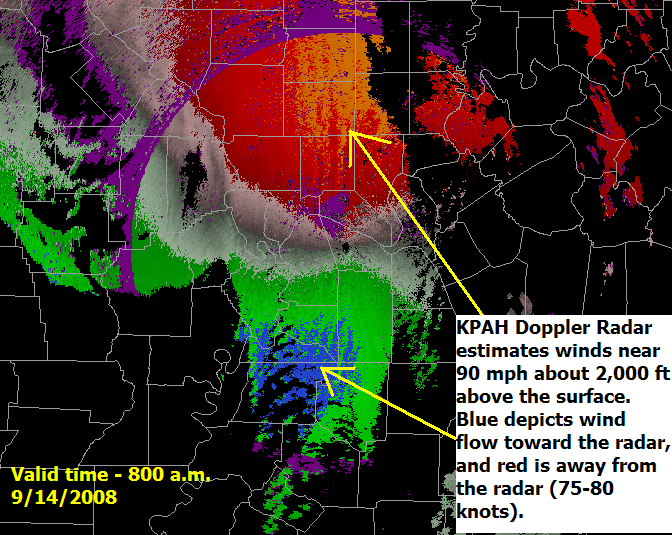
Radar Winds
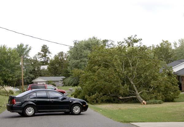
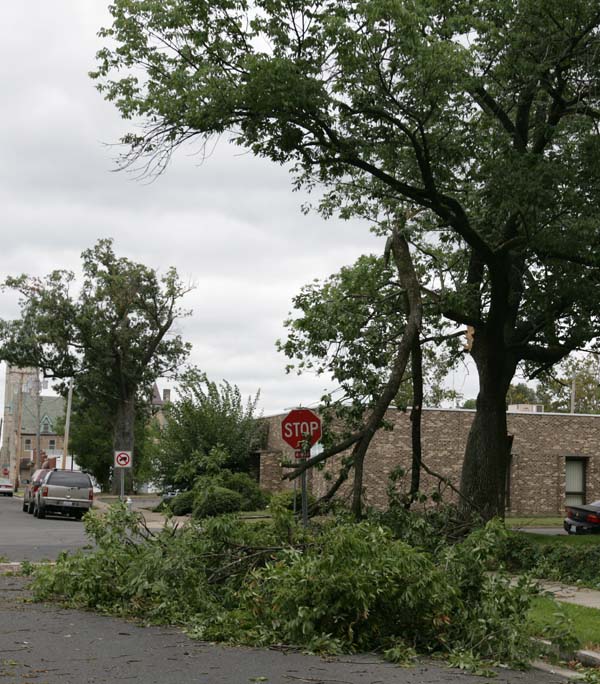
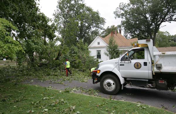
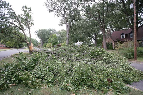
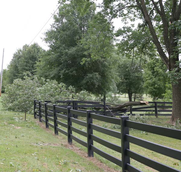
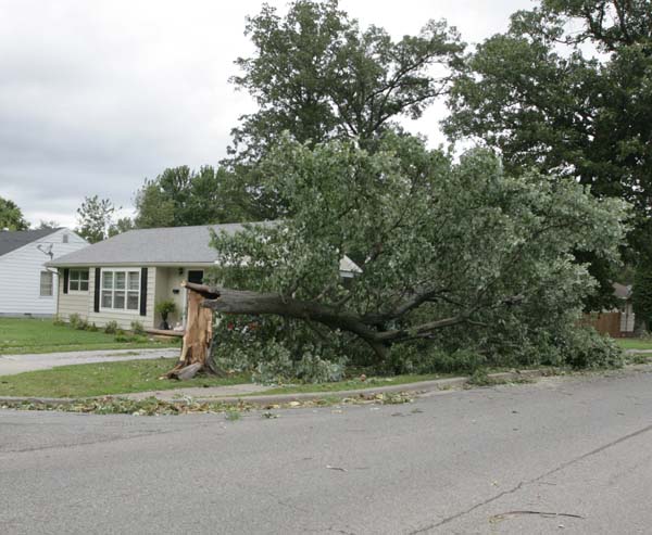
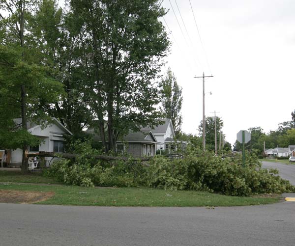
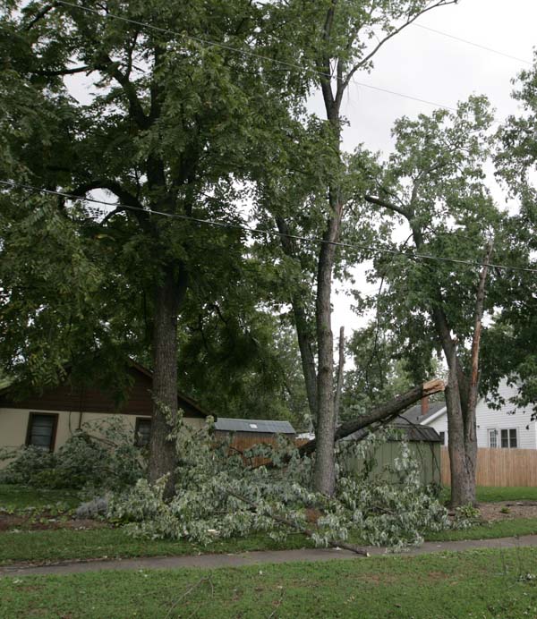
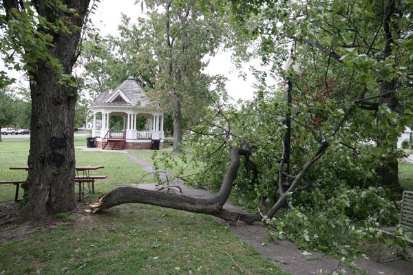
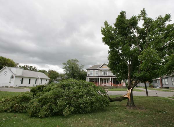
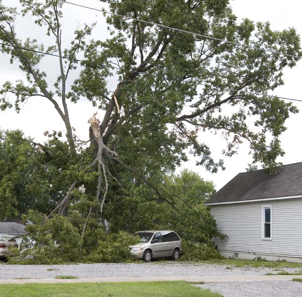
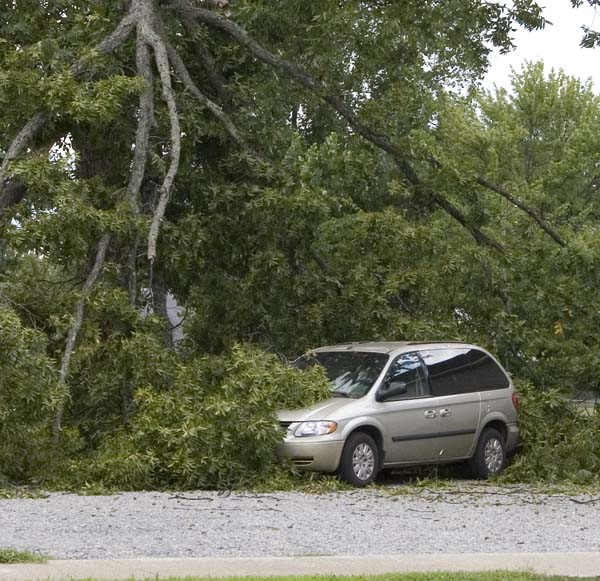
Below are some damage photographs that I took in my neighborhood and county.
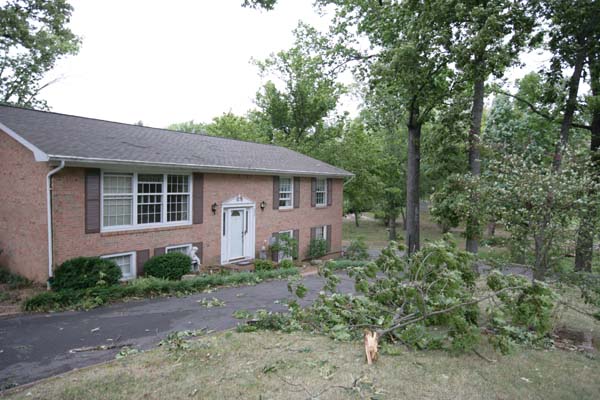
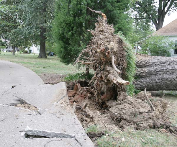
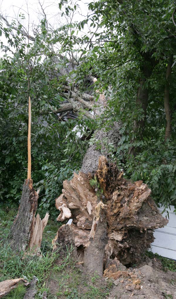
Tree in front of my house
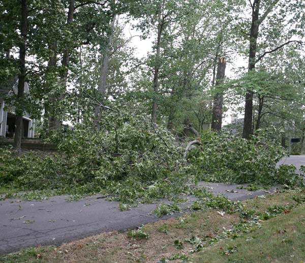
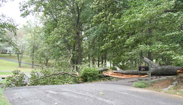
Trees blocking the road in front of my house
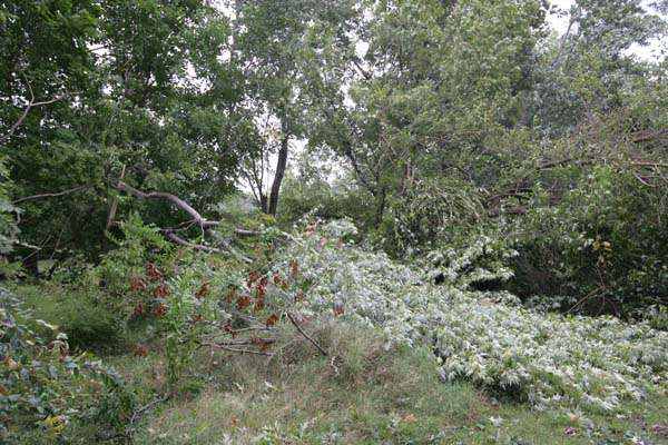
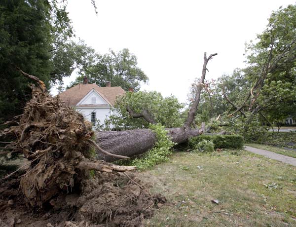
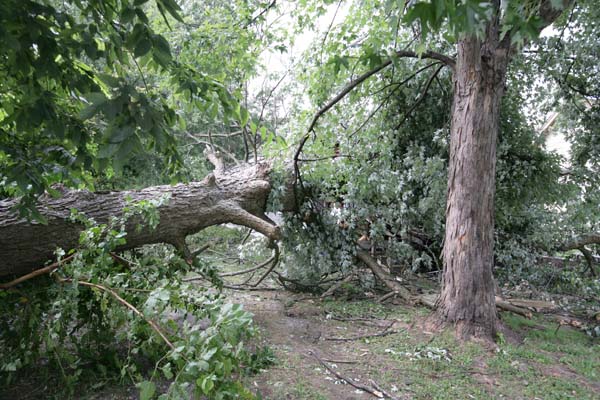
Trees down in my backyard - Lone Oak, Kentucky

The tops of these trees blew out in the backyard
Front yard has tree branches downed
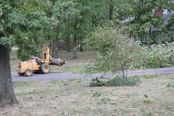
Cleanup begins in my neighborhood
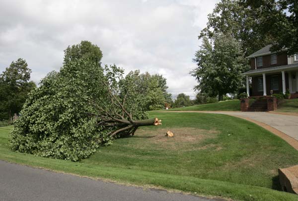
Lone Oak, KY Tree Damage
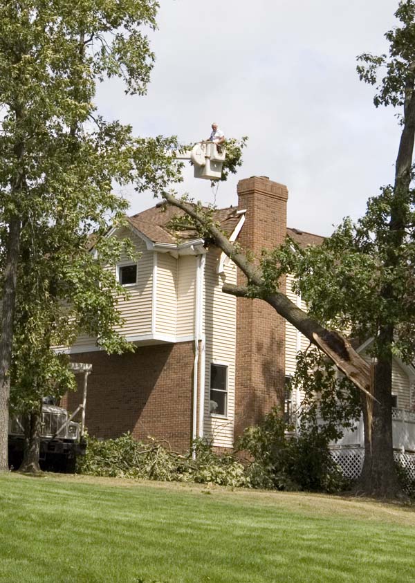
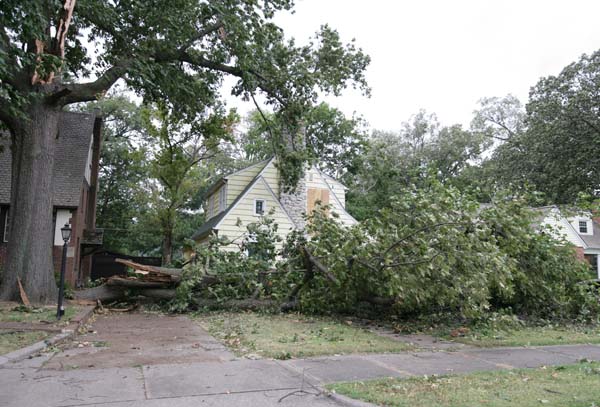
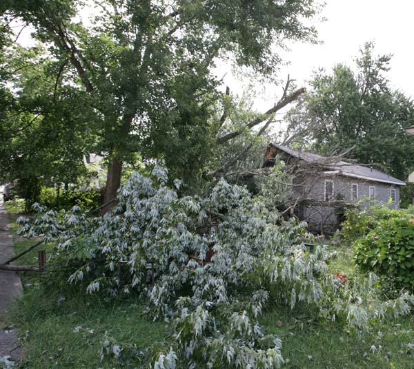
Lone Oak - tree on home
Lone Oak, Kentucky
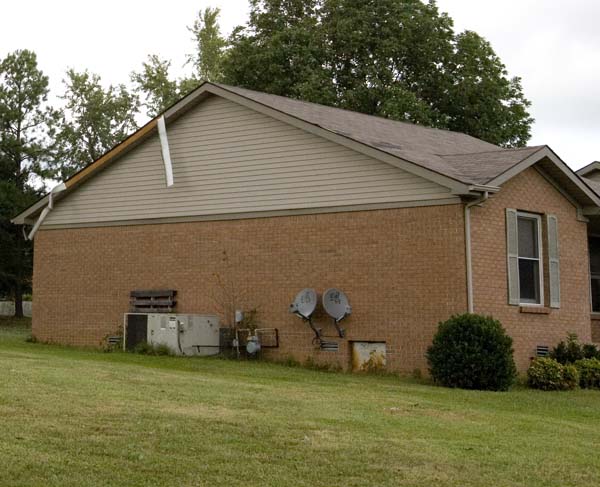
Lone Oak, Kentucky
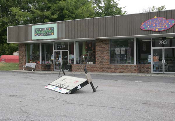
Lone Oak, KY - business sign damage
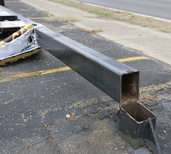
Lone Oak, KY - Business sign sheared off at base
Lone Oak, KY - Sign blown down
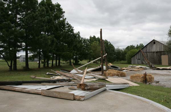
Metropolis, Illinois. Massac County. Shed destroyed
Shed destroyed

Lone Oak - Highway 45 sign damage
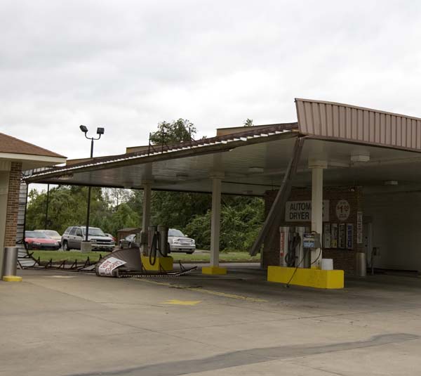
Lone Oak, KY. Car wash damage.
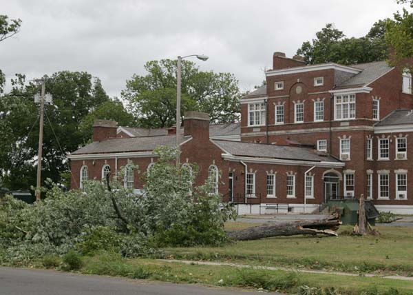
Downtown Paducah
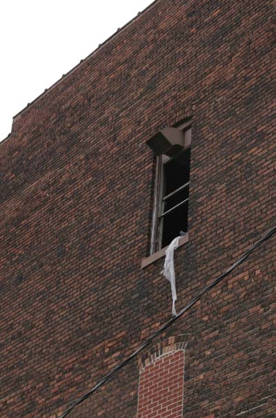
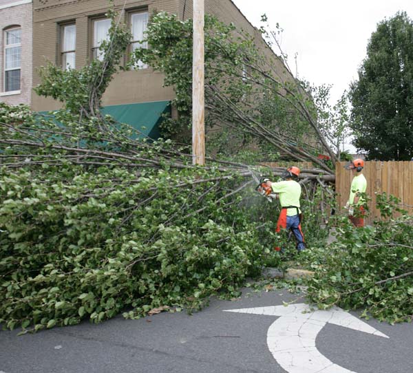
Downtown Paducah - glass blown out
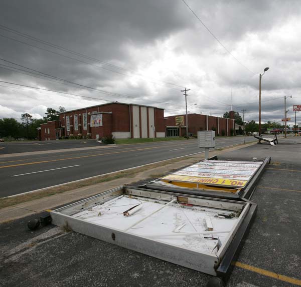
Paducah, KY. Sign damage.
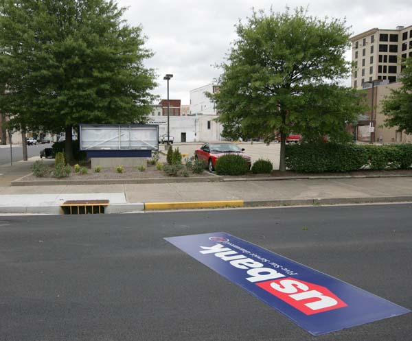
Jefferson Street - Paducah, KY
Jefferson Street, Paducah KY
Jefferson Street, Paducah KY
Jefferson Street, Paducah, Kentucky
Jefferson Street, Paducah KY
Jefferson Street, Paducah KY
Jefferson Street, Paducah KY
Jefferson Street, Paducah, Kentucky
Jefferson Street, Paducah, KY
Paducah, KY
Paducah, KY
Paducah, KY
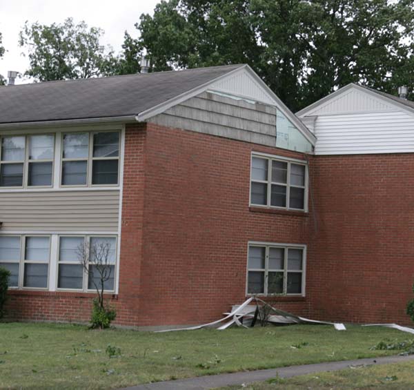
Paducah, KY - Apartment damage
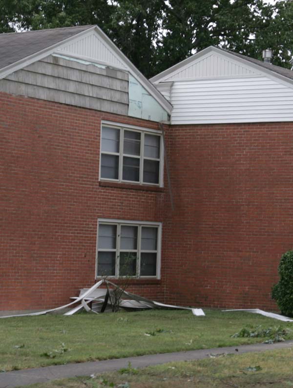
Apartment damage

Kentucky Oak Mall - lights downed
Kentucky Oaks Mall - power lights are down


Kentucky Oaks Mall
Paducah, Kentucky
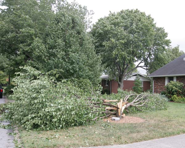
Lone Oak, Kentucky
Lone Oak, Kentucky
Metropolis, Illinois
Metropolis, Illinois
Metropolis, Illinois
Metropolis, Illinois
Metropolis, Illinois
Metropolis, Illinois
Metropolis, Illinois
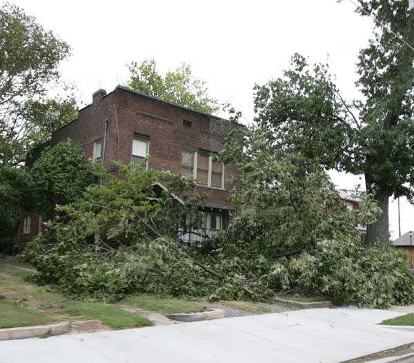
11th and Broadway - home with tree on it
11th and Broadway, Metropolis, Illinois
Metropolis, Illinois - tree on home
North Avenue, Metropolis, Illiois
Metropolis, Illinois
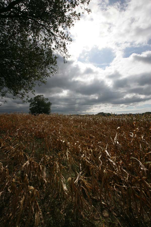
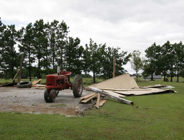
Tree damage on my farm
September 18, 2008
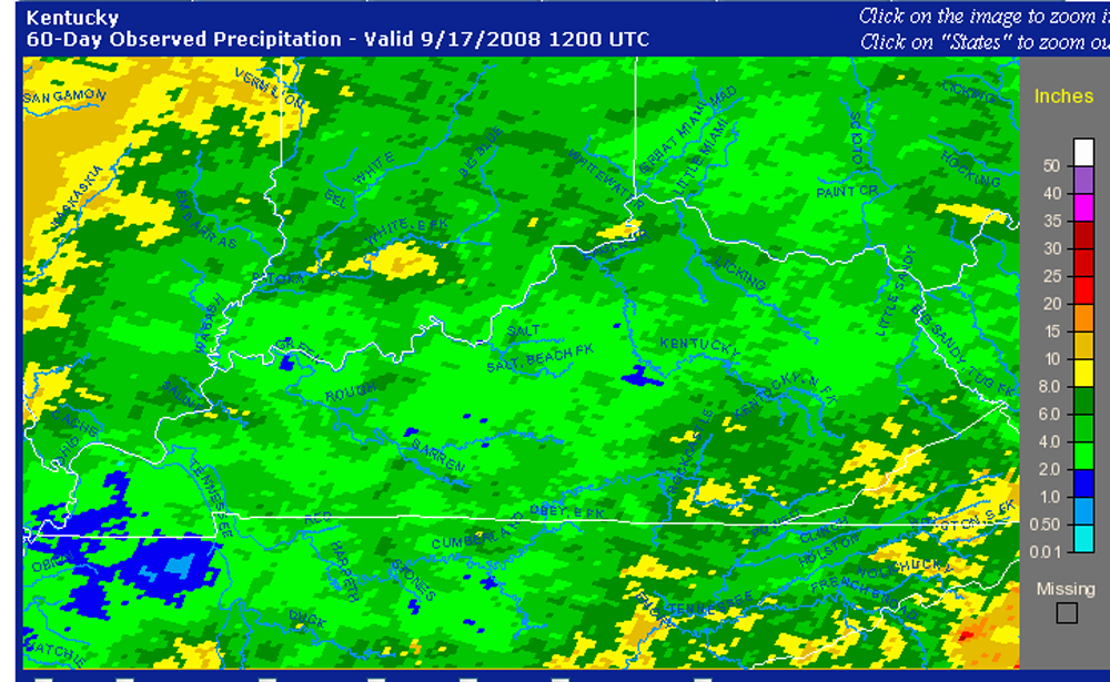
Dry weather across the Ohio Valley? Well, portions of it at least. Western Kentucky has been extremely dry over the last few months. Basically little or no rainfall. Fire season will be here soon. We need moisture.
There has been a stark contrast in moisture from this area northward. Portions of Missouri and Illinois have been pounded with heavy rain. BUCKETS! Hurricane Hanna and Ike both flooded the area to our north. Meanwhile, we only received trace amounts from both systems (in Paducah).
Here are some maps showing rainfall totals and departures from normal.
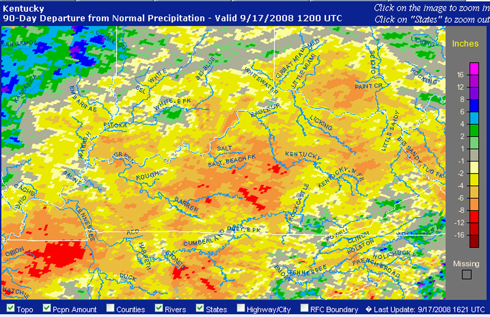
90 Day Departure From Normal
Centered On Kentucky.
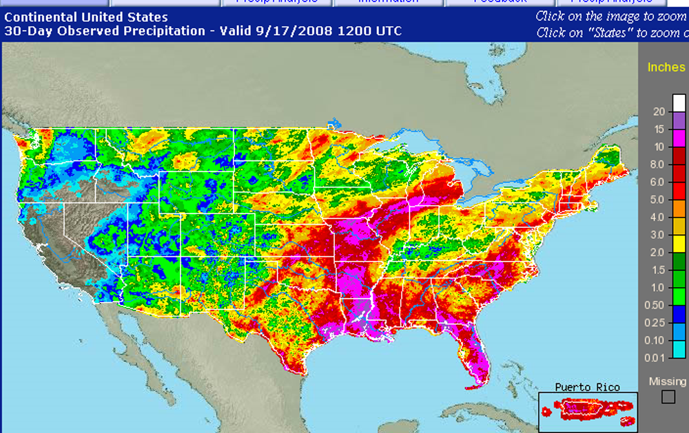
30 Day Observed
Precipitation.
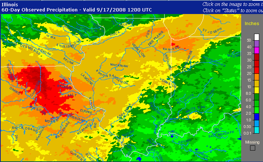
60 Day Observed Precipitation
Centered On Illinois.
60 Day Observed Precipitation
Centered On Kentucky.
September 30, 2008
Well, a rather boring month for weather across the western Kentucky area. Taking aside the dramatic and widespread wind damage event, there was little other weather to report on. Little rainfall, no major temperature swings, nothing special.
We need rain. Portions of the area are now in drought (short term). Meanwhile, area to the north and west are swimming in water, as several tropical systems have pummeled those areas with rainfall totals in excess of 10 inches.
Time to turn the page for October. Hopefully, we have a nice fall ahead of us.
Turn the page for more weather
Home | About | News | Upcoming Events| Photo Gallery | Video | Links | Contact
All Photos are copyrighted by Beau Dodson (unless otherwise clearly stated) and are used on this site with his permission. Any use other than authorized by them is against the law. If you wish to contact him regarding use of these photos, please e-mail me and I will forward it.